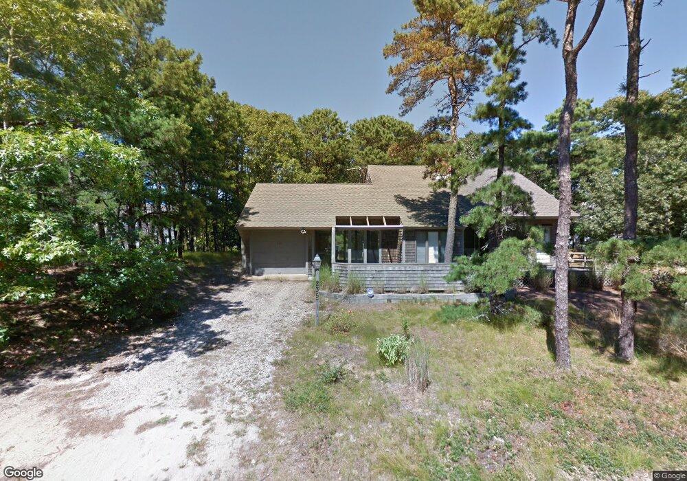
235 Blue Heron Rd Wellfleet, MA 02667
Estimated Value: $825,000 - $862,000
3
Beds
2
Baths
1,504
Sq Ft
$560/Sq Ft
Est. Value
About This Home
This home is located at 235 Blue Heron Rd, Wellfleet, MA 02667 and is currently estimated at $842,566, approximately $560 per square foot. 235 Blue Heron Rd is a home located in Barnstable County with nearby schools including Wellfleet Elementary School, Nauset Regional Middle School, and Nauset Regional High School.
Ownership History
Date
Name
Owned For
Owner Type
Purchase Details
Closed on
Jul 27, 2007
Sold by
Pearl M Johnson Ret and Johnson
Bought by
Cohen Robert and Mills-Cohen Sara
Current Estimated Value
Home Financials for this Owner
Home Financials are based on the most recent Mortgage that was taken out on this home.
Original Mortgage
$246,000
Outstanding Balance
$156,707
Interest Rate
6.78%
Mortgage Type
Purchase Money Mortgage
Estimated Equity
$685,859
Create a Home Valuation Report for This Property
The Home Valuation Report is an in-depth analysis detailing your home's value as well as a comparison with similar homes in the area
Home Values in the Area
Average Home Value in this Area
Purchase History
| Date | Buyer | Sale Price | Title Company |
|---|---|---|---|
| Cohen Robert | $492,500 | -- | |
| Cohen Robert | $492,500 | -- |
Source: Public Records
Mortgage History
| Date | Status | Borrower | Loan Amount |
|---|---|---|---|
| Open | Cohen Robert | $246,000 | |
| Closed | Cohen Robert | $246,000 |
Source: Public Records
Tax History Compared to Growth
Tax History
| Year | Tax Paid | Tax Assessment Tax Assessment Total Assessment is a certain percentage of the fair market value that is determined by local assessors to be the total taxable value of land and additions on the property. | Land | Improvement |
|---|---|---|---|---|
| 2025 | $5,432 | $764,000 | $309,600 | $454,400 |
| 2024 | $5,066 | $741,700 | $294,800 | $446,900 |
| 2023 | $4,531 | $651,000 | $249,900 | $401,100 |
| 2022 | $3,972 | $510,600 | $219,200 | $291,400 |
| 2021 | $2,826 | $456,500 | $195,700 | $260,800 |
| 2020 | $3,556 | $458,900 | $206,000 | $252,900 |
| 2019 | $3,458 | $447,300 | $206,000 | $241,300 |
| 2018 | $3,266 | $454,900 | $206,000 | $248,900 |
| 2017 | $3,052 | $450,200 | $206,000 | $244,200 |
| 2016 | $3,114 | $455,900 | $204,000 | $251,900 |
| 2015 | $3,044 | $449,000 | $201,900 | $247,100 |
Source: Public Records
Map
Nearby Homes
- 90 Blue Heron Rd
- 90 Ring Rd
- 210 West Rd Unit B9
- 210 West Rd Unit M-16
- 40 Leilla Rich Dr
- 176 Village Ln
- 11 Whelpley Rd
- 55 Harvard St
- 140 Harvest Rd
- 95 Barker St
- 1020 3rd Ave
- 675 N Sunken Meadow Rd
- 100 Gigi Ln
- 5470 State Hwy
- 190 Meadow Ave W
- 41-43 9th St
- 65 Harmes Way
- 125 Wamsutta Rd
- 25 1st Ave
- 1460 Massasoit Rd
- 175 Blue Heron Rd
- 76 Upper Marsh Rd
- 205 Blue Heron Rd
- 240 Blue Heron Rd
- 86 Upper Marsh Rd
- 159 Blue Heron Rd
- 220 Blue Heron Rd
- 260 Blue Heron Rd
- 170 Blue Heron Rd
- 210 Blue Heron Rd
- 310 Blue Heron
- 190 Blue Heron Rd
- 66 Upper Marsh Rd
- 150 Blue Heron Rd
- 65 Upper Marsh Rd
- 200 Blue Heron Rd
- 285 Blue Heron Rd
- 145 Blue Heron Rd
- 50 Upper Marsh Rd
- 45 Upper Marsh Rd