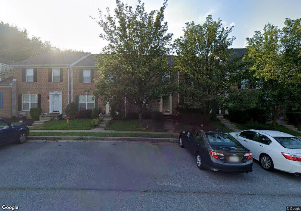
235 Carolstowne Rd Reisterstown, MD 21136
Estimated Value: $336,000 - $362,000
3
Beds
3
Baths
1,400
Sq Ft
$249/Sq Ft
Est. Value
About This Home
This home is located at 235 Carolstowne Rd, Reisterstown, MD 21136 and is currently estimated at $348,310, approximately $248 per square foot. 235 Carolstowne Rd is a home located in Baltimore County with nearby schools including Franklin Elementary School, Franklin Middle, and Franklin High.
Ownership History
Date
Name
Owned For
Owner Type
Purchase Details
Closed on
Nov 22, 2011
Sold by
Ford Martha A
Bought by
Sachse Timothy Jordan
Current Estimated Value
Home Financials for this Owner
Home Financials are based on the most recent Mortgage that was taken out on this home.
Original Mortgage
$173,487
Outstanding Balance
$118,700
Interest Rate
4.09%
Mortgage Type
FHA
Estimated Equity
$229,610
Purchase Details
Closed on
Nov 7, 2003
Sold by
Romeo Pietro Paolo
Bought by
Ford Martha A
Purchase Details
Closed on
Apr 8, 1999
Sold by
Hopkins Properties Inc
Bought by
Romeo Pietro Paolo and Bailey Romeo Julie
Create a Home Valuation Report for This Property
The Home Valuation Report is an in-depth analysis detailing your home's value as well as a comparison with similar homes in the area
Home Values in the Area
Average Home Value in this Area
Purchase History
| Date | Buyer | Sale Price | Title Company |
|---|---|---|---|
| Sachse Timothy Jordan | $178,000 | Pride Title & Escrow Llc | |
| Ford Martha A | $192,000 | -- | |
| Romeo Pietro Paolo | $108,000 | -- |
Source: Public Records
Mortgage History
| Date | Status | Borrower | Loan Amount |
|---|---|---|---|
| Open | Sachse Timothy Jordan | $173,487 |
Source: Public Records
Tax History Compared to Growth
Tax History
| Year | Tax Paid | Tax Assessment Tax Assessment Total Assessment is a certain percentage of the fair market value that is determined by local assessors to be the total taxable value of land and additions on the property. | Land | Improvement |
|---|---|---|---|---|
| 2025 | $3,884 | $247,633 | -- | -- |
| 2024 | $3,884 | $227,600 | $61,400 | $166,200 |
| 2023 | $3,763 | $221,367 | $0 | $0 |
| 2022 | $3,562 | $215,133 | $0 | $0 |
| 2021 | $3,288 | $208,900 | $61,400 | $147,500 |
| 2020 | $3,288 | $207,967 | $0 | $0 |
| 2019 | $3,300 | $207,033 | $0 | $0 |
| 2018 | $3,189 | $206,100 | $61,400 | $144,700 |
| 2017 | $2,984 | $199,233 | $0 | $0 |
| 2016 | -- | $192,367 | $0 | $0 |
| 2015 | $2,533 | $185,500 | $0 | $0 |
| 2014 | $2,533 | $185,500 | $0 | $0 |
Source: Public Records
Map
Nearby Homes
- 246 Pidco Rd
- 237 Pidco Rd
- 56 Main St
- 4 Wolf Ave
- 131 Westminster Rd
- 116 Westgate Way
- 19 Bond Ave
- 7 Butler Rd
- 27 Farm Gate Way
- 10 Pennyborough Ct
- 65A Bond Ave
- 123 Glyndon Trace Dr
- 13943 B Old Hanover Rd
- 13943 C Old Hanover Rd
- 13943 D Old Hanover Rd
- 426 Main St
- 116 Northway Rd
- 209 Bentley Hill Dr
- 117 Chargeur Rd
- 225 Northway Rd
- 233 Carolstowne Rd
- 237 Carolstowne Rd
- 239 Carolstowne Rd
- 231 Carolstowne Rd
- 241 Carolstowne Rd
- 229 Carolstowne Rd
- 227 Carolstowne Rd
- 225 Carolstowne Rd
- 223 Carolstowne Rd
- 233 Brownwood Rd
- 221 Carolstowne Rd
- 231 Brownwood Rd
- 219 Carolstowne Rd
- 229 Brownwood Rd
- 229 Browwood Rd
- 217 Carolstowne Rd
- 227 Brownwood Rd
- 215 Carolstowne Rd
- 254 Pidco Rd
- 225 Brownwood Rd