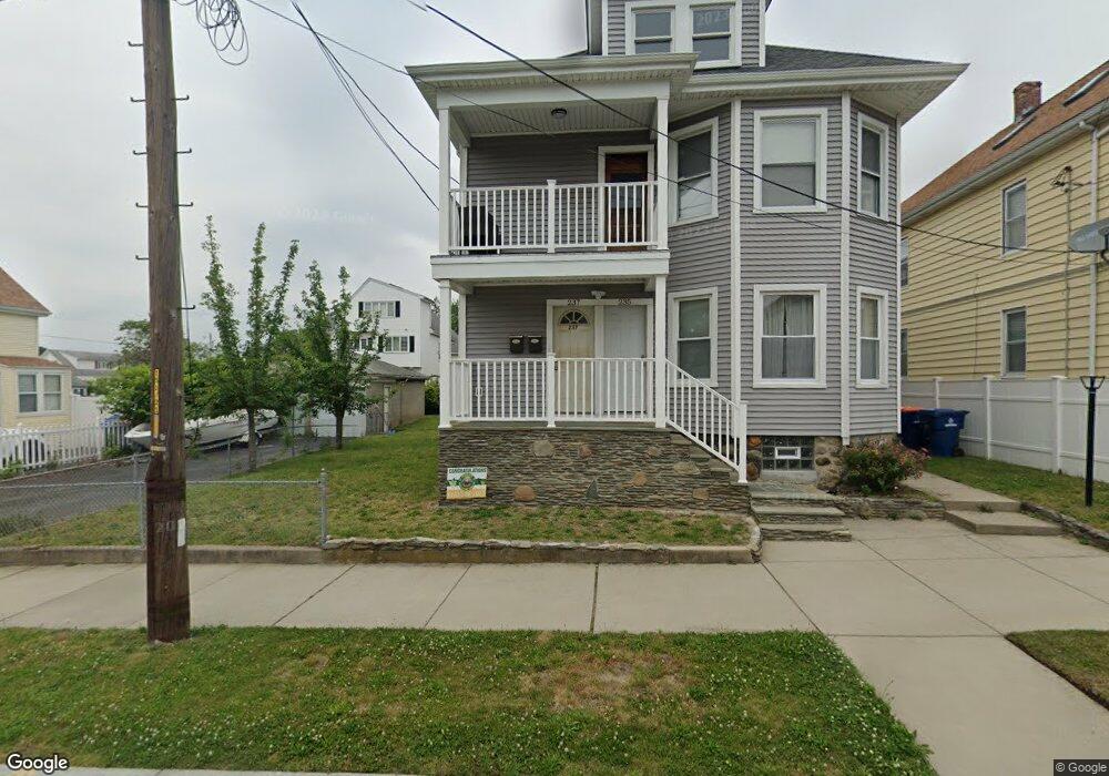
235 Clifford St Unit 237 New Bedford, MA 02745
Acushnet Station NeighborhoodEstimated Value: $524,329 - $598,000
6
Beds
1
Bath
2,400
Sq Ft
$236/Sq Ft
Est. Value
About This Home
This home is located at 235 Clifford St Unit 237, New Bedford, MA 02745 and is currently estimated at $566,082, approximately $235 per square foot. 235 Clifford St Unit 237 is a home located in Bristol County with nearby schools including Charles S. Ashley Elementary School, Normandin Middle School, and New Bedford High School.
Ownership History
Date
Name
Owned For
Owner Type
Purchase Details
Closed on
Oct 21, 2005
Sold by
Ferreira Jarret W
Bought by
Adao Michael C
Current Estimated Value
Home Financials for this Owner
Home Financials are based on the most recent Mortgage that was taken out on this home.
Original Mortgage
$232,000
Outstanding Balance
$123,864
Interest Rate
5.72%
Mortgage Type
Purchase Money Mortgage
Estimated Equity
$442,218
Create a Home Valuation Report for This Property
The Home Valuation Report is an in-depth analysis detailing your home's value as well as a comparison with similar homes in the area
Home Values in the Area
Average Home Value in this Area
Purchase History
| Date | Buyer | Sale Price | Title Company |
|---|---|---|---|
| Adao Michael C | $290,000 | -- | |
| Adao Michael C | $290,000 | -- |
Source: Public Records
Mortgage History
| Date | Status | Borrower | Loan Amount |
|---|---|---|---|
| Open | Adao Michael C | $232,000 | |
| Closed | Adao Michael C | $232,000 | |
| Previous Owner | Adao Michael C | $15,000 |
Source: Public Records
Tax History Compared to Growth
Tax History
| Year | Tax Paid | Tax Assessment Tax Assessment Total Assessment is a certain percentage of the fair market value that is determined by local assessors to be the total taxable value of land and additions on the property. | Land | Improvement |
|---|---|---|---|---|
| 2025 | $5,692 | $503,300 | $117,100 | $386,200 |
| 2024 | $5,074 | $422,800 | $113,400 | $309,400 |
| 2023 | $4,893 | $342,400 | $95,200 | $247,200 |
| 2022 | $4,463 | $287,200 | $90,700 | $196,500 |
| 2021 | $4,477 | $287,200 | $90,700 | $196,500 |
| 2020 | $4,350 | $269,200 | $92,600 | $176,600 |
| 2019 | $3,915 | $237,700 | $92,600 | $145,100 |
| 2018 | $3,758 | $226,000 | $92,600 | $133,400 |
| 2017 | $3,361 | $201,400 | $85,000 | $116,400 |
| 2016 | $3,181 | $192,900 | $81,200 | $111,700 |
| 2015 | $2,979 | $189,400 | $81,200 | $108,200 |
| 2014 | $2,852 | $188,100 | $79,400 | $108,700 |
Source: Public Records
Map
Nearby Homes
- 223 225 Prinston
- 208 Princeton St
- 162 Princeton St
- 250-252 Shaw St
- 98 Seabury St
- 209-211 Eugenia St
- 40 Glennon St Unit 42
- 228 Eugenia St
- 135-137 Query St
- 18 Edison St
- 42 Princeton St
- 11 Moynan St
- 1840 1846 Acushnet Ave
- 203-205 Tinkham St
- 113 Eugenia St
- 219 Hathaway St
- 125 +135 Tinkham St
- 42 Query St
- 363 Earle St
- 128 Nash Rd
- 231-233 Clifford St
- 245 Clifford St
- 231 Clifford St Unit 233
- 250 Princeton St
- 240 Princeton St Unit 242
- 229 Clifford St
- 240 Clifford St Unit 242
- 240 Clifford St Unit 1
- 238 Princeton St
- 236 Clifford St Unit 238
- 232 Clifford St Unit 234
- 244 Clifford St Unit 246
- 234-236 Princeton St
- 234 Princeton St Unit 236
- 257 Clifford St
- 221 Clifford St Unit 223
- 226 Clifford St
- 405 Brook St
- 230 Princeton St
- 256 Clifford St