235 Dawes Ave Pittsfield, MA 01201
Estimated payment $2,424/month
Highlights
- Colonial Architecture
- Mud Room
- 1 Car Detached Garage
- Wood Flooring
- Mature Landscaping
- Porch
About This Home
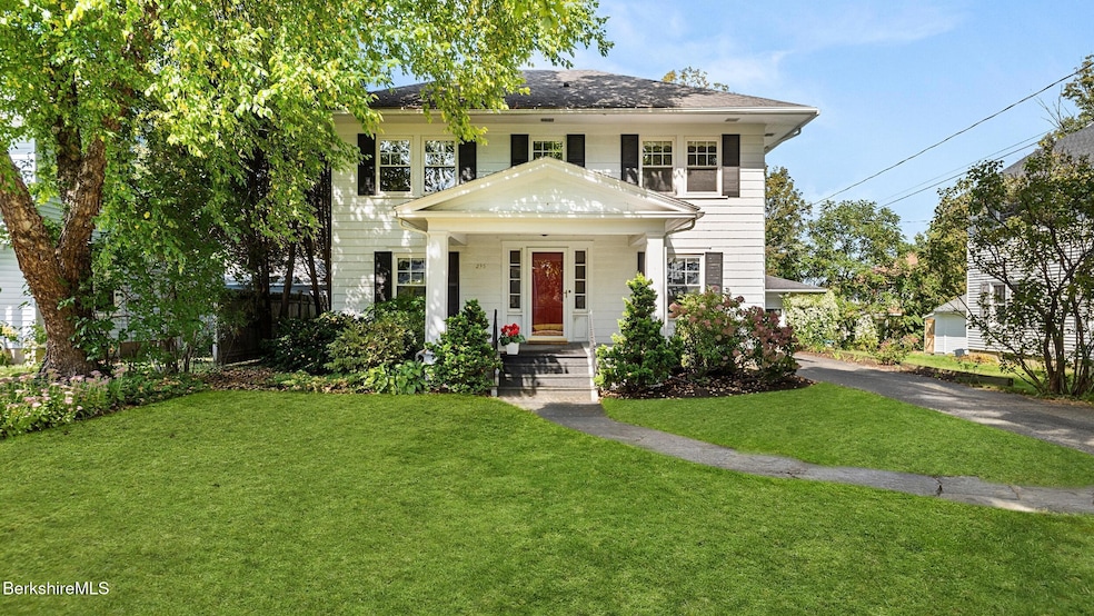
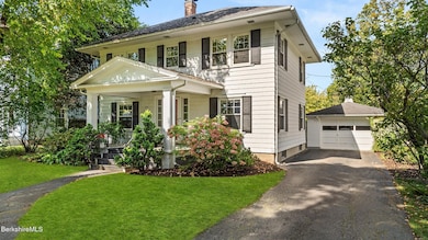
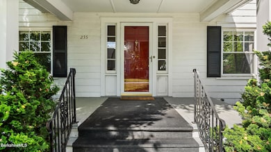
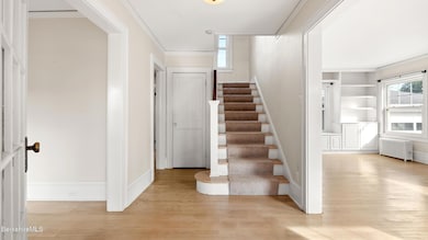
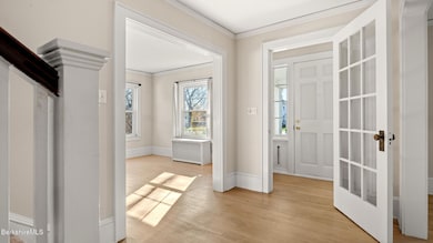
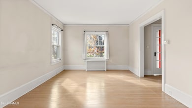
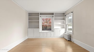
This timeless hip-roof Colonial sits proudly in one of Pittsfield's most desirable southeast neighborhoods. Sunlight pours into every room of this well-loved and well-maintained three-bedroom, 1.5 bath home, filled with warmth and character. The bright and spacious interior features hardwood floors, French doors, built-ins, and cedar closets. A large kitchen offers abundant cabinetry, while the updated tiled baths and modernized utilities provide comfort and peace of mind.Enjoy a welcoming mudroom and a finished lower level with laundry for added living space. Outside, a charming courtyard-style backyard with a brick patio is surrounded by mature landscaping and specimen trees and is ideal for relaxing or entertaining. The one-car detached garage includes an automatic opener.
Home Details
Home Type
- Single Family
Est. Annual Taxes
- $5,373
Year Built
- 1925
Lot Details
- 6,098 Sq Ft Lot
- Partially Fenced Property
- Mature Landscaping
- Landscaped with Trees
Home Design
- Colonial Architecture
- Wood Frame Construction
- Asphalt Shingled Roof
- Wood Siding
Interior Spaces
- 1,596 Sq Ft Home
- Mud Room
Kitchen
- Range
- Dishwasher
- Disposal
Flooring
- Wood
- Carpet
- Linoleum
Bedrooms and Bathrooms
- 3 Bedrooms
- Cedar Closet
- Walk-In Closet
Laundry
- Dryer
- Washer
Unfinished Basement
- Basement Fills Entire Space Under The House
- Interior Basement Entry
Parking
- 1 Car Detached Garage
- Automatic Garage Door Opener
- Off-Street Parking
Outdoor Features
- Patio
- Porch
Schools
- Egremont Elementary School
- Theodore Herberg Middle School
- Pittsfield High School
Utilities
- Heating System Uses Steam
- Boiler Heating System
- Heating System Uses Natural Gas
- Storage Tank
- Natural Gas Water Heater
- Cable TV Available
Community Details
- Public Transportation
Map
Home Values in the Area
Average Home Value in this Area
Tax History
| Year | Tax Paid | Tax Assessment Tax Assessment Total Assessment is a certain percentage of the fair market value that is determined by local assessors to be the total taxable value of land and additions on the property. | Land | Improvement |
|---|---|---|---|---|
| 2025 | $5,373 | $299,500 | $82,800 | $216,700 |
| 2024 | $5,282 | $286,300 | $82,800 | $203,500 |
| 2023 | $4,750 | $259,300 | $73,600 | $185,700 |
| 2022 | $4,356 | $234,700 | $73,600 | $161,100 |
| 2021 | $4,137 | $214,900 | $73,600 | $141,300 |
| 2020 | $4,143 | $210,200 | $73,600 | $136,600 |
| 2019 | $3,917 | $201,700 | $73,600 | $128,100 |
| 2018 | $3,946 | $197,200 | $73,600 | $123,600 |
| 2017 | $3,718 | $189,400 | $73,600 | $115,800 |
| 2016 | $3,519 | $187,600 | $73,600 | $114,000 |
| 2015 | $3,388 | $187,600 | $73,600 | $114,000 |
Property History
| Date | Event | Price | List to Sale | Price per Sq Ft |
|---|---|---|---|---|
| 11/05/2025 11/05/25 | For Sale | $375,000 | -- | $235 / Sq Ft |
Purchase History
| Date | Type | Sale Price | Title Company |
|---|---|---|---|
| Deed | $140,000 | -- | |
| Deed | $140,000 | -- | |
| Deed | $134,500 | -- | |
| Deed | $125,000 | -- | |
| Deed | $125,000 | -- |
Mortgage History
| Date | Status | Loan Amount | Loan Type |
|---|---|---|---|
| Previous Owner | $67,000 | No Value Available | |
| Previous Owner | $121,000 | Purchase Money Mortgage | |
| Previous Owner | $100,000 | Purchase Money Mortgage |
Source: Berkshire County Board of REALTORS®
MLS Number: 248177
APN: PITT-000007J-000011-000002
Disclaimer: Certain information contained herein is derived from information provided by parties other than Homes.com. All information provided is deemed reliable, but is not guaranteed to be accurate and should be independently verified.
![]() IDX information is provided exclusively for consumers' personal, non-commercial use, that it may not be used for any purpose other than to identify prospective properties consumers may be interested in purchasing. Information deemed to be reliable but not guaranteed.
IDX information is provided exclusively for consumers' personal, non-commercial use, that it may not be used for any purpose other than to identify prospective properties consumers may be interested in purchasing. Information deemed to be reliable but not guaranteed.
The data relating to real estate for sale on this website comes from Berkshire County Board of Realtors and the Broker Reciprocity Program.
Copyright 2025 Berkshire County Board of Realtors. All rights reserved.
- 31 Lexington Pkwy
- 206 Dawes Ave
- 66 Holmes Rd
- 39 Lexington Pkwy
- 81 Northumberland Rd
- 100 Northumberland Rd
- 40 Sampson Pkwy
- 51 Foote Ave
- 38 Northumberland Rd
- 168 Elm St
- 106 Sampson Pkwy
- 25 Putnam Ave
- 36 Chickering St
- 70 Elm St
- 26 Crosier Ave
- 69 Gravesleigh Terrace
- 63 Reuter Ave
- 20 Marshall Ave
- 381 Williams St
- 25 Ashley St
- 5 Whipple St
- 10 Wendell Avenue Extension
- 20 Bank Row
- 20 Allessio St Unit 20
- 6 Cherry St Unit 6A
- 41 North St
- 34 Depot St
- 241 Second St
- 324 North St
- 113 West St
- 105 Parker St Unit 3
- 44 Robbins Ave
- 44 Robbins Ave
- 44 Robbins Ave
- 305 Springside Ave
- 5 Dewey Ave
- 99 Hawthorne Ave
- 81 Linden St
- 83 Sadler Ave Unit 83 sadler
- 89 Pecks Rd
