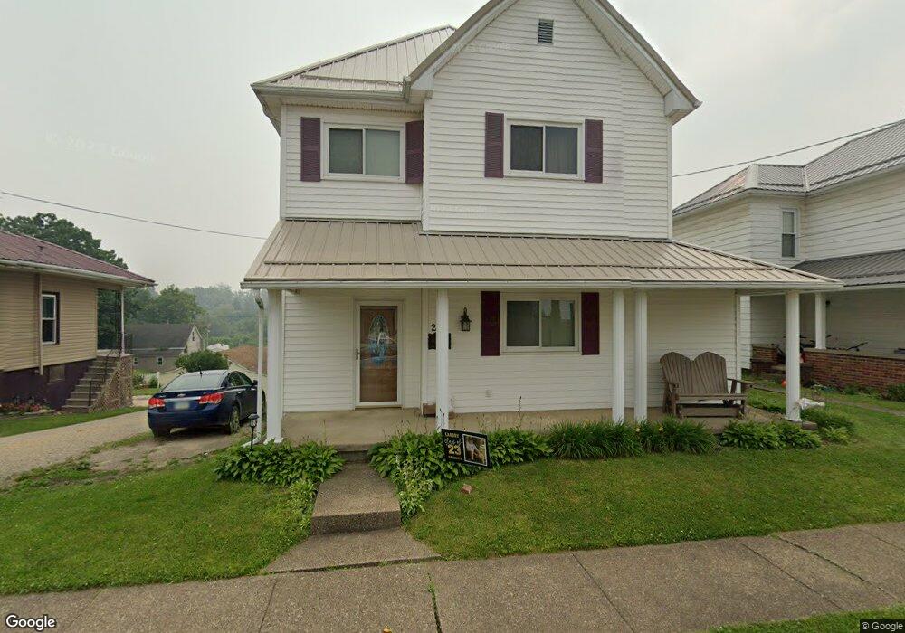
235 Franklin St Barnesville, OH 43713
Estimated Value: $151,000 - $161,000
4
Beds
1
Bath
1,881
Sq Ft
$82/Sq Ft
Est. Value
About This Home
This home is located at 235 Franklin St, Barnesville, OH 43713 and is currently estimated at $154,826, approximately $82 per square foot. 235 Franklin St is a home located in Belmont County with nearby schools including Barnesville Elementary School, Barnesville Middle School, and Barnesville High School.
Ownership History
Date
Name
Owned For
Owner Type
Purchase Details
Closed on
May 9, 2012
Sold by
Brooks Dennis E and Brooks Bonnie J
Bought by
Burke Heidi D
Current Estimated Value
Purchase Details
Closed on
Jan 1, 1987
Sold by
Brooks Dennis E and Brooks Bonnie
Bought by
Brooks Dennis E and Brooks Bonnie J
Create a Home Valuation Report for This Property
The Home Valuation Report is an in-depth analysis detailing your home's value as well as a comparison with similar homes in the area
Home Values in the Area
Average Home Value in this Area
Purchase History
| Date | Buyer | Sale Price | Title Company |
|---|---|---|---|
| Burke Heidi D | -- | Attorney | |
| Brooks Dennis E | -- | -- |
Source: Public Records
Tax History
| Year | Tax Paid | Tax Assessment Tax Assessment Total Assessment is a certain percentage of the fair market value that is determined by local assessors to be the total taxable value of land and additions on the property. | Land | Improvement |
|---|---|---|---|---|
| 2025 | $1,457 | $44,400 | $2,650 | $41,750 |
| 2024 | $1,435 | $44,400 | $2,650 | $41,750 |
| 2023 | $987 | $29,260 | $2,240 | $27,020 |
| 2022 | $986 | $29,264 | $2,244 | $27,020 |
| 2021 | $988 | $29,264 | $2,244 | $27,020 |
| 2020 | $862 | $24,390 | $1,870 | $22,520 |
| 2019 | $864 | $24,390 | $1,870 | $22,520 |
| 2018 | $859 | $24,390 | $1,870 | $22,520 |
| 2017 | $1,141 | $31,700 | $1,530 | $30,170 |
| 2016 | $1,068 | $31,700 | $1,530 | $30,170 |
| 2015 | $1,065 | $31,700 | $1,530 | $30,170 |
| 2014 | $887 | $26,120 | $1,390 | $24,730 |
| 2013 | $891 | $26,120 | $1,390 | $24,730 |
Source: Public Records
Map
Nearby Homes
- 152 E Main St
- 329 S Chestnut St
- 136 E Walnut St
- 613 E Main St
- 724 E Main St
- 164 Pine Ln
- 202 Walton Ave
- 118 Pine Ln
- 617 Park St
- 618 Park St
- 0 Fairmont Ave Unit 5163774
- 0 Fairmont Ave Unit 5163784
- TBD W Main St
- 62239 Hillcrest Rd
- 0 County Road 114
- 0 Nevada Rd
- 57128 Somerton Hwy
- Lot 1 Cattle Dr
- 0 Johnson Bethel Rd
- 63054 & 63060 S 26 Rd
- 239 Franklin St
- 233 Franklin St
- 243 Franklin St
- 225 Franklin St
- 232 Henderson St
- 236 Henderson St
- 228 Henderson St
- 316 Clifton St
- 236 Franklin St
- 240 Franklin St
- 247 Franklin St
- 0 Franklin St Unit T9514106
- 224 Henderson St
- 329 Vine St
- 240 Henderson St
- 244 Franklin St
- 221 Franklin St
- 308 Clifton St
- 248 Franklin St
- 220 Henderson St
Your Personal Tour Guide
Ask me questions while you tour the home.