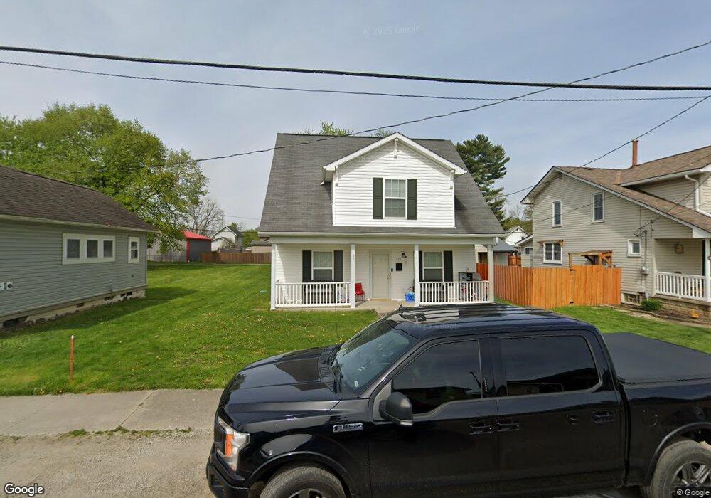
235 N Wing St Newark, OH 43055
Estimated Value: $146,000 - $181,109
4
Beds
4
Baths
1,596
Sq Ft
$101/Sq Ft
Est. Value
About This Home
This home is located at 235 N Wing St, Newark, OH 43055 and is currently estimated at $161,527, approximately $101 per square foot. 235 N Wing St is a home located in Licking County with nearby schools including Carson Elementary School, Heritage Middle School, and Newark High School.
Ownership History
Date
Name
Owned For
Owner Type
Purchase Details
Closed on
Nov 1, 2007
Sold by
Newark Development Properties Llc
Bought by
East Newark Homes Llc
Current Estimated Value
Purchase Details
Closed on
Dec 16, 2005
Sold by
Grigsby David P and Grigsby Bonnie L
Bought by
East Newark Homes Llc
Purchase Details
Closed on
Dec 7, 2005
Sold by
Conoor Barbara A
Bought by
Wiseman Maxine and Estate Of Mary E Black
Purchase Details
Closed on
Oct 5, 2005
Sold by
Estate Of Thomas R Black
Bought by
Black Mary Elizabeth
Create a Home Valuation Report for This Property
The Home Valuation Report is an in-depth analysis detailing your home's value as well as a comparison with similar homes in the area
Home Values in the Area
Average Home Value in this Area
Purchase History
| Date | Buyer | Sale Price | Title Company |
|---|---|---|---|
| East Newark Homes Llc | -- | Attorney | |
| East Newark Homes Llc | $15,000 | -- | |
| Wiseman Maxine | -- | -- | |
| Black Mary Elizabeth | -- | -- |
Source: Public Records
Tax History Compared to Growth
Tax History
| Year | Tax Paid | Tax Assessment Tax Assessment Total Assessment is a certain percentage of the fair market value that is determined by local assessors to be the total taxable value of land and additions on the property. | Land | Improvement |
|---|---|---|---|---|
| 2024 | $819 | $22,300 | $8,400 | $13,900 |
| 2023 | $1,026 | $28,000 | $8,400 | $19,600 |
| 2022 | $680 | $16,450 | $2,660 | $13,790 |
| 2021 | $714 | $16,450 | $2,660 | $13,790 |
| 2020 | $947 | $21,390 | $3,470 | $17,920 |
| 2019 | $758 | $16,450 | $2,660 | $13,790 |
| 2018 | $758 | $0 | $0 | $0 |
| 2017 | $726 | $0 | $0 | $0 |
| 2016 | $768 | $0 | $0 | $0 |
| 2015 | $945 | $0 | $0 | $0 |
| 2014 | $1,178 | $0 | $0 | $0 |
| 2013 | $899 | $0 | $0 | $0 |
Source: Public Records
Map
Nearby Homes
- 491 Garfield Ave
- 240 N Wing St
- 554 Garfield Ave
- 424 Ridge Ave
- 167 Essex St
- 160 N Cedar St
- 483 Allston Ave
- 81 Madison Ave
- 460 Allston Ave
- 76 Oakwood Ave
- 506 Lexington Ave
- 688 Russell Ave
- 408 Cedarcrest Ave
- 430 E Main St
- 136 Hunter St
- 284 Everett Ave
- 61 Rosebud Ave
- 51 Mill St
- 452 Walnut Ln
- 203 Lawrence St