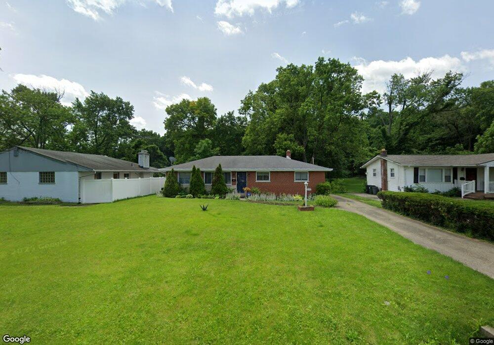
235 Riddle Rd Cincinnati, OH 45215
Estimated Value: $194,000 - $247,000
3
Beds
2
Baths
1,399
Sq Ft
$160/Sq Ft
Est. Value
About This Home
This home is located at 235 Riddle Rd, Cincinnati, OH 45215 and is currently estimated at $223,372, approximately $159 per square foot. 235 Riddle Rd is a home located in Hamilton County with nearby schools including Woodlawn Elementary School, Princeton Community Middle School, and Princeton High School.
Ownership History
Date
Name
Owned For
Owner Type
Purchase Details
Closed on
Nov 14, 2008
Sold by
Munlin Addie and Simmons Fannie
Bought by
Stenson Michael E and Williams Stenson Patricia A
Current Estimated Value
Home Financials for this Owner
Home Financials are based on the most recent Mortgage that was taken out on this home.
Original Mortgage
$87,923
Outstanding Balance
$56,376
Interest Rate
5.95%
Mortgage Type
FHA
Estimated Equity
$166,996
Create a Home Valuation Report for This Property
The Home Valuation Report is an in-depth analysis detailing your home's value as well as a comparison with similar homes in the area
Home Values in the Area
Average Home Value in this Area
Purchase History
| Date | Buyer | Sale Price | Title Company |
|---|---|---|---|
| Stenson Michael E | $88,400 | American Homeland Title Agen |
Source: Public Records
Mortgage History
| Date | Status | Borrower | Loan Amount |
|---|---|---|---|
| Open | Stenson Michael E | $87,923 |
Source: Public Records
Tax History
| Year | Tax Paid | Tax Assessment Tax Assessment Total Assessment is a certain percentage of the fair market value that is determined by local assessors to be the total taxable value of land and additions on the property. | Land | Improvement |
|---|---|---|---|---|
| 2025 | $2,299 | $49,676 | $13,391 | $36,285 |
| 2024 | $2,537 | $49,676 | $13,391 | $36,285 |
| 2023 | $2,542 | $49,676 | $13,391 | $36,285 |
| 2022 | $2,234 | $38,077 | $11,949 | $26,128 |
| 2021 | $2,177 | $38,077 | $11,949 | $26,128 |
| 2020 | $2,192 | $38,077 | $11,949 | $26,128 |
| 2019 | $2,054 | $32,824 | $10,301 | $22,523 |
| 2018 | $1,944 | $32,824 | $10,301 | $22,523 |
| 2017 | $1,836 | $32,824 | $10,301 | $22,523 |
| 2016 | $1,451 | $25,603 | $6,223 | $19,380 |
| 2015 | $1,464 | $25,603 | $6,223 | $19,380 |
| 2014 | $1,468 | $25,603 | $6,223 | $19,380 |
| 2013 | $1,374 | $26,950 | $6,552 | $20,398 |
Source: Public Records
Map
Nearby Homes
- 10060 Ronnie Rd
- 10055 Ronnie Rd
- 51 Grove Rd
- 398 Brookhaven Ave
- 10133 Leacrest Rd
- 0 E Leslie Ave
- 39 Rolling Hills Ct
- 155 Bonham Rd
- 1704 Harmon Dr
- 156 Sheffield Rd
- 10167 Wayne Ave
- 10483 Toulon Dr
- 15 Bonham Rd
- 343 Ashley Ln
- 502 Marion Rd
- 311 Ritchie Ave
- 357 Meadowcrest Rd
- 162 Sheffield Rd
- 820 van Nes Dr
- 1239 Springfield Pike
Your Personal Tour Guide
Ask me questions while you tour the home.