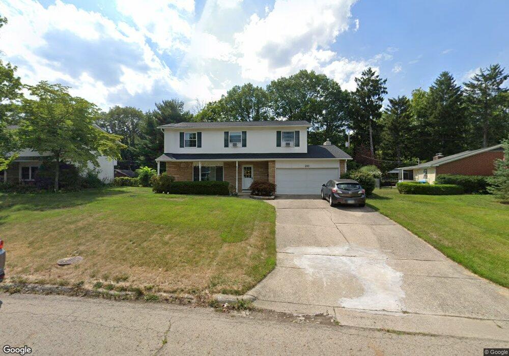
235 Rocky Fork Dr Columbus, OH 43230
Gahanna-Havens Corners NeighborhoodEstimated Value: $352,088 - $380,000
4
Beds
3
Baths
1,963
Sq Ft
$186/Sq Ft
Est. Value
About This Home
This home is located at 235 Rocky Fork Dr, Columbus, OH 43230 and is currently estimated at $364,272, approximately $185 per square foot. 235 Rocky Fork Dr is a home located in Franklin County with nearby schools including Goshen Lane Elementary School, Gahanna East Middle School, and Lincoln High School.
Ownership History
Date
Name
Owned For
Owner Type
Purchase Details
Closed on
Jun 28, 2022
Sold by
Armen Ohanyan
Bought by
Manare One Llc
Current Estimated Value
Purchase Details
Closed on
Jun 7, 2022
Sold by
Armen Ohanyan
Bought by
Manare One Llc
Purchase Details
Closed on
Nov 16, 2021
Sold by
Doone John and Donna M Donne Revocable Living
Bought by
Ohanyan Armen and Ohanyan Marina
Purchase Details
Closed on
Sep 4, 2018
Sold by
Doone Donna M
Bought by
Doone Donna M and The Donna M Doone Revocable Li
Purchase Details
Closed on
Apr 22, 1981
Bought by
Doone James O
Create a Home Valuation Report for This Property
The Home Valuation Report is an in-depth analysis detailing your home's value as well as a comparison with similar homes in the area
Home Values in the Area
Average Home Value in this Area
Purchase History
| Date | Buyer | Sale Price | Title Company |
|---|---|---|---|
| Manare One Llc | -- | Mccarthy Patrick D | |
| Manare One Llc | -- | Mccarthy Patrick D | |
| Ohanyan Armen | $260,000 | Gahanna Title Agency Llc | |
| Doone Donna M | -- | None Available | |
| Doone James O | -- | -- |
Source: Public Records
Tax History
| Year | Tax Paid | Tax Assessment Tax Assessment Total Assessment is a certain percentage of the fair market value that is determined by local assessors to be the total taxable value of land and additions on the property. | Land | Improvement |
|---|---|---|---|---|
| 2025 | $6,825 | $113,550 | $25,870 | $87,680 |
| 2024 | $6,825 | $113,550 | $25,870 | $87,680 |
| 2023 | $6,890 | $113,540 | $25,865 | $87,675 |
| 2022 | $5,599 | $74,980 | $12,080 | $62,900 |
| 2021 | $4,784 | $74,980 | $12,080 | $62,900 |
| 2020 | $4,743 | $74,980 | $12,080 | $62,900 |
| 2019 | $3,856 | $62,480 | $10,050 | $52,430 |
| 2018 | $3,593 | $62,480 | $10,050 | $52,430 |
| 2017 | $3,539 | $62,480 | $10,050 | $52,430 |
| 2016 | $3,355 | $55,130 | $14,950 | $40,180 |
| 2015 | $3,357 | $55,130 | $14,950 | $40,180 |
| 2014 | $3,331 | $55,130 | $14,950 | $40,180 |
| 2013 | $1,629 | $54,425 | $14,245 | $40,180 |
Source: Public Records
Map
Nearby Homes
- 169 Flint Ridge Dr
- 329 Cliffview Dr
- 258 Rocky Fork Dr S
- 343 Flint Ridge Dr
- 84 River Dr
- 167 Lansdowne Ave
- 219 N Hamilton Rd
- 206 Lintner St
- 300 Dunbarton Rd
- 402 Citadel St
- 62 Saint Stephens Ct
- 769 Ashford Glen Ct
- 701 Hunters Run
- 440 Colony Place
- 302 Zander Ln Unit 302
- 481 Clotts Rd
- 309 Baroness Way
- 299 Sherwood Meadows Dr
- 600 Agler Rd
- 365 Sycamore Woods Ln Unit 365
- 229 Rocky Fork Dr
- 243 Rocky Fork Dr
- 218 Rocky Fork Dr
- 249 Rocky Fork Dr
- 210 Rocky Fork Dr
- 225 Rocky Fork Dr
- 238 Rocky Fork Dr
- 242 Rocky Fork Dr
- 244 Rocky Fork Dr
- 255 Rocky Fork Dr
- 221 Rocky Fork Dr
- 250 Rocky Fork Dr
- 250 Rocky Fork Dr
- 230 Rocky Fork Dr
- 241 Cliffview Dr
- 256 Rocky Fork Dr
- 261 Rocky Fork Dr
- 249 Cliffview Dr
- 217 Rocky Fork Dr
- 217 Rocky Fork Dr
Your Personal Tour Guide
Ask me questions while you tour the home.