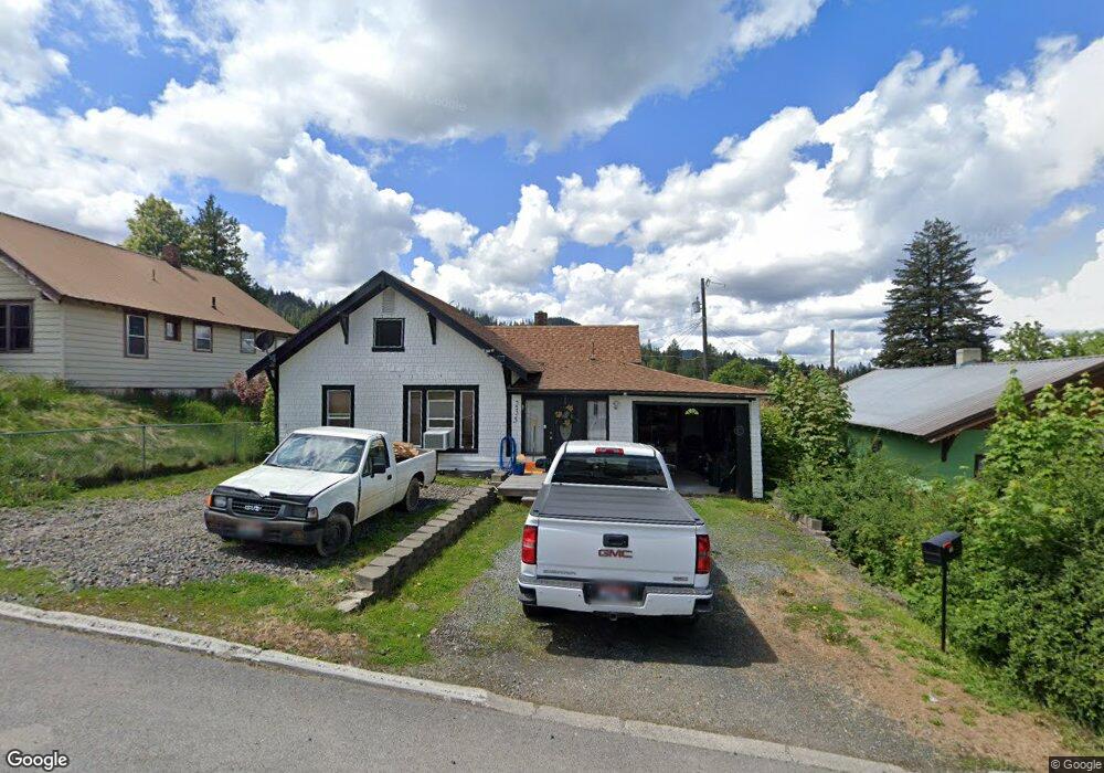
235 S 12th St Saint Maries, ID 83861
Estimated Value: $193,000 - $205,000
2
Beds
1
Bath
760
Sq Ft
$260/Sq Ft
Est. Value
About This Home
This home is located at 235 S 12th St, Saint Maries, ID 83861 and is currently estimated at $197,411, approximately $259 per square foot. 235 S 12th St is a home located in Benewah County with nearby schools including Heyburn Elementary School, UpRiver Elementary/Junior High School, and St. Maries Middle School.
Ownership History
Date
Name
Owned For
Owner Type
Purchase Details
Closed on
Aug 27, 2015
Sold by
Lanphear Floyd A and Lanphear Carol A
Bought by
Borgman Britt C
Current Estimated Value
Home Financials for this Owner
Home Financials are based on the most recent Mortgage that was taken out on this home.
Original Mortgage
$60,000
Interest Rate
3.97%
Mortgage Type
New Conventional
Create a Home Valuation Report for This Property
The Home Valuation Report is an in-depth analysis detailing your home's value as well as a comparison with similar homes in the area
Home Values in the Area
Average Home Value in this Area
Purchase History
| Date | Buyer | Sale Price | Title Company |
|---|---|---|---|
| Borgman Britt C | -- | None Available |
Source: Public Records
Mortgage History
| Date | Status | Borrower | Loan Amount |
|---|---|---|---|
| Closed | Borgman Britt C | $60,000 |
Source: Public Records
Tax History Compared to Growth
Tax History
| Year | Tax Paid | Tax Assessment Tax Assessment Total Assessment is a certain percentage of the fair market value that is determined by local assessors to be the total taxable value of land and additions on the property. | Land | Improvement |
|---|---|---|---|---|
| 2025 | $517 | $113,072 | $42,600 | $70,472 |
| 2024 | $517 | $110,120 | $42,600 | $67,520 |
| 2023 | $764 | $158,478 | $56,400 | $102,078 |
| 2022 | $815 | $153,693 | $42,600 | $111,093 |
| 2021 | $617 | $77,070 | $28,400 | $48,670 |
| 2020 | $590 | $66,937 | $24,950 | $41,987 |
| 2019 | $588 | $66,586 | $24,950 | $41,636 |
| 2018 | $610 | $66,666 | $24,950 | $41,716 |
| 2017 | $526 | $50,610 | $14,950 | $35,660 |
| 2016 | $561 | $53,857 | $14,950 | $38,907 |
| 2015 | $554 | $53,857 | $14,950 | $38,907 |
| 2014 | $535 | $53,414 | $14,950 | $38,464 |
| 2013 | -- | $53,474 | $14,950 | $38,524 |
Source: Public Records
Map
Nearby Homes
- 2353 St Marie Sriver Rd
- Nka Railroad Grade Rd
- 214 S 13th St
- 32 Horn Hooked Ln
- 31 Horn Hooked Ln
- 30 Horn Hooked Ln
- 22 Horn Hooked Ln
- 29 Horn Hooked Ln
- 28 Horn Hooked Ln
- 21 Horn Hooked Ln
- 20 Horn Hooked Ln
- 1001 W Jefferson Ave
- 1402 W Jefferson Ave
- 915 Main Ave
- 0 Ninth St
- 1161 Juniper Dr
- 1002 Highland Ave
- 1615 Lincoln Ave
- 211 S Coeur d Alene Ave
- 1538 Center Ave
- 245 S 12th St
- 227 S 12th St
- 238 S 13th St
- 246 S 13th St
- 303 S 12th St
- NKA Monarch
- NKA #2 Waddell Rd
- Lots 1 &2 Government Townsite Block 34
- 110 E Ridge (Tract 9) Dr
- 326 16th St
- 32850 Garnet Rd S
- NNA Winchester Ln
- 234 Patriot Dr
- 183 Lost Cabin Trail
- 220 S 12th St
- 1652 Trapper Loop Rd
- 324 Boxwood Ln
- 546 Trapper Loop Rd
- 1474 Trapper Loop Rd
- 2852 Pettis Peak Rd