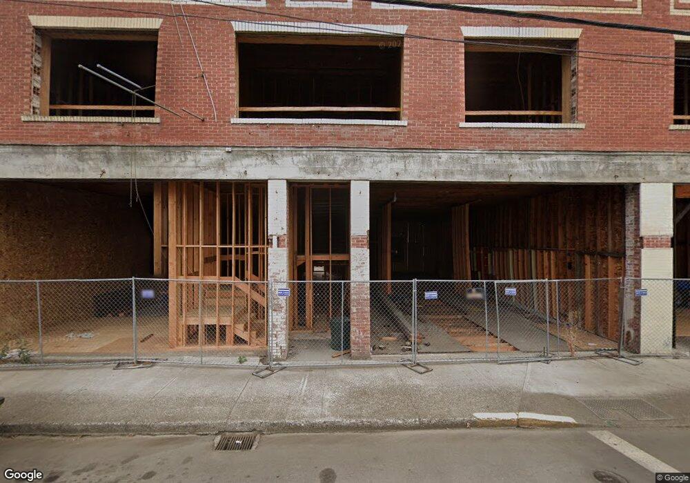
235 S Bridge St Sheridan, OR 97378
Estimated Value: $887,174
--
Bed
--
Bath
15,000
Sq Ft
$59/Sq Ft
Est. Value
About This Home
This home is located at 235 S Bridge St, Sheridan, OR 97378 and is currently estimated at $887,174, approximately $59 per square foot. 235 S Bridge St is a home located in Yamhill County with nearby schools including Faulconer-Chapman School, Sheridan High School, and Sheridan Allprep Academy.
Ownership History
Date
Name
Owned For
Owner Type
Purchase Details
Closed on
Jul 29, 2025
Sold by
Bridge Street Commercial Llc
Bought by
Pacwest Funding Inc
Current Estimated Value
Purchase Details
Closed on
Dec 22, 2016
Sold by
Davis Loren B
Bought by
Bridge Street Commercial Llc
Home Financials for this Owner
Home Financials are based on the most recent Mortgage that was taken out on this home.
Original Mortgage
$300,000
Interest Rate
3.94%
Mortgage Type
Commercial
Purchase Details
Closed on
Oct 4, 2016
Sold by
Davis Anthony R and Davis Martha S
Bought by
Davis Loren B
Purchase Details
Closed on
Oct 9, 2007
Sold by
Rylou Properties Inc
Bought by
Davis Anthony R and Davis Martha S
Home Financials for this Owner
Home Financials are based on the most recent Mortgage that was taken out on this home.
Original Mortgage
$170,200
Interest Rate
6.46%
Mortgage Type
Seller Take Back
Create a Home Valuation Report for This Property
The Home Valuation Report is an in-depth analysis detailing your home's value as well as a comparison with similar homes in the area
Home Values in the Area
Average Home Value in this Area
Purchase History
| Date | Buyer | Sale Price | Title Company |
|---|---|---|---|
| Pacwest Funding Inc | $350,000 | None Listed On Document | |
| Bridge Street Commercial Llc | $500,000 | Ticor Title Company Of Or | |
| Davis Loren B | -- | Ticor Title Company Of Or | |
| Davis Anthony R | $570,200 | Ticor Title Insurance Co |
Source: Public Records
Mortgage History
| Date | Status | Borrower | Loan Amount |
|---|---|---|---|
| Previous Owner | Bridge Street Commercial Llc | $300,000 | |
| Previous Owner | Davis Anthony R | $170,200 |
Source: Public Records
Tax History Compared to Growth
Tax History
| Year | Tax Paid | Tax Assessment Tax Assessment Total Assessment is a certain percentage of the fair market value that is determined by local assessors to be the total taxable value of land and additions on the property. | Land | Improvement |
|---|---|---|---|---|
| 2025 | $4,910 | $362,278 | -- | -- |
| 2024 | $4,509 | $351,726 | -- | -- |
| 2023 | $4,379 | $341,482 | $0 | $0 |
| 2022 | $4,258 | $331,536 | $0 | $0 |
| 2021 | $4,820 | $321,880 | $0 | $0 |
| 2020 | $4,657 | $312,505 | $0 | $0 |
| 2019 | $3,434 | $227,786 | $0 | $0 |
| 2018 | $3,338 | $221,151 | $0 | $0 |
| 2017 | $3,276 | $214,710 | $0 | $0 |
| 2016 | $3,181 | $208,456 | $0 | $0 |
| 2015 | $3,103 | $202,386 | $0 | $0 |
| 2014 | $3,018 | $196,493 | $0 | $0 |
Source: Public Records
Map
Nearby Homes
- 518 S Bridge St
- 243 SE Harney St
- 204 SW Water St
- 419 SE Sheridan Rd
- 370 NW Yamhill St
- 119 NW Sherman St
- 328 NW Sherman St
- 503 SE Sheridan Rd Unit 8
- 634 E Main St
- 240 SW Jefferson St
- 740 SE Alicia St
- 515 SE Sheridan Rd
- 515 SE Sheridan Rd Unit 6
- 240 NW Sagan Loop
- 347 NE Oak St
- 617 SW Monroe St
- 510 NE Hill St
- 1200 Blk NE Center St Unit Parcel 4
- 0 NE Center St Unit 1 491349230
- 0 NE Center St Unit 2 430429617
- 209 S Bridge St
- 142 Bridge St (- 144) S
- 144 S Bridge St
- 251 S Bridge St
- 146 N Bridge St
- 142 S Bridge St
- 136 S Bridge St
- 146 S Bridge St
- 215 S Bridge St
- 304 E Main St Unit 304
- 226 S Bridge St
- 146 SW Monroe St
- 128 S Bridge St
- 131 SW Monroe St
- 135 S Bridge St
- 145 SE Harney St
- 147 SE Harney St
- 127 SW Mill St
- 125 SW Morgan St
- 227 SW Morgan St