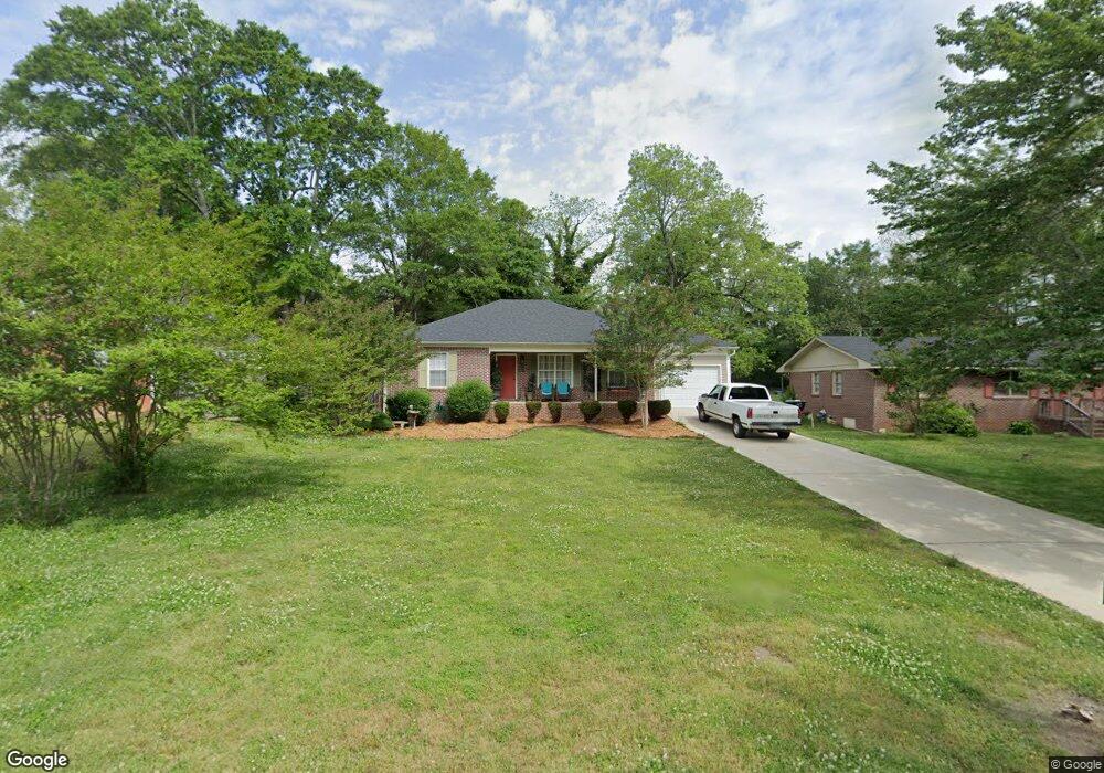
235 Sherwood Dr Winder, GA 30680
Estimated Value: $245,064 - $283,000
--
Bed
2
Baths
1,234
Sq Ft
$215/Sq Ft
Est. Value
About This Home
This home is located at 235 Sherwood Dr, Winder, GA 30680 and is currently estimated at $265,016, approximately $214 per square foot. 235 Sherwood Dr is a home located in Barrow County with nearby schools including Holsenbeck Elementary School, Bear Creek Middle School, and Winder-Barrow High School.
Ownership History
Date
Name
Owned For
Owner Type
Purchase Details
Closed on
Mar 18, 2025
Sold by
Chancey Patricia Ann
Bought by
Chancey Patricia Ann Trust and Patricia Ann Chancey Revocable Living Tr
Current Estimated Value
Purchase Details
Closed on
Jul 22, 2020
Sold by
Beverly Patricia Chancey
Bought by
Chancey Patricia Ann
Purchase Details
Closed on
Sep 27, 2012
Sold by
Jackson Ridge Llc
Bought by
Beverly Patricia C
Home Financials for this Owner
Home Financials are based on the most recent Mortgage that was taken out on this home.
Original Mortgage
$56,020
Interest Rate
3.64%
Mortgage Type
New Conventional
Purchase Details
Closed on
Jun 5, 2012
Sold by
Styles Barney Allen
Bought by
Jackson Ridge Llc
Create a Home Valuation Report for This Property
The Home Valuation Report is an in-depth analysis detailing your home's value as well as a comparison with similar homes in the area
Home Values in the Area
Average Home Value in this Area
Purchase History
| Date | Buyer | Sale Price | Title Company |
|---|---|---|---|
| Chancey Patricia Ann Trust | -- | -- | |
| Chancey Patricia Ann | -- | -- | |
| Beverly Patricia C | $54,900 | -- | |
| Jackson Ridge Llc | $37,000 | -- |
Source: Public Records
Mortgage History
| Date | Status | Borrower | Loan Amount |
|---|---|---|---|
| Previous Owner | Beverly Patricia C | $56,020 |
Source: Public Records
Tax History Compared to Growth
Tax History
| Year | Tax Paid | Tax Assessment Tax Assessment Total Assessment is a certain percentage of the fair market value that is determined by local assessors to be the total taxable value of land and additions on the property. | Land | Improvement |
|---|---|---|---|---|
| 2024 | $940 | $77,029 | $10,000 | $67,029 |
| 2023 | $748 | $77,029 | $10,000 | $67,029 |
| 2022 | $790 | $50,313 | $10,000 | $40,313 |
| 2021 | $750 | $47,680 | $10,000 | $37,680 |
| 2020 | $616 | $39,782 | $10,000 | $29,782 |
| 2019 | $565 | $35,149 | $8,000 | $27,149 |
| 2018 | $1,172 | $35,149 | $8,000 | $27,149 |
| 2017 | $920 | $30,833 | $8,000 | $22,833 |
| 2016 | $934 | $31,363 | $8,000 | $23,363 |
| 2015 | $944 | $31,628 | $8,000 | $23,628 |
| 2014 | $844 | $29,382 | $5,488 | $23,894 |
| 2013 | -- | $28,013 | $5,488 | $22,525 |
Source: Public Records
Map
Nearby Homes
- 131 Pinehurst Dr
- 317 Georgia Ave
- 0 W Williams St Unit 10464682
- 17 W Wright St
- 18 E New St
- 165 Shields St
- 15 E New St
- 273 Nancy St
- 0 Jerome St Unit 7439149
- 0 Jerome St Unit 10359679
- 209 Georgia Ave
- 19 Holland Cove
- 25 Holland Cove
- 270 Griffith St
- 227 Martin Luther King jr Dr
- 311 2nd Ave
- 116 N Broad St
- 323 Lumpkin St
- 122 Capitol Ave
- 120 N Williamson St
- 241 Sherwood Dr
- 231 Sherwood Dr
- 245 Sherwood Dr
- 223 Sherwood Dr
- 199 E Broad St
- 247 Sherwood Dr
- 232 Sherwood Dr
- 232 Sherwood Dr
- 213 E Broad St
- 248 Sherwood Dr
- 61 Mcelroy St
- 249 Sherwood Dr
- 0 Sherwood Dr Unit 3270133
- 252 Sherwood Dr
- 65 Mcelroy St
- 251 Sherwood Dr
- 256 Sherwood Dr
- 216 E Broad St
- 206 E Broad St
- 185 E Broad St