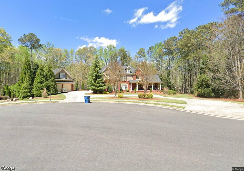
235 Sulling Way Alpharetta, GA 30009
Estimated Value: $1,582,000 - $1,849,000
5
Beds
5
Baths
5,905
Sq Ft
$298/Sq Ft
Est. Value
About This Home
This home is located at 235 Sulling Way, Alpharetta, GA 30009 and is currently estimated at $1,760,196, approximately $298 per square foot. 235 Sulling Way is a home located in Fulton County with nearby schools including Alpharetta Elementary School, Northwestern Middle School, and Milton High School.
Ownership History
Date
Name
Owned For
Owner Type
Purchase Details
Closed on
Apr 19, 2023
Sold by
Nedza Glen A
Bought by
Nedza Glen A and Nedza Jacob
Current Estimated Value
Purchase Details
Closed on
Dec 20, 2001
Sold by
Nedza Glen A
Bought by
Nedza Glen A and Nedza Tami T
Home Financials for this Owner
Home Financials are based on the most recent Mortgage that was taken out on this home.
Original Mortgage
$565,000
Interest Rate
7.08%
Mortgage Type
New Conventional
Create a Home Valuation Report for This Property
The Home Valuation Report is an in-depth analysis detailing your home's value as well as a comparison with similar homes in the area
Home Values in the Area
Average Home Value in this Area
Purchase History
| Date | Buyer | Sale Price | Title Company |
|---|---|---|---|
| Nedza Glen A | -- | -- | |
| Nedza Glen A | -- | -- | |
| Nedza Glen A | $128,600 | -- | |
| Spectrum Builders-Dsi Llc | $128,600 | -- |
Source: Public Records
Mortgage History
| Date | Status | Borrower | Loan Amount |
|---|---|---|---|
| Previous Owner | Spectrum Builders-Dsi Llc | $565,000 |
Source: Public Records
Tax History Compared to Growth
Tax History
| Year | Tax Paid | Tax Assessment Tax Assessment Total Assessment is a certain percentage of the fair market value that is determined by local assessors to be the total taxable value of land and additions on the property. | Land | Improvement |
|---|---|---|---|---|
| 2025 | $4,031 | $689,880 | $128,120 | $561,760 |
| 2023 | $17,228 | $610,360 | $98,440 | $511,920 |
| 2022 | $9,063 | $491,960 | $87,280 | $404,680 |
| 2021 | $10,864 | $420,080 | $65,720 | $354,360 |
| 2020 | $10,183 | $320,000 | $36,760 | $283,240 |
| 2019 | $1,647 | $320,000 | $36,760 | $283,240 |
| 2018 | $10,210 | $399,640 | $36,760 | $362,880 |
| 2017 | $9,231 | $332,120 | $44,680 | $287,440 |
| 2016 | $9,187 | $332,120 | $44,680 | $287,440 |
| 2015 | $10,931 | $332,120 | $44,680 | $287,440 |
| 2014 | $9,088 | $309,240 | $48,520 | $260,720 |
Source: Public Records
Map
Nearby Homes
- 1580 Mayfield Rd
- 1895 Henley Way
- 4110 Providence Square
- 1645 Mayfield Rd
- 165 Oakhurst Leaf Dr Unit 4
- 1835 Henley Way
- 2100 Providence Oaks St
- 275 Heatherton Way
- 842 N Brookshade Pkwy
- 245 Heatherton Way
- 735 Hammock Ln
- 925 Pebblestone Ct
- 14050 Providence Rd
- 4016 Dover Ave
- 1050 Little River Ln
- 1360 Bethany Ct
- 406 Woodliff Place
- 175 Heatherton Ln
- 195 Wendy Hill Dr
- 245 Sulling Way
- 225 Sulling Way
- 210 Sulling Way
- 220 Sulling Way
- 1770 Providence Farms Ln
- 240 Sulling Way
- 215 Sulling Way
- 340 Newcastle Dr
- 180 Sulling Way
- 1780 Providence Farms Ln
- 380 Newcastle Dr
- 1750 Providence Farms Ln
- 330 Newcastle Dr
- 1760 Providence Farms Ln
- 205 Sulling Way
- 370 Newcastle Dr
- 170 Sulling Way
- 320 Newcastle Dr
- 395 Newcastle Dr
- 195 Sulling Way