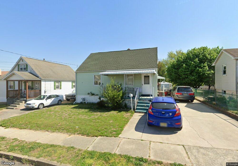
235 Vanneman Blvd Paulsboro, NJ 08066
Estimated Value: $183,305 - $299,000
--
Bed
--
Bath
1,248
Sq Ft
$188/Sq Ft
Est. Value
About This Home
This home is located at 235 Vanneman Blvd, Paulsboro, NJ 08066 and is currently estimated at $234,576, approximately $187 per square foot. 235 Vanneman Blvd is a home located in Gloucester County with nearby schools including Billingsport Elementary School, Loudenslager Elementary School, and Paulsboro High School.
Ownership History
Date
Name
Owned For
Owner Type
Purchase Details
Closed on
Apr 28, 2006
Sold by
Smith Edward
Bought by
Steven Smith
Current Estimated Value
Home Financials for this Owner
Home Financials are based on the most recent Mortgage that was taken out on this home.
Original Mortgage
$99,216
Outstanding Balance
$57,264
Interest Rate
6.34%
Mortgage Type
Purchase Money Mortgage
Estimated Equity
$177,312
Create a Home Valuation Report for This Property
The Home Valuation Report is an in-depth analysis detailing your home's value as well as a comparison with similar homes in the area
Home Values in the Area
Average Home Value in this Area
Purchase History
| Date | Buyer | Sale Price | Title Company |
|---|---|---|---|
| Steven Smith | $100,000 | -- |
Source: Public Records
Mortgage History
| Date | Status | Borrower | Loan Amount |
|---|---|---|---|
| Open | Steven Smith | $99,216 |
Source: Public Records
Tax History Compared to Growth
Tax History
| Year | Tax Paid | Tax Assessment Tax Assessment Total Assessment is a certain percentage of the fair market value that is determined by local assessors to be the total taxable value of land and additions on the property. | Land | Improvement |
|---|---|---|---|---|
| 2025 | $4,356 | $99,000 | $22,300 | $76,700 |
| 2024 | $4,352 | $99,000 | $22,300 | $76,700 |
| 2023 | $4,352 | $99,000 | $22,300 | $76,700 |
| 2022 | $4,273 | $99,000 | $22,300 | $76,700 |
| 2021 | $4,190 | $99,000 | $22,300 | $76,700 |
| 2020 | $4,164 | $99,000 | $22,300 | $76,700 |
| 2019 | $4,033 | $99,000 | $22,300 | $76,700 |
| 2018 | $3,803 | $99,000 | $22,300 | $76,700 |
| 2017 | $3,787 | $99,000 | $22,300 | $76,700 |
| 2016 | $3,608 | $99,000 | $22,300 | $76,700 |
| 2015 | $3,587 | $99,000 | $22,300 | $76,700 |
| 2014 | $3,654 | $108,500 | $24,300 | $84,200 |
Source: Public Records
Map
Nearby Homes
- 219 Vanneman Blvd
- 255 Elizabeth Ave
- L18 20 W Broad St
- 330 Croce Ave
- 836 E Broad St
- 335 W Buck St
- 344 W Washington St
- 1214 Walter Ave
- 269 W Broad St
- 1224 Heddon Ave
- 1534 Pine St
- 1519 Pine St
- 227 W Buck St
- 1043 Penn Line Rd
- 122 W Washington St
- 129 W Washington St
- 131 Jessup St
- 140 142 W Jefferson St
- 11 W Washington St
- 28 W Jefferson St
- 231 Vanneman Blvd
- 239 Vanneman Blvd
- 227 Vanneman Blvd
- 245 Vanneman Blvd
- 444 Cook Ave
- 445 Morton Ave
- 440 Cook Ave
- 441 Morton Ave
- 4471 Cook Ave
- 232 Vanneman Blvd
- 253 Vanneman Blvd
- 436 Cook Ave
- 236 Vanneman Blvd
- 437 Morton Ave
- 228 Vanneman Blvd
- 240 Vanneman Blvd
- 451 Cook Ave
- 224 Vanneman Blvd
- 244 Vanneman Blvd
- 449 Cook Ave