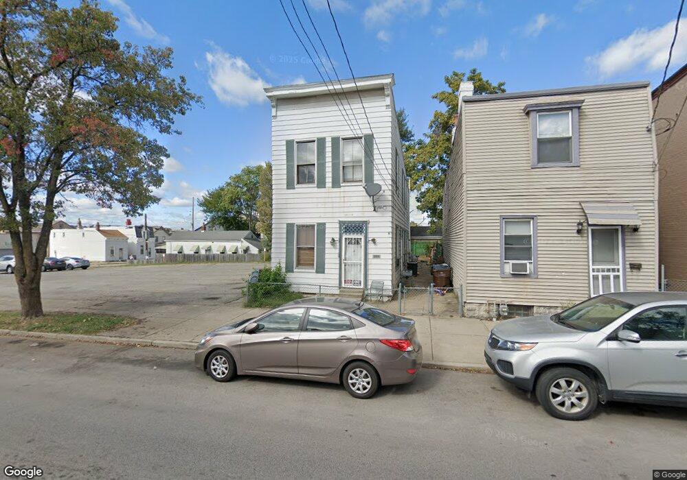
235 W 11th St Newport, KY 41071
Estimated Value: $141,000 - $226,000
--
Bed
2
Baths
1,801
Sq Ft
$102/Sq Ft
Est. Value
About This Home
This home is located at 235 W 11th St, Newport, KY 41071 and is currently estimated at $184,198, approximately $102 per square foot. 235 W 11th St is a home located in Campbell County with nearby schools including Newport Primary School, Newport Intermediate School, and Newport High School.
Ownership History
Date
Name
Owned For
Owner Type
Purchase Details
Closed on
Feb 20, 2012
Sold by
Barnett Donald Keith and Estate Of Cora Elizabeth Barne
Bought by
Mahan Edward Donal
Current Estimated Value
Home Financials for this Owner
Home Financials are based on the most recent Mortgage that was taken out on this home.
Original Mortgage
$10,000
Interest Rate
3.92%
Mortgage Type
Purchase Money Mortgage
Create a Home Valuation Report for This Property
The Home Valuation Report is an in-depth analysis detailing your home's value as well as a comparison with similar homes in the area
Home Values in the Area
Average Home Value in this Area
Purchase History
| Date | Buyer | Sale Price | Title Company |
|---|---|---|---|
| Mahan Edward Donal | $10,000 | None Available |
Source: Public Records
Mortgage History
| Date | Status | Borrower | Loan Amount |
|---|---|---|---|
| Closed | Mahan Edward Donal | $10,000 |
Source: Public Records
Tax History Compared to Growth
Tax History
| Year | Tax Paid | Tax Assessment Tax Assessment Total Assessment is a certain percentage of the fair market value that is determined by local assessors to be the total taxable value of land and additions on the property. | Land | Improvement |
|---|---|---|---|---|
| 2024 | $316 | $82,000 | $10,000 | $72,000 |
| 2023 | $273 | $69,100 | $4,600 | $64,500 |
| 2022 | $344 | $69,100 | $4,600 | $64,500 |
| 2021 | $352 | $69,100 | $4,600 | $64,500 |
| 2020 | $358 | $69,100 | $4,600 | $64,500 |
| 2019 | $335 | $62,900 | $3,800 | $59,100 |
| 2018 | $331 | $62,900 | $3,800 | $59,100 |
| 2017 | $332 | $62,900 | $3,800 | $59,100 |
| 2016 | $304 | $62,900 | $0 | $0 |
| 2015 | $308 | $62,900 | $0 | $0 |
| 2014 | $303 | $62,900 | $0 | $0 |
Source: Public Records
Map
Nearby Homes
- 1145 Isabella St
- 327 W 11th St
- 1140 Central Ave
- 318 W 12th St
- 308-310 W 10th St
- 226 W 10th St
- 339 W 12th St
- 1006 Central Ave
- 320 W 10th St
- 1035 Ann St
- 305 W 10th St
- 414 Hodge St
- 406 W 10th St
- 427 W 11th St
- 423 Hodge St
- The Breckenridge Plan at Martin's Gate
- 202 W 13th St
- 117 W 10th St
- 303 Lindsey St
- 118 W 13th St Unit Lot 23
- 227 W 11th St
- 225 W 11th St
- 1038 Liberty St
- 217 W 11th St
- 1036 Liberty St
- 1039 Liberty St
- 1037 Isabella St
- 211 W 11th St
- 1031 Isabella St
- 1037 Liberty St
- 1035 Isabella St
- 226 W 11th St
- 224 W 11th St
- 1029 Isabella St
- 228 W 11th St
- 209 W 11th St
- 1031 Liberty St
- 1101 Isabella St
- 1025 Isabella St
- 1105 Isabella St