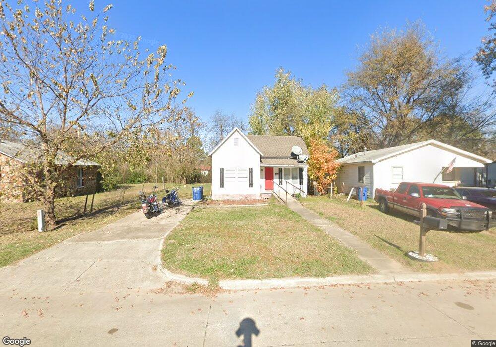
235 W Kiowa Ave McAlester, OK 74501
Estimated Value: $58,000 - $66,000
3
Beds
1
Bath
1,068
Sq Ft
$59/Sq Ft
Est. Value
About This Home
This home is located at 235 W Kiowa Ave, McAlester, OK 74501 and is currently estimated at $62,592, approximately $58 per square foot. 235 W Kiowa Ave is a home located in Pittsburg County with nearby schools including McAlester High School, Mcalester Christian Academy, and McAlester Christian Academy.
Ownership History
Date
Name
Owned For
Owner Type
Purchase Details
Closed on
Nov 8, 2023
Sold by
Roberts O W O and Roberts Karen E
Bought by
Smith Jackie
Current Estimated Value
Purchase Details
Closed on
Jan 11, 2022
Sold by
Roberts Ow E and Roberts Karen E
Bought by
Roberts Doug and Roberts Julie
Purchase Details
Closed on
Jun 11, 2010
Sold by
Roberts O W and Roberts Karen E
Bought by
Roberts Rick A
Purchase Details
Closed on
Nov 29, 2007
Sold by
Roberts O W and Roberts Karen E
Bought by
Wilson Eddie Bert and Wilson Alma Louse
Purchase Details
Closed on
Jun 27, 2003
Sold by
Ketcherside Dorothy
Bought by
Roberts O W
Create a Home Valuation Report for This Property
The Home Valuation Report is an in-depth analysis detailing your home's value as well as a comparison with similar homes in the area
Home Values in the Area
Average Home Value in this Area
Purchase History
| Date | Buyer | Sale Price | Title Company |
|---|---|---|---|
| Smith Jackie | $5,000 | None Listed On Document | |
| Roberts Doug | $24,000 | None Listed On Document | |
| Roberts Rick A | $8,500 | None Available | |
| Wilson Eddie Bert | $29,000 | None Available | |
| Roberts O W | $12,500 | -- |
Source: Public Records
Tax History Compared to Growth
Tax History
| Year | Tax Paid | Tax Assessment Tax Assessment Total Assessment is a certain percentage of the fair market value that is determined by local assessors to be the total taxable value of land and additions on the property. | Land | Improvement |
|---|---|---|---|---|
| 2025 | $229 | $2,607 | $355 | $2,252 |
| 2024 | $229 | $2,782 | $355 | $2,427 |
| 2023 | $244 | $2,149 | $224 | $1,925 |
| 2022 | $179 | $2,047 | $215 | $1,832 |
| 2021 | $178 | $2,047 | $215 | $1,832 |
| 2020 | $163 | $1,857 | $199 | $1,658 |
| 2019 | $143 | $1,857 | $202 | $1,655 |
| 2018 | $136 | $1,684 | $182 | $1,502 |
| 2017 | $131 | $1,604 | $173 | $1,431 |
| 2016 | $124 | $1,528 | $165 | $1,363 |
| 2015 | $108 | $1,455 | $208 | $1,247 |
| 2014 | $108 | $1,455 | $208 | $1,247 |
Source: Public Records
Map
Nearby Homes
- 0 W Delaware Ave
- 419 W Delaware Ave
- 604 W Cherokee Ave
- 422 W Cherokee Ave
- 217 W Seminole Ave
- 232 W Seminole Ave
- 401 W Cherokee Ave
- 717 S A St
- 1311 S George Nigh Expy
- 420 W Ottawa Ave
- 0 S Oak St
- Pittsburg County
- 220 W Washington
- 204 W Washington Ave
- 0 Oklahoma 31 Unit 2543194
- 905 S 2nd St
- 919 S 2nd St
- 415 W Adams Ave
- 610 W Washington Ave
- 060 Oklahoma 31
- 233 W Kiowa Ave
- 237 W Kiowa Ave
- 227 W Kiowa Ave
- 0 Us Hwy 270 Hwy W Unit 1705293
- 0 Us Hwy 270 Hwy W Unit 1638854
- 0 Us Hwy 270 Hwy W Unit 1628327
- 0 Us Hwy 270 Hwy W Unit 1601974
- 0 Us Hwy 270 Hwy W Unit 1601945
- 0 Us Hwy 270 Hwy W Unit 1601926
- 0 Us Hwy 270 Hwy W Unit 1601789
- 0 Us Hwy 270 Hwy W Unit 1550838
- 230 W Delaware Ave
- 238 W Delaware Ave
- 225 W Kiowa Ave
- 228 W Kiowa Ave
- 226 W Kiowa Ave
- 224 W Kiowa Ave
- 412 S B St
- 302 W Delaware Ave
- 217 W Kiowa Ave