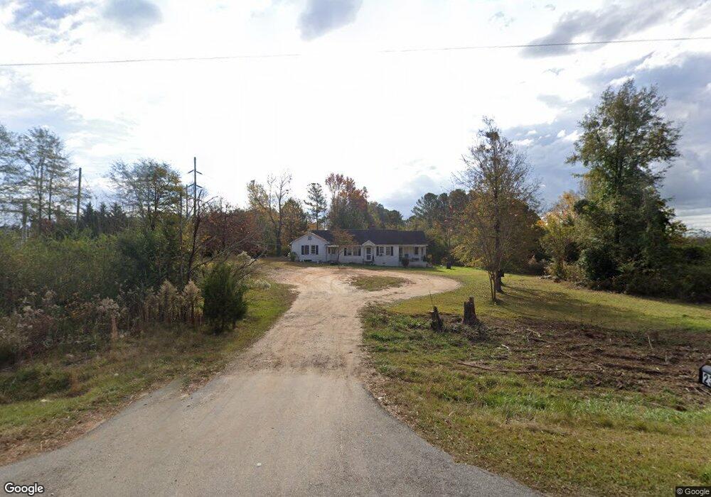
2351 Union Point Hwy Greensboro, GA 30642
Estimated Value: $107,000 - $130,000
3
Beds
2
Baths
1,759
Sq Ft
$69/Sq Ft
Est. Value
About This Home
This home is located at 2351 Union Point Hwy, Greensboro, GA 30642 and is currently estimated at $121,196, approximately $68 per square foot. 2351 Union Point Hwy is a home located in Greene County with nearby schools including Greene County High School.
Ownership History
Date
Name
Owned For
Owner Type
Purchase Details
Closed on
Oct 18, 2017
Bought by
Billtown Llc
Current Estimated Value
Home Financials for this Owner
Home Financials are based on the most recent Mortgage that was taken out on this home.
Original Mortgage
$66,986
Interest Rate
3.83%
Mortgage Type
Purchase Money Mortgage
Purchase Details
Closed on
Apr 5, 1995
Sold by
Whichard Clyde Lafayette
Bought by
Smith Donna B Guardian Of
Purchase Details
Closed on
Apr 26, 1994
Sold by
Whichard Clyde L and Whichard Floye J
Bought by
Whichard Clyde Lafayette
Purchase Details
Closed on
Jan 1, 1970
Sold by
Lewis Miles Walker
Bought by
Whichard Clyde L and Whichard Floye J
Purchase Details
Closed on
Jan 1, 1952
Bought by
Whichard Clyde
Create a Home Valuation Report for This Property
The Home Valuation Report is an in-depth analysis detailing your home's value as well as a comparison with similar homes in the area
Home Values in the Area
Average Home Value in this Area
Purchase History
| Date | Buyer | Sale Price | Title Company |
|---|---|---|---|
| Billtown Llc | $50,000 | -- | |
| Smith Donna B Guardian Of | -- | -- | |
| Whichard Clyde Lafayette | -- | -- | |
| Whichard Clyde L | -- | -- | |
| Lewis Miles Walker | -- | -- | |
| Whichard Clyde | -- | -- |
Source: Public Records
Mortgage History
| Date | Status | Borrower | Loan Amount |
|---|---|---|---|
| Closed | Billtown Llc | $66,986 |
Source: Public Records
Tax History Compared to Growth
Tax History
| Year | Tax Paid | Tax Assessment Tax Assessment Total Assessment is a certain percentage of the fair market value that is determined by local assessors to be the total taxable value of land and additions on the property. | Land | Improvement |
|---|---|---|---|---|
| 2024 | $839 | $23,442 | $5,312 | $18,130 |
| 2023 | $562 | $24,676 | $4,840 | $19,836 |
| 2022 | $466 | $16,636 | $3,720 | $12,916 |
| 2021 | $454 | $15,276 | $3,720 | $11,556 |
| 2020 | $449 | $13,800 | $2,600 | $11,200 |
| 2019 | $456 | $13,800 | $2,600 | $11,200 |
| 2018 | $434 | $13,800 | $2,600 | $11,200 |
| 2017 | $415 | $13,827 | $2,615 | $11,212 |
| 2016 | $415 | $13,827 | $2,615 | $11,212 |
| 2015 | $389 | $13,827 | $2,615 | $11,212 |
| 2014 | $377 | $12,847 | $2,615 | $10,232 |
Source: Public Records
Map
Nearby Homes
- 0 Union Point Hwy Unit 69532
- 0 Union Point Hwy Unit 7607786
- 0 Union Point Hwy Unit 10555176
- 1141 Planing Mill Rd
- 1131 Planing Mill Rd
- 0 Shady Side Ln
- 0 Cunningham Rd
- 2260 Cunningham Rd
- 1641 Bowden Pond Rd
- LOT 1 Penfield
- 1531 E Broad St
- 0 Railroad St Unit 218854
- 0 Railroad St Unit 10578007
- 0 Railroad St Unit 531919
- 1020 Horton Dr
- 1060 Twin Pines Cir
- 0 Old Union Point Rd Unit 1 10557753
- 1251 Brickhouse Rd
- 1251 Brick House Rd
- 1681 Sibley School Rd
- 2331 Union Point Hwy
- 2350 Union Point Hwy
- 2330 Union Point Hwy
- 2450 Union Point Hwy
- 2340 Union Point Hwy
- 2261 Union Point Hwy
- 1071 Ball Field Rd
- 0 Airport Rd Unit 8260315
- 0 Airport Rd Unit 7214425
- 0 Airport Rd Unit 2
- 0 Airport Rd Unit 7380076
- 0 Airport Rd Unit 7218292
- 0 Airport Rd Unit 2 7320881
- 0 Airport Rd Unit 7584757
- 0 Airport Rd Unit 9073110
- 0 Airport Rd Unit 9073063
- 0 Airport Rd Unit 8285513
- 0 Airport Rd Unit 3091373
- 0 Airport Rd Unit 48479
- 0 Airport Rd Unit 8500094