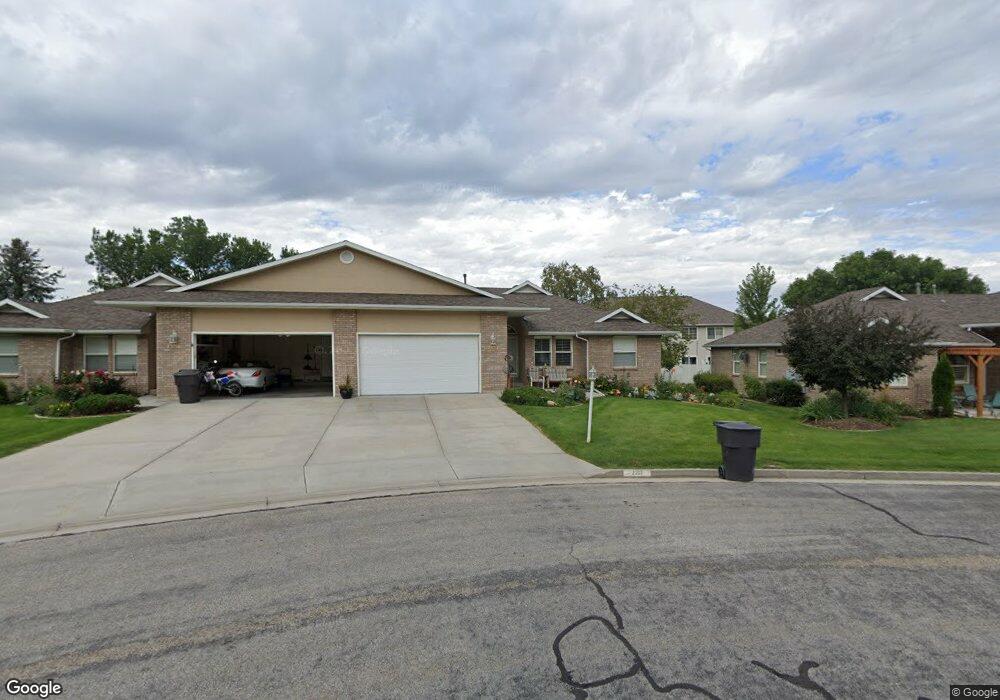
2352 S 600 W Brigham City, UT 84302
Estimated Value: $365,539 - $509,000
--
Bed
--
Bath
1,377
Sq Ft
$325/Sq Ft
Est. Value
About This Home
This home is located at 2352 S 600 W, Brigham City, UT 84302 and is currently estimated at $447,385, approximately $324 per square foot. 2352 S 600 W is a home located in Box Elder County with nearby schools including Three Mile Creek School, Adele C. Young Intermediate School, and Box Elder Middle School.
Ownership History
Date
Name
Owned For
Owner Type
Purchase Details
Closed on
Dec 13, 2024
Sold by
Shauna C Astle Family Trust and Astle Shauna C
Bought by
Brown Forrest S and Bunton Whitney R
Current Estimated Value
Home Financials for this Owner
Home Financials are based on the most recent Mortgage that was taken out on this home.
Original Mortgage
$160,000
Outstanding Balance
$158,725
Interest Rate
6.72%
Mortgage Type
New Conventional
Estimated Equity
$288,660
Purchase Details
Closed on
May 14, 2024
Sold by
Astle Shauna C
Bought by
Shauna Astle Family Trust and Astle
Purchase Details
Closed on
May 11, 2015
Sold by
Black Karen I
Bought by
Astle Shauna C
Home Financials for this Owner
Home Financials are based on the most recent Mortgage that was taken out on this home.
Original Mortgage
$144,000
Interest Rate
3.64%
Mortgage Type
New Conventional
Create a Home Valuation Report for This Property
The Home Valuation Report is an in-depth analysis detailing your home's value as well as a comparison with similar homes in the area
Home Values in the Area
Average Home Value in this Area
Purchase History
| Date | Buyer | Sale Price | Title Company |
|---|---|---|---|
| Brown Forrest S | -- | Secure Land Title | |
| Shauna Astle Family Trust | -- | None Listed On Document | |
| Astle Shauna C | -- | None Available |
Source: Public Records
Mortgage History
| Date | Status | Borrower | Loan Amount |
|---|---|---|---|
| Open | Brown Forrest S | $160,000 | |
| Previous Owner | Astle Shauna C | $144,000 |
Source: Public Records
Tax History Compared to Growth
Tax History
| Year | Tax Paid | Tax Assessment Tax Assessment Total Assessment is a certain percentage of the fair market value that is determined by local assessors to be the total taxable value of land and additions on the property. | Land | Improvement |
|---|---|---|---|---|
| 2025 | $2,386 | $359,436 | $95,000 | $264,436 |
| 2024 | $2,239 | $401,561 | $90,000 | $311,561 |
| 2023 | $2,180 | $397,222 | $80,000 | $317,222 |
| 2022 | $2,500 | $235,437 | $27,500 | $207,937 |
| 2021 | $2,057 | $264,271 | $50,000 | $214,271 |
| 2020 | $1,775 | $264,271 | $50,000 | $214,271 |
| 2019 | $1,562 | $123,255 | $27,500 | $95,755 |
| 2018 | $1,469 | $110,765 | $27,500 | $83,265 |
| 2017 | $1,559 | $201,391 | $27,500 | $151,391 |
| 2016 | $1,545 | $106,800 | $27,500 | $79,300 |
| 2015 | $1,420 | $99,591 | $27,500 | $72,091 |
| 2014 | $1,420 | $96,159 | $5,869 | $90,290 |
| 2013 | -- | $87,950 | $5,869 | $82,081 |
Source: Public Records
Map
Nearby Homes
- 635 W Liberty Cir
- 2230 S 635 W Unit C
- 2230 S 635 W Unit D
- 2245 S 450 W
- 2475 S 450 W
- 2548 S 700 W
- 409 W 2100 S
- 2484 S 900 W
- 2788 Peach St
- 295 W 2000 S
- Hadleigh Plan at West Meadows
- Edgeworth Plan at West Meadows
- Hyland Plan at West Meadows
- Cambria Plan at West Meadows
- Stanton Plan at West Meadows
- Ravenstone Plan at West Meadows
- Clearpoint Plan at West Meadows
- Aldin Plan at West Meadows
- Northfield Plan at West Meadows
- Norfolk Plan at West Meadows
- 2356 S 600 W
- 2320 S 600 W
- 2850 S 600 W
- 2312 S 600 W
- 603 W 2350 S
- 603 W 2350 S
- 588 W 2350 S
- 619 W 2300 S
- 619 W 2300 S Unit 1
- 619 W 2300 S Unit 4
- 619 W 2300 S Unit 8
- 619 W 2300 S Unit 6
- 619 W 2300 S Unit 5
- 619 W 2300 S Unit 3
- 619 W 2300 S
- 619 W 2300 S Unit 7
- 619 W 2300 S Unit 2
- 587 W 2300 S
- 595 W 2350 S
- 580 W 2350 S