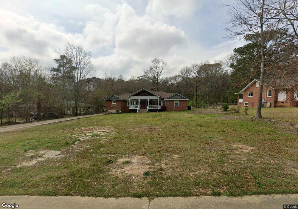
2353 Elm Dr Columbus, GA 31907
Eastern Columbus NeighborhoodEstimated Value: $219,000 - $245,393
4
Beds
4
Baths
2,253
Sq Ft
$104/Sq Ft
Est. Value
About This Home
This home is located at 2353 Elm Dr, Columbus, GA 31907 and is currently estimated at $234,598, approximately $104 per square foot. 2353 Elm Dr is a home located in Muscogee County with nearby schools including Rigdon Road Elementary School, Fort Middle School, and Hardaway High School.
Ownership History
Date
Name
Owned For
Owner Type
Purchase Details
Closed on
May 28, 2020
Sold by
Torres Isabel
Bought by
Torres Isabel and Vicente Huga
Current Estimated Value
Purchase Details
Closed on
May 22, 2020
Sold by
Federal Home Loan Mtg Corp
Bought by
Torres Isabel
Purchase Details
Closed on
May 7, 2019
Sold by
Statebridge Co Llc
Bought by
Federal Home Loan Mtg Corp
Create a Home Valuation Report for This Property
The Home Valuation Report is an in-depth analysis detailing your home's value as well as a comparison with similar homes in the area
Home Values in the Area
Average Home Value in this Area
Purchase History
| Date | Buyer | Sale Price | Title Company |
|---|---|---|---|
| Torres Isabel | -- | -- | |
| Torres Isabel | -- | -- | |
| Federal Home Loan Mtg Corp | $85,713 | -- | |
| Statebridge Co Llc | $85,713 | -- |
Source: Public Records
Tax History Compared to Growth
Tax History
| Year | Tax Paid | Tax Assessment Tax Assessment Total Assessment is a certain percentage of the fair market value that is determined by local assessors to be the total taxable value of land and additions on the property. | Land | Improvement |
|---|---|---|---|---|
| 2025 | $4,312 | $110,160 | $14,084 | $96,076 |
| 2024 | $4,312 | $110,160 | $14,084 | $96,076 |
| 2023 | $4,339 | $110,160 | $14,084 | $96,076 |
| 2022 | $3,285 | $80,456 | $10,608 | $69,848 |
| 2021 | $2,533 | $55,668 | $10,608 | $45,060 |
| 2020 | $2,489 | $60,936 | $10,608 | $50,328 |
| 2019 | $2,497 | $60,936 | $10,608 | $50,328 |
| 2018 | $536 | $60,936 | $10,608 | $50,328 |
| 2017 | $540 | $60,936 | $10,608 | $50,328 |
| 2016 | $543 | $37,315 | $4,872 | $32,443 |
| 2015 | $543 | $37,315 | $4,872 | $32,443 |
| 2014 | $217 | $37,315 | $4,872 | $32,443 |
| 2013 | -- | $37,315 | $4,872 | $32,443 |
Source: Public Records
Map
Nearby Homes
- 4161 Althea Dr
- 4160 Spirea Dr
- 2608 Juniper Ave
- 4201 Forrest Rd
- 3800 Woodmont Dr
- 8 Kingswood Ct
- 2 Kingswood Ct
- 4237 Fort St
- 3875 Mulberry Dr
- 4248 Yates Dr
- 3760 Mulberry Dr
- 8 Primrose Ct
- 3836 Mulberry Dr
- 4268 Yates Dr
- 3935 Dexter Dr
- 4 Clausen Dr
- 911 Lamore St
- 1674 Forestside Dr
- 3604 Norris Rd
- 2525 Norris Rd Unit 36