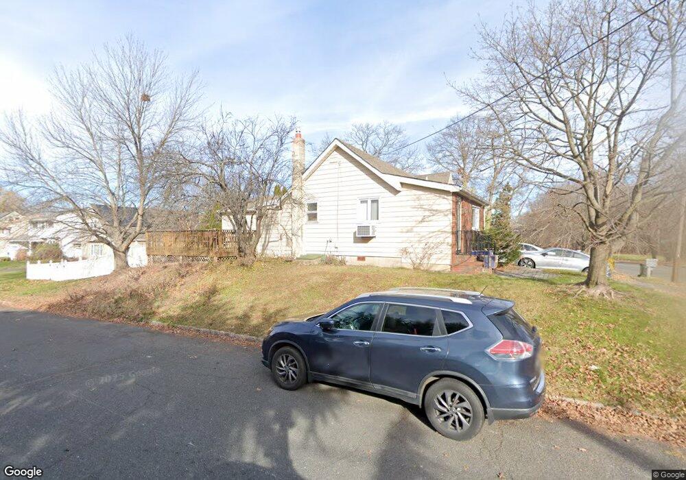
2359 Morse Ave Scotch Plains, NJ 07076
Estimated Value: $402,000 - $603,000
3
Beds
2
Baths
1,096
Sq Ft
$469/Sq Ft
Est. Value
About This Home
This home is located at 2359 Morse Ave, Scotch Plains, NJ 07076 and is currently estimated at $513,889, approximately $468 per square foot. 2359 Morse Ave is a home located in Union County with nearby schools including Howard B. Brunner Elementary School, Nettingham Middle School, and Scotch Plains-Fanwood High School.
Ownership History
Date
Name
Owned For
Owner Type
Purchase Details
Closed on
May 10, 2014
Sold by
Garland Edward J and Garland Blanche B
Bought by
Garland Edward J and Garland Blanche B
Current Estimated Value
Purchase Details
Closed on
Apr 4, 2006
Sold by
Bartram Jane S
Bought by
Garland Edward J and Garland Blanche B
Purchase Details
Closed on
May 7, 2003
Sold by
Duthie Richard
Bought by
Bartram Jane
Home Financials for this Owner
Home Financials are based on the most recent Mortgage that was taken out on this home.
Original Mortgage
$182,000
Interest Rate
5.84%
Create a Home Valuation Report for This Property
The Home Valuation Report is an in-depth analysis detailing your home's value as well as a comparison with similar homes in the area
Home Values in the Area
Average Home Value in this Area
Purchase History
| Date | Buyer | Sale Price | Title Company |
|---|---|---|---|
| Garland Edward J | -- | Multiple | |
| Garland Edward J | $359,000 | -- | |
| Bartram Jane | $260,000 | -- |
Source: Public Records
Mortgage History
| Date | Status | Borrower | Loan Amount |
|---|---|---|---|
| Previous Owner | Bartram Jane | $182,000 |
Source: Public Records
Tax History Compared to Growth
Tax History
| Year | Tax Paid | Tax Assessment Tax Assessment Total Assessment is a certain percentage of the fair market value that is determined by local assessors to be the total taxable value of land and additions on the property. | Land | Improvement |
|---|---|---|---|---|
| 2025 | $7,402 | $62,900 | $20,300 | $42,600 |
| 2024 | $7,184 | $62,900 | $20,300 | $42,600 |
| 2023 | $7,184 | $62,900 | $20,300 | $42,600 |
| 2022 | $7,098 | $62,900 | $20,300 | $42,600 |
| 2021 | $7,086 | $62,900 | $20,300 | $42,600 |
| 2020 | $7,052 | $62,900 | $20,300 | $42,600 |
| 2019 | $7,000 | $62,900 | $20,300 | $42,600 |
| 2018 | $6,883 | $62,900 | $20,300 | $42,600 |
| 2017 | $6,730 | $62,900 | $20,300 | $42,600 |
| 2016 | $6,600 | $62,900 | $20,300 | $42,600 |
| 2015 | $6,492 | $62,900 | $20,300 | $42,600 |
| 2014 | $6,278 | $62,900 | $20,300 | $42,600 |
Source: Public Records
Map
Nearby Homes
- 869 Ternay Ave
- 2286 Stocker Ln
- 2406 Park Place
- 2398 Hamlette Place
- 2314 Longfellow Ave
- 2219 North Ave Unit 6
- 2269 Redwood Rd
- 4 Lois Place
- 9 Timberline Dr
- 350 W Dudley Ave
- 143 Stanmore Place
- 2588 Liberty Ave
- 24 Deborah Way
- 26 Riga Ct Unit 3A
- 16 Riga Ct Unit 2B
- 7 Riga Ct
- 177 Pleasant Ave
- 2116 Newark Ave
- 21 Old South Ave
- 524 William St
- 2365 Morse Ave
- 875 Ternay Ave
- 2353 Morse Ave
- 878 Ternay Ave
- 2347 Morse Ave
- 2360 Morse Ave
- 2375 Morse Ave
- 874 Ternay Ave
- 872 Sims Ave
- 2366 Morse Ave
- 2352 Morse Ave
- 863 Ternay Ave
- 868 Sims Ave
- 2345 Morse Ave
- 870 Ternay Ave
- 879 Odonnell Ave
- 879 O'Donnell Ave
- 875 Odonnell Ave
- 2339 Morse Ave
- 2340 Morse Ave