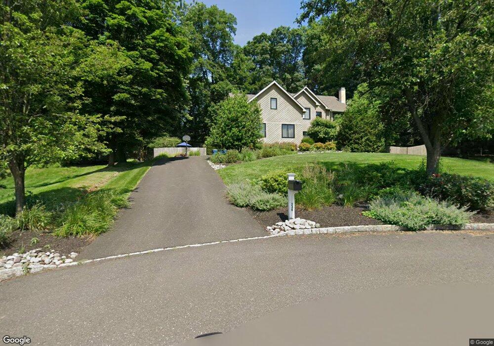
236 Amherst Dr Doylestown, PA 18901
Estimated Value: $848,000 - $1,010,000
4
Beds
3
Baths
3,337
Sq Ft
$287/Sq Ft
Est. Value
About This Home
This home is located at 236 Amherst Dr, Doylestown, PA 18901 and is currently estimated at $959,304, approximately $287 per square foot. 236 Amherst Dr is a home located in Bucks County with nearby schools including Groveland Elementary School, Tohickon Middle School, and Central Bucks High School-West.
Ownership History
Date
Name
Owned For
Owner Type
Purchase Details
Closed on
Aug 15, 2005
Sold by
Dimond Roberta R and Stonesifer Frederic Sandberg
Bought by
Albert Kevin and Albert Danielle
Current Estimated Value
Home Financials for this Owner
Home Financials are based on the most recent Mortgage that was taken out on this home.
Original Mortgage
$50,000
Outstanding Balance
$26,868
Interest Rate
5.92%
Mortgage Type
Credit Line Revolving
Estimated Equity
$932,436
Purchase Details
Closed on
Nov 9, 1992
Bought by
Dimond Roberta R
Create a Home Valuation Report for This Property
The Home Valuation Report is an in-depth analysis detailing your home's value as well as a comparison with similar homes in the area
Home Values in the Area
Average Home Value in this Area
Purchase History
| Date | Buyer | Sale Price | Title Company |
|---|---|---|---|
| Albert Kevin | $601,000 | None Available | |
| Dimond Roberta R | $378,800 | -- |
Source: Public Records
Mortgage History
| Date | Status | Borrower | Loan Amount |
|---|---|---|---|
| Open | Albert Kevin | $50,000 | |
| Open | Albert Kevin | $480,000 |
Source: Public Records
Tax History Compared to Growth
Tax History
| Year | Tax Paid | Tax Assessment Tax Assessment Total Assessment is a certain percentage of the fair market value that is determined by local assessors to be the total taxable value of land and additions on the property. | Land | Improvement |
|---|---|---|---|---|
| 2025 | $11,722 | $66,240 | $11,720 | $54,520 |
| 2024 | $11,722 | $66,240 | $11,720 | $54,520 |
| 2023 | $11,177 | $66,240 | $11,720 | $54,520 |
| 2022 | $11,053 | $66,240 | $11,720 | $54,520 |
| 2021 | $10,825 | $66,240 | $11,720 | $54,520 |
| 2020 | $10,776 | $66,240 | $11,720 | $54,520 |
| 2019 | $10,660 | $66,240 | $11,720 | $54,520 |
| 2018 | $10,627 | $66,240 | $11,720 | $54,520 |
| 2017 | $10,544 | $66,240 | $11,720 | $54,520 |
| 2016 | $10,478 | $66,240 | $11,720 | $54,520 |
| 2015 | -- | $66,240 | $11,720 | $54,520 |
| 2014 | -- | $66,240 | $11,720 | $54,520 |
Source: Public Records
Map
Nearby Homes
- 301 Windy Run Rd
- 3711 Jacob Stout Rd Unit 5
- 3723 William Daves Rd
- 3765 William Daves Rd
- 100 Bishops Gate Ln Unit 67
- 114 Blackfriars Cir
- 194 Victoria Ct Unit 143
- 4748 Bishop Cir
- 3838 Jacob Stout Rd
- 5437 Rinker Cir Unit 283
- 3923 Ferry Rd
- 157 Pine Run Rd
- 62 Constitution Ave
- 1 Gatehouse Ln
- 90 Chapman Ave
- 4263 Kleinot Dr
- 4 Old Colonial Dr Unit 254
- 4317 Kleinot Dr
- 4464 Kleinot Dr
- 4330 Kleinot Dr
- 234 Amherst Dr
- 341 Windy Run Rd
- 339 Windy Run Rd
- 233 Amherst Dr
- 232 Amherst Dr Unit 13
- 337 Windy Run Rd
- 319 Windy Run Rd
- 317 Windy Run Rd
- 342 Windy Run Rd
- 206 Southwind Dr
- 321 Windy Run Rd
- 204 Southwind Dr
- 202 Southwind Dr
- 340 Windy Run Rd
- 231 Amherst Dr
- 335 Windy Run Rd
- 200 Southwind Dr
- 323 Windy Run Rd
- 338 Windy Run Rd
- 208 Southwind Dr