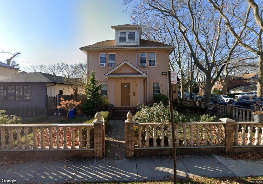
236 Bancroft Ave Staten Island, NY 10306
New Dorp NeighborhoodEstimated Value: $833,207 - $1,082,000
4
Beds
2
Baths
1,944
Sq Ft
$512/Sq Ft
Est. Value
About This Home
This home is located at 236 Bancroft Ave, Staten Island, NY 10306 and is currently estimated at $995,552, approximately $512 per square foot. 236 Bancroft Ave is a home located in Richmond County with nearby schools including P.S. 41 The Stephanie a Vierno School, Is 2 George L Egbert, and New Dorp High School.
Ownership History
Date
Name
Owned For
Owner Type
Purchase Details
Closed on
Aug 28, 2003
Sold by
Morahan Thomas
Bought by
Abuzahrieh Iyad
Current Estimated Value
Home Financials for this Owner
Home Financials are based on the most recent Mortgage that was taken out on this home.
Original Mortgage
$350,250
Interest Rate
18%
Mortgage Type
Purchase Money Mortgage
Create a Home Valuation Report for This Property
The Home Valuation Report is an in-depth analysis detailing your home's value as well as a comparison with similar homes in the area
Home Values in the Area
Average Home Value in this Area
Purchase History
| Date | Buyer | Sale Price | Title Company |
|---|---|---|---|
| Abuzahrieh Iyad | $495,000 | Lawyers Title Insurance Corp |
Source: Public Records
Mortgage History
| Date | Status | Borrower | Loan Amount |
|---|---|---|---|
| Previous Owner | Abuzahrieh Iyad | $350,250 |
Source: Public Records
Tax History Compared to Growth
Tax History
| Year | Tax Paid | Tax Assessment Tax Assessment Total Assessment is a certain percentage of the fair market value that is determined by local assessors to be the total taxable value of land and additions on the property. | Land | Improvement |
|---|---|---|---|---|
| 2025 | $7,003 | $51,960 | $7,514 | $44,446 |
| 2024 | $7,015 | $51,720 | $7,152 | $44,568 |
| 2023 | $6,664 | $34,214 | $6,385 | $27,829 |
| 2022 | $6,543 | $55,140 | $10,200 | $44,940 |
| 2021 | $6,812 | $49,980 | $10,200 | $39,780 |
| 2020 | $6,455 | $45,240 | $10,200 | $35,040 |
| 2019 | $6,029 | $42,960 | $10,200 | $32,760 |
| 2018 | $5,515 | $28,512 | $8,518 | $19,994 |
| 2017 | $5,513 | $28,512 | $7,445 | $21,067 |
| 2016 | $5,322 | $28,174 | $9,937 | $18,237 |
| 2015 | $4,528 | $26,580 | $8,520 | $18,060 |
| 2014 | $4,528 | $25,185 | $7,758 | $17,427 |
Source: Public Records
Map
Nearby Homes
- 217 Bancroft Ave
- 2309 Hylan Blvd
- 240 Otis Ave
- 239 Burbank Ave
- 260 Clawson St
- 210 Lincoln Ave
- 238 Burbank Ave
- 124 Bancroft Ave
- 142 Fremont Ave
- 190 Burbank Ave
- 145 Lincoln Ave Unit 2F
- 145 Lincoln Ave Unit 6J
- 145 Lincoln Ave Unit 5H
- 145 Lincoln Ave Unit 3X
- 145 Lincoln Ave Unit 6X
- 145 Lincoln Ave Unit 1K
- 145 Lincoln Ave Unit 1V
- 145 Lincoln Ave Unit 1P
- 155 Burbank Ave
- 374 Greeley Ave
- 246 Bancroft Ave
- 252 Bancroft Ave
- 243 Bryant Ave
- 245 Bryant Ave
- 157 Clawson St
- 241 Bryant Ave
- 241 Bryant Ave Unit 243
- 241 Bryant Ave Unit 241-243
- 256 Bancroft Ave
- 251 Bryant Ave
- 169 Clawson St Unit 2
- 169 Clawson St Unit 2R
- 235 Bryant Ave
- 237 Bancroft Ave
- 220 Bancroft Ave
- 257 Bryant Ave
- 257 Bryant Ave Unit 259
- 257 Bryant Ave Unit 2-L
- 257 Bryant Ave Unit 2R
- 257-259 Bryant Ave