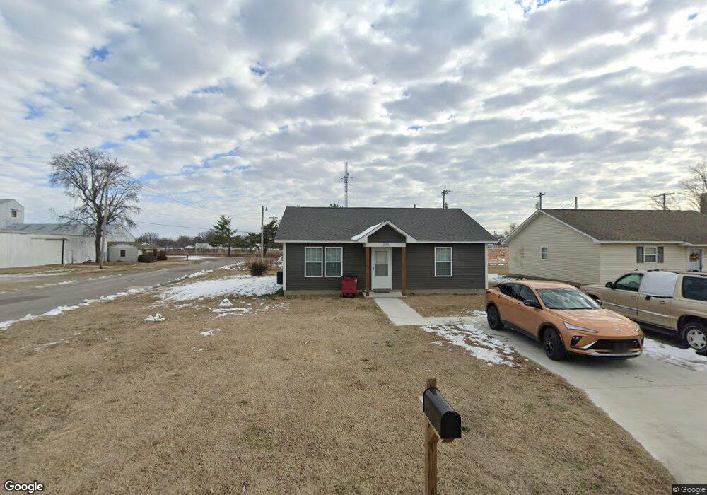
236 N Handy St Sikeston, MO 63801
Estimated Value: $47,000 - $167,000
--
Bed
--
Bath
1,274
Sq Ft
$81/Sq Ft
Est. Value
About This Home
This home is located at 236 N Handy St, Sikeston, MO 63801 and is currently estimated at $103,248, approximately $81 per square foot. 236 N Handy St is a home with nearby schools including Sikeston Senior High School, St. Francis Xavier School, and The Christian Academy.
Ownership History
Date
Name
Owned For
Owner Type
Purchase Details
Closed on
Feb 9, 2022
Sold by
Land Clearance For Redevelopment Authori
Bought by
Dockins Albert and Dockins Kaylan M
Current Estimated Value
Purchase Details
Closed on
Feb 24, 2021
Sold by
Lofton Darla E
Bought by
Land Clearance For Redevelopment Authori and City Of Sikeston
Purchase Details
Closed on
Dec 16, 2020
Sold by
Lofton Darla E and Lofton Carl
Bought by
Land Clearance For Development Authority and City Of Sikeston
Purchase Details
Closed on
Aug 24, 2020
Sold by
Lofton Darla E
Bought by
City Of Sikeston Land Clearance For Rede
Create a Home Valuation Report for This Property
The Home Valuation Report is an in-depth analysis detailing your home's value as well as a comparison with similar homes in the area
Home Values in the Area
Average Home Value in this Area
Purchase History
| Date | Buyer | Sale Price | Title Company |
|---|---|---|---|
| Dockins Albert | -- | -- | |
| Land Clearance For Redevelopment Authori | $1,601 | None Available | |
| Land Clearance For Development Authority | -- | None Available | |
| City Of Sikeston Land Clearance For Rede | $278 | None Available |
Source: Public Records
Tax History Compared to Growth
Tax History
| Year | Tax Paid | Tax Assessment Tax Assessment Total Assessment is a certain percentage of the fair market value that is determined by local assessors to be the total taxable value of land and additions on the property. | Land | Improvement |
|---|---|---|---|---|
| 2025 | $558 | $13,170 | $0 | $0 |
| 2024 | $558 | $11,740 | $0 | $0 |
| 2023 | $178 | $11,740 | $0 | $0 |
| 2022 | $178 | $310 | $0 | $0 |
| 2021 | $178 | $0 | $0 | $0 |
| 2020 | $178 | $2,250 | $0 | $0 |
| 2019 | -- | $2,250 | $0 | $0 |
| 2018 | -- | $3,900 | $0 | $0 |
| 2017 | -- | $3,900 | $0 | $0 |
| 2014 | -- | $3,860 | $0 | $0 |
| 2011 | -- | $3,860 | $0 | $0 |
Source: Public Records
Map
Nearby Homes
- 723 Kendall St
- 114 W North St
- 406 W Gladys St
- 4 N West St
- 203 N Kingshighway St
- 848 Agnes St
- 202 E Woodlawn Ave
- 102 Ruth St
- 817 N Kingshighway St
- 918 Hawthorn Dr
- 312 Tanner St
- 512 S New Madrid St
- 325 Daniel St
- 417 S Kingshighway St
- 849 William St
- 115 William St
- 202 College St
- 511 S Kingshighway St
- 933 Hawthorn Dr
- 1140 Ruth St
- 234 N Handy St
- 230 N Handy St
- 227 N Frisco St Unit B
- 228 N Handy St
- 226 N Handy St
- 223 N Handy St
- 224 N Handy St
- 229 N Handy St
- 228 N West St
- 219 N Frisco St
- 230 N West St
- 226 N West St
- 218 N Handy St
- 215 N Frisco St
- 216 N Handy St
- 219 N Handy St
- 214 N West St
- 214 N Handy St
- 215 N Handy St
- 225 N West St