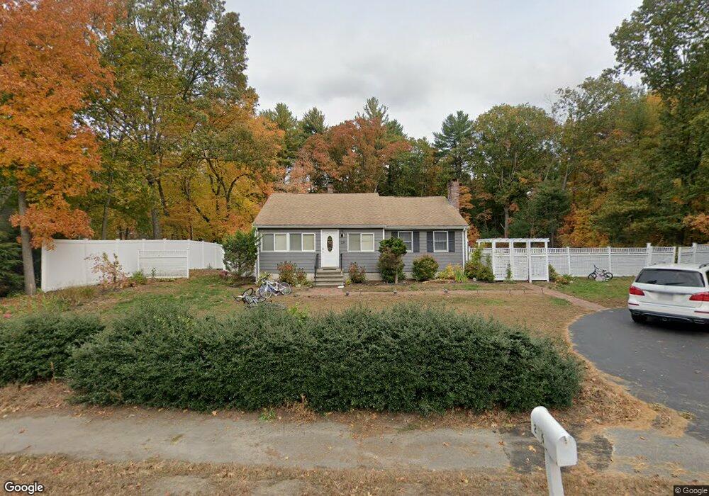
236 Old Lancaster Rd Sudbury, MA 01776
Estimated Value: $873,000 - $1,181,000
3
Beds
1
Bath
1,560
Sq Ft
$646/Sq Ft
Est. Value
About This Home
This home is located at 236 Old Lancaster Rd, Sudbury, MA 01776 and is currently estimated at $1,007,087, approximately $645 per square foot. 236 Old Lancaster Rd is a home located in Middlesex County with nearby schools including Peter Noyes Elementary School, Ephraim Curtis Middle School, and Lincoln-Sudbury Regional High School.
Ownership History
Date
Name
Owned For
Owner Type
Purchase Details
Closed on
Aug 19, 2005
Sold by
Loewald Jonathan F and Hughes Lauren M
Bought by
Cho Chong M and Cho Wai-Wai
Current Estimated Value
Home Financials for this Owner
Home Financials are based on the most recent Mortgage that was taken out on this home.
Original Mortgage
$350,000
Interest Rate
5.66%
Mortgage Type
Purchase Money Mortgage
Create a Home Valuation Report for This Property
The Home Valuation Report is an in-depth analysis detailing your home's value as well as a comparison with similar homes in the area
Home Values in the Area
Average Home Value in this Area
Purchase History
| Date | Buyer | Sale Price | Title Company |
|---|---|---|---|
| Cho Chong M | $442,000 | -- | |
| Cho Chong M | $442,000 | -- |
Source: Public Records
Mortgage History
| Date | Status | Borrower | Loan Amount |
|---|---|---|---|
| Open | Cho Chong M | $324,000 | |
| Closed | Cho Chong M | $336,000 | |
| Closed | Cho Chong M | $350,000 |
Source: Public Records
Tax History Compared to Growth
Tax History
| Year | Tax Paid | Tax Assessment Tax Assessment Total Assessment is a certain percentage of the fair market value that is determined by local assessors to be the total taxable value of land and additions on the property. | Land | Improvement |
|---|---|---|---|---|
| 2025 | $12,563 | $858,100 | $440,000 | $418,100 |
| 2024 | $12,107 | $828,700 | $427,200 | $401,500 |
| 2023 | $12,212 | $774,400 | $395,600 | $378,800 |
| 2022 | $9,830 | $544,600 | $363,200 | $181,400 |
| 2021 | $9,439 | $501,300 | $363,200 | $138,100 |
| 2020 | $9,249 | $501,300 | $363,200 | $138,100 |
| 2019 | $8,978 | $501,300 | $363,200 | $138,100 |
| 2018 | $8,868 | $494,600 | $387,200 | $107,400 |
| 2017 | $8,166 | $460,300 | $368,400 | $91,900 |
| 2016 | $7,860 | $441,600 | $354,400 | $87,200 |
| 2015 | $7,232 | $410,900 | $340,800 | $70,100 |
| 2014 | $7,199 | $399,300 | $330,800 | $68,500 |
Source: Public Records
Map
Nearby Homes
- 270 Old Lancaster Rd
- 89 Bridle Path
- 36 Concord Rd
- 23 Massasoit Ave
- 1011 Boston Post Rd
- 94 Goodmans Hill Rd
- 24 Goodnow Rd
- 427 Concord Rd
- 7 Saddle Ridge Rd
- 30 Rolling Ln
- 24 Woodland Rd
- 36 Old Forge Ln
- 12 Hickory Rd
- 0 Robbins Rd
- 7 Adams Rd
- 54 Stone Rd
- 128 Nobscot Rd
- 216 Landham Rd
- 6 Old County Rd Unit 16
- 21 Summer St
- 233 Old Lancaster Rd
- 238 Old Lancaster Rd
- 226 Old Lancaster Rd
- 223 Old Lancaster Rd
- 239 Old Lancaster Rd
- 244 Old Lancaster Rd
- 14 Gerry Dr
- 219 Old Lancaster Rd
- 9 Gerry Dr
- 247 Old Lancaster Rd
- 31 Pennymeadow Rd
- 11 Meadow Dr
- 216 Old Lancaster Rd
- 8 Pineridge Rd
- 252 Old Lancaster Rd
- 22 Gerry Dr
- 212 Old Lancaster Rd
- 19 Meadow Dr
- 248 Old Lancaster Rd
- 35 Pennymeadow Rd