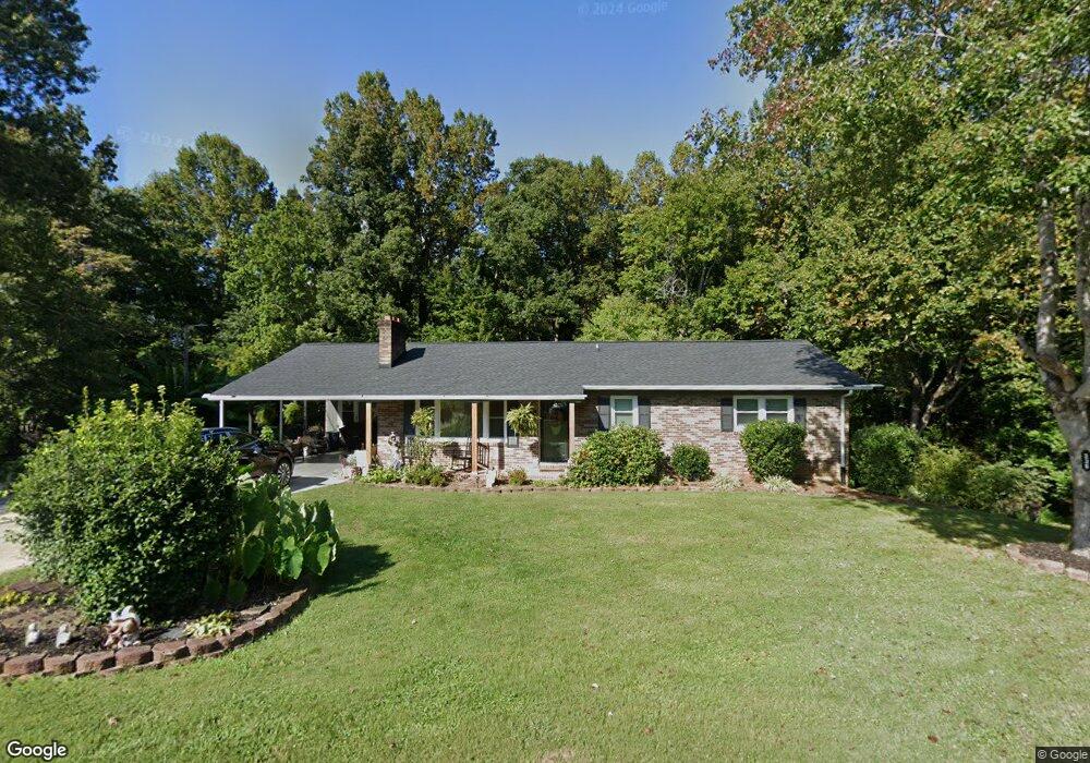
236 Paynetown Rd Mount Airy, NC 27030
Estimated Value: $198,000 - $287,000
3
Beds
2
Baths
2,007
Sq Ft
$117/Sq Ft
Est. Value
About This Home
This home is located at 236 Paynetown Rd, Mount Airy, NC 27030 and is currently estimated at $235,611, approximately $117 per square foot. 236 Paynetown Rd is a home located in Surry County with nearby schools including Flat Rock Elementary School, Meadowview Magnet Middle School, and North Surry High School.
Ownership History
Date
Name
Owned For
Owner Type
Purchase Details
Closed on
Jun 1, 1998
Current Estimated Value
Purchase Details
Closed on
Aug 1, 1968
Create a Home Valuation Report for This Property
The Home Valuation Report is an in-depth analysis detailing your home's value as well as a comparison with similar homes in the area
Home Values in the Area
Average Home Value in this Area
Purchase History
| Date | Buyer | Sale Price | Title Company |
|---|---|---|---|
| -- | $75,000 | -- | |
| -- | -- | -- |
Source: Public Records
Tax History Compared to Growth
Tax History
| Year | Tax Paid | Tax Assessment Tax Assessment Total Assessment is a certain percentage of the fair market value that is determined by local assessors to be the total taxable value of land and additions on the property. | Land | Improvement |
|---|---|---|---|---|
| 2025 | $1,001 | $153,710 | $10,400 | $143,310 |
| 2024 | $836 | $118,510 | $9,600 | $108,910 |
| 2023 | $823 | $118,510 | $9,600 | $108,910 |
| 2022 | $823 | $118,510 | $9,600 | $108,910 |
| 2021 | $836 | $118,510 | $9,600 | $108,910 |
| 2020 | $817 | $110,830 | $9,600 | $101,230 |
| 2019 | $814 | $110,830 | $9,600 | $101,230 |
| 2018 | $802 | $110,830 | $0 | $0 |
| 2017 | $797 | $110,830 | $0 | $0 |
| 2016 | $789 | $110,830 | $0 | $0 |
| 2013 | -- | $113,790 | $0 | $0 |
Source: Public Records
Map
Nearby Homes
- 00 Paynetown Rd
- 335 Badgett Ave
- 663 Mcbride Rd
- 0 NE Pine St
- 280 Burke Rd
- xx 44.93 Acres Stardust Trail
- 845 Linville Rd
- 2638 Riverside Dr
- 0 Blue Hollow Rd Unit 33 1176021
- 0 Blue Hollow Rd Unit 23105199
- 000 Blue Hollow Rd Unit 27
- 2384 Westfield Rd
- 1769 Inglebrook Trail
- 200 Englewood Trail
- 2326 Westfield Rd
- 00 Jackson Rd Unit 8.64 Ac
- 1694 Woodbury Ln
- 607 Riverside Dr
- 0 Jackson Rd
- 583 Snody Rd
- 231 Paynetown Rd
- 209 Paynetown Rd
- 220 Paynetown Rd
- 270 Paynetown Rd
- 273 Paynetown Rd
- 190 Paynetown Rd
- 225 Paynetown Rd
- 195 Paynetown Rd
- 287 Paynetown Rd
- 290 Paynetown Rd
- 296 Paynetown Rd
- 177 Paynetown Rd
- 286 Paynetown Rd
- 328 Paynetown Rd
- 307 Paynetown Rd
- 342 Paynetown Rd
- 1835 E Pine St
- 336 Paynetown Rd
- 1917 E Pine St
- 1927 E Pine St