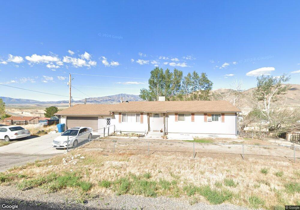
236 S Grant Ave Stockton, UT 84071
Estimated Value: $392,000 - $457,000
4
Beds
2
Baths
2,560
Sq Ft
$168/Sq Ft
Est. Value
About This Home
This home is located at 236 S Grant Ave, Stockton, UT 84071 and is currently estimated at $429,981, approximately $167 per square foot. 236 S Grant Ave is a home located in Tooele County with nearby schools including Settlement Canyon Elementary School and Dugway.
Ownership History
Date
Name
Owned For
Owner Type
Purchase Details
Closed on
Aug 11, 2021
Sold by
Deyoung Brenda Carol and Rolph Daniel Nelson
Bought by
Warren Joshua Dennis and Warren Sarah Anne
Current Estimated Value
Home Financials for this Owner
Home Financials are based on the most recent Mortgage that was taken out on this home.
Original Mortgage
$333,333
Outstanding Balance
$303,103
Interest Rate
2.9%
Mortgage Type
New Conventional
Estimated Equity
$126,878
Purchase Details
Closed on
Mar 6, 2014
Sold by
Rolph Ruth
Bought by
Rolph Ruth and Deyoung Brenda Carol
Create a Home Valuation Report for This Property
The Home Valuation Report is an in-depth analysis detailing your home's value as well as a comparison with similar homes in the area
Home Values in the Area
Average Home Value in this Area
Purchase History
| Date | Buyer | Sale Price | Title Company |
|---|---|---|---|
| Warren Joshua Dennis | -- | Inwest Title Tooele Office | |
| Rolph Ruth | -- | None Available |
Source: Public Records
Mortgage History
| Date | Status | Borrower | Loan Amount |
|---|---|---|---|
| Open | Warren Joshua Dennis | $333,333 |
Source: Public Records
Tax History Compared to Growth
Tax History
| Year | Tax Paid | Tax Assessment Tax Assessment Total Assessment is a certain percentage of the fair market value that is determined by local assessors to be the total taxable value of land and additions on the property. | Land | Improvement |
|---|---|---|---|---|
| 2025 | $3,555 | $261,208 | $49,225 | $211,983 |
| 2024 | $3,555 | $261,986 | $49,225 | $212,761 |
| 2023 | $3,555 | $245,529 | $49,225 | $196,304 |
| 2022 | $2,608 | $210,748 | $44,715 | $166,033 |
| 2021 | $2,340 | $157,474 | $44,715 | $112,759 |
| 2020 | $968 | $271,621 | $6,500 | $265,121 |
| 2019 | $1,905 | $227,434 | $6,500 | $220,934 |
| 2018 | $657 | $190,612 | $6,500 | $184,112 |
| 2017 | $91 | $159,927 | $6,500 | $153,427 |
| 2016 | $1,076 | $87,960 | $3,575 | $84,385 |
| 2015 | $1,076 | $72,765 | $0 | $0 |
| 2014 | -- | $72,765 | $0 | $0 |
Source: Public Records
Map
Nearby Homes
- 25 W Pearson
- 1703 Copper St Unit 1277
- 1717 Copper St Unit 1281
- 0 E Bald Mountain Rd
- 0 Utah 36
- 2258 W Deer Run Dr Unit 174
- 2423 W Cedarline Loop
- 2521 W Ridgeline Rd
- 2692 W Rim Rock Dr Unit 910
- 1472 S Hogans Rd
- 2912 W Rim Rock Dr
- 2974 W Ridgeline Rd Unit 85
- 3214 W Ridgeline Rd
- 879 Sundown Ln
- 1115 S 1010 W
- 1118 S 900 W
- 954 S 1050 W
- 1038 S 860 W
- 729 Timpie Rd
- 858 S 780 W
- 212 S Grant Ave
- 212 S Grant Ave
- 37 W Honerine Ave
- 231 S Grant Ave
- 213 S Highway 36
- 205 S Grant Ave
- 202 S Grant Ave
- 6000 Utah 36
- 282 S Sheridan St Unit 3&4
- 290 S Sheridan St
- 160 S Grant St
- 245 S Sheridan St
- 235 S Sheridan St
- 225 S Sheridan St
- 70 E Honerine St
- 275 S Sheridan St
- 193 S Sheridan St
- 162 S Sheridan St
- 147 S Grant St
- 328 S Sheridan St