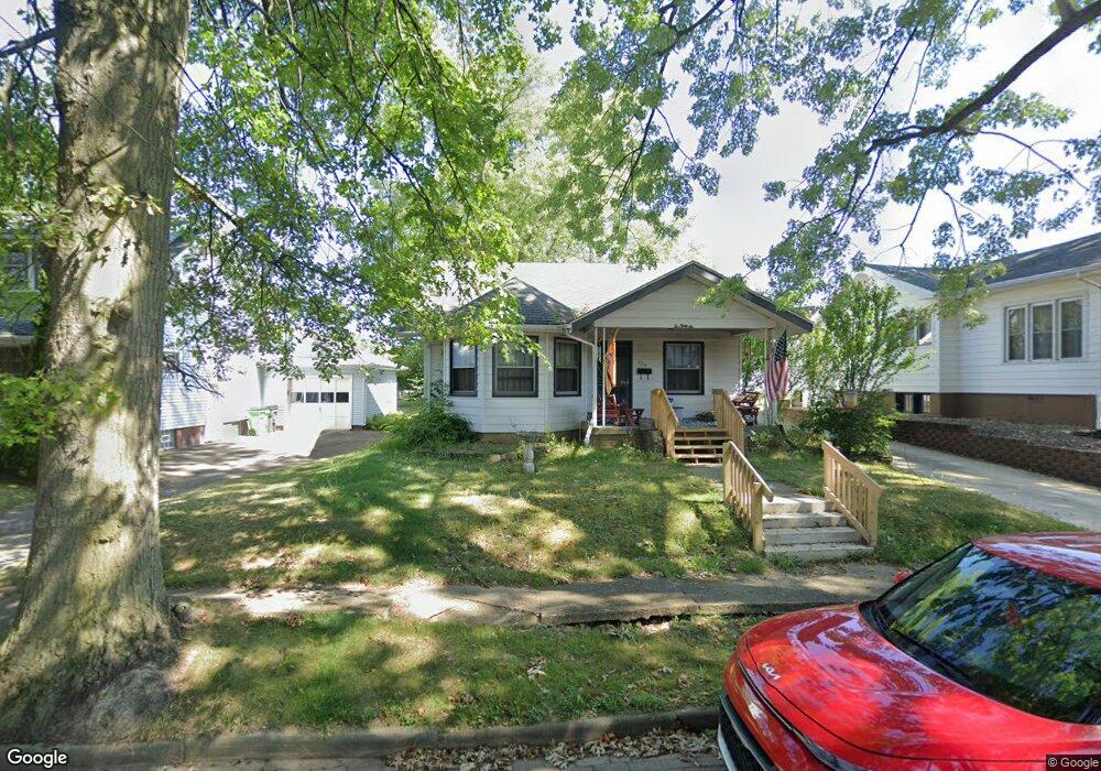
236 Shadyside Ct Alliance, OH 44601
Estimated Value: $93,601 - $159,000
2
Beds
1
Bath
1,688
Sq Ft
$81/Sq Ft
Est. Value
About This Home
This home is located at 236 Shadyside Ct, Alliance, OH 44601 and is currently estimated at $135,900, approximately $80 per square foot. 236 Shadyside Ct is a home located in Stark County with nearby schools including Alliance Elementary School at Rockhill, Alliance Intermediate School at Northside, and Alliance Middle School.
Ownership History
Date
Name
Owned For
Owner Type
Purchase Details
Closed on
Aug 5, 2005
Sold by
Safkow Philip S and Safkow Jennifer L
Bought by
Heston Jack L and Heston Erin J
Current Estimated Value
Home Financials for this Owner
Home Financials are based on the most recent Mortgage that was taken out on this home.
Original Mortgage
$80,851
Outstanding Balance
$48,605
Interest Rate
7.99%
Mortgage Type
Fannie Mae Freddie Mac
Estimated Equity
$87,295
Purchase Details
Closed on
Jun 14, 1999
Sold by
Blecker Patricia M
Bought by
Safkow Philip S and Safkow Jennifer L
Home Financials for this Owner
Home Financials are based on the most recent Mortgage that was taken out on this home.
Original Mortgage
$55,900
Interest Rate
6.99%
Mortgage Type
FHA
Purchase Details
Closed on
Feb 1, 1999
Sold by
Estate Of Martha J Donely
Bought by
Blecker Patricia M
Create a Home Valuation Report for This Property
The Home Valuation Report is an in-depth analysis detailing your home's value as well as a comparison with similar homes in the area
Home Values in the Area
Average Home Value in this Area
Purchase History
| Date | Buyer | Sale Price | Title Company |
|---|---|---|---|
| Heston Jack L | $80,900 | Union Title Co | |
| Safkow Philip S | $56,000 | -- | |
| Blecker Patricia M | -- | -- |
Source: Public Records
Mortgage History
| Date | Status | Borrower | Loan Amount |
|---|---|---|---|
| Open | Heston Jack L | $80,851 | |
| Closed | Safkow Philip S | $55,900 |
Source: Public Records
Tax History Compared to Growth
Tax History
| Year | Tax Paid | Tax Assessment Tax Assessment Total Assessment is a certain percentage of the fair market value that is determined by local assessors to be the total taxable value of land and additions on the property. | Land | Improvement |
|---|---|---|---|---|
| 2025 | -- | $24,160 | $4,590 | $19,570 |
| 2024 | -- | $24,160 | $4,590 | $19,570 |
| 2023 | $843 | $20,970 | $4,480 | $16,490 |
| 2022 | $848 | $20,970 | $4,480 | $16,490 |
| 2021 | $849 | $20,970 | $4,480 | $16,490 |
| 2020 | $809 | $18,660 | $3,920 | $14,740 |
| 2019 | $797 | $18,670 | $3,930 | $14,740 |
| 2018 | $802 | $18,670 | $3,930 | $14,740 |
| 2017 | $717 | $16,420 | $3,260 | $13,160 |
| 2016 | $722 | $16,420 | $3,260 | $13,160 |
| 2015 | $731 | $16,460 | $3,300 | $13,160 |
| 2014 | $790 | $16,950 | $3,400 | $13,550 |
| 2013 | $394 | $16,950 | $3,400 | $13,550 |
Source: Public Records
Map
Nearby Homes
- 1475 Chatauqua Ct
- 1437 S Linden Ave
- 112 E College St
- 390 E College St
- 551 South St
- 1005 S Freedom Ave
- 729 Waugh St
- 1395 S Webb Ave
- 815 Grace St
- 1846 S Freedom Ave
- 1044 S Liberty Ave
- 317 E State St
- 807 S Union Ave
- 814 Milner St
- 203 Glamorgan St
- 1233 Woodland Ave
- 452 E Summit St
- 2218 S Freedom Ave
- 140 W Summit St
- 831 Wade Ave
- 224 Shadyside Ct
- 246 Shadyside Ct
- 216 Shadyside Ct
- 204 Shadyside Ct
- 233 Shadyside Ct
- 245 Shadyside Ct
- 225 Shadyside Ct
- 255 Shadyside Ct
- 164 Shadyside Ct
- 217 Shadyside Ct
- 205 Shadyside Ct
- 1465 S Arch Ave
- 1477 S Arch Ave
- 165 Shadyside Ct
- 155 Shadyside Ct
- 1495 S Arch Ave
- 140 Shadyside Ct
- 1406 S Arch Ave
- 163 Ramsey Ct
- 1426 S Arch Ave