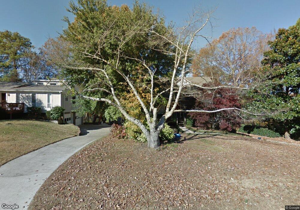
236 Stonebridge Rd Irondale, AL 35210
Estimated Value: $261,000 - $320,000
3
Beds
2
Baths
2,248
Sq Ft
$130/Sq Ft
Est. Value
About This Home
This home is located at 236 Stonebridge Rd, Irondale, AL 35210 and is currently estimated at $293,275, approximately $130 per square foot. 236 Stonebridge Rd is a home located in Jefferson County with nearby schools including Grantswood Community Elementary School, Irondale Middle School, and Shades Valley High School.
Ownership History
Date
Name
Owned For
Owner Type
Purchase Details
Closed on
Jun 28, 2002
Sold by
Robinson Sandra K George and Robinson James J
Bought by
Wohlmuth Herbert and Clayton Susan
Current Estimated Value
Home Financials for this Owner
Home Financials are based on the most recent Mortgage that was taken out on this home.
Original Mortgage
$121,250
Interest Rate
6.86%
Purchase Details
Closed on
Apr 16, 2002
Sold by
George Sandra K and Greene Steven S
Bought by
George Sandra K
Create a Home Valuation Report for This Property
The Home Valuation Report is an in-depth analysis detailing your home's value as well as a comparison with similar homes in the area
Home Values in the Area
Average Home Value in this Area
Purchase History
| Date | Buyer | Sale Price | Title Company |
|---|---|---|---|
| Wohlmuth Herbert | $125,000 | -- | |
| George Sandra K | -- | -- |
Source: Public Records
Mortgage History
| Date | Status | Borrower | Loan Amount |
|---|---|---|---|
| Closed | Wohlmuth Herbert | $121,250 |
Source: Public Records
Tax History
| Year | Tax Paid | Tax Assessment Tax Assessment Total Assessment is a certain percentage of the fair market value that is determined by local assessors to be the total taxable value of land and additions on the property. | Land | Improvement |
|---|---|---|---|---|
| 2025 | $1,392 | $24,680 | -- | -- |
| 2024 | $1,392 | $23,080 | -- | -- |
| 2022 | $1,236 | $22,780 | $6,800 | $15,980 |
| 2021 | $998 | $18,550 | $6,800 | $11,750 |
| 2020 | $998 | $18,550 | $6,800 | $11,750 |
| 2019 | $998 | $18,560 | $0 | $0 |
| 2018 | $774 | $14,620 | $0 | $0 |
| 2017 | $808 | $15,220 | $0 | $0 |
| 2016 | $774 | $14,620 | $0 | $0 |
| 2015 | $774 | $14,620 | $0 | $0 |
| 2014 | $768 | $14,420 | $0 | $0 |
| 2013 | $768 | $14,420 | $0 | $0 |
Source: Public Records
Map
Nearby Homes
- 4143 Riverbrook Rd
- 5531 Overton Rd
- 4024 Michael Place
- 5620 Alexandria Dr
- 123 Trillium Dr
- 111 Trillium Dr
- 4317 Palisades Rd
- 3601 Bermuda Dr
- 1866 Grants Mill Rd
- 7410 Kings Mountain Ct Unit 102
- 7385 Ridgecrest Court Rd
- 5173 Club Ridge Dr E
- 5169 Club Ridge Dr E
- 5161 Clubridge Dr E
- 5173 Clubridge Dr E
- 4251 Cedar St
- 5169 Clubridge Dr E
- 1144 Clubridge Dr E
- 1143 Clubridge Dr E
- 822 Bainbridge Way
- 244 Stonebridge Rd
- 252 Stonebridge Rd
- 4134 Riverbrook Rd
- 227 Stonebridge Rd
- 4130 Riverbrook Rd
- 260 Stonebridge Rd
- 4603 Stonebridge Cir
- 217 Stonebridge Rd
- 4610 Stonebridge Cir
- 268 Stonebridge Rd
- 4125 Brookmont Dr
- 2239 Stonebridge Rd
- 4126 Riverbrook Rd
- 4613 Stonebridge Cir
- 4138 Riverbrook Rd
- 269 Stonebridge Rd
- 4620 Stonebridge Cir
- 4131 Riverbrook Rd
- 276 Stonebridge Rd
- 4127 Riverbrook Rd
Your Personal Tour Guide
Ask me questions while you tour the home.