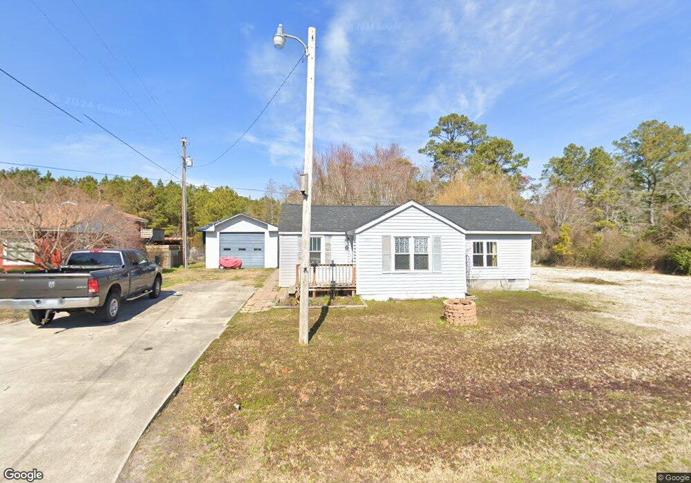
236 Tom Mann Rd Newport, NC 28570
Estimated Value: $190,000 - $312,000
2
Beds
2
Baths
1,232
Sq Ft
$203/Sq Ft
Est. Value
About This Home
This home is located at 236 Tom Mann Rd, Newport, NC 28570 and is currently estimated at $250,594, approximately $203 per square foot. 236 Tom Mann Rd is a home located in Carteret County with nearby schools including Newport Elementary School, Newport Middle School, and West Carteret High School.
Ownership History
Date
Name
Owned For
Owner Type
Purchase Details
Closed on
Aug 20, 2021
Sold by
Tong Wade William and White Tong Karen
Bought by
Young Jillian Elizabeth and Porter Timothy Richard
Current Estimated Value
Home Financials for this Owner
Home Financials are based on the most recent Mortgage that was taken out on this home.
Original Mortgage
$48,370
Outstanding Balance
$36,672
Interest Rate
2.1%
Mortgage Type
New Conventional
Estimated Equity
$213,922
Create a Home Valuation Report for This Property
The Home Valuation Report is an in-depth analysis detailing your home's value as well as a comparison with similar homes in the area
Home Values in the Area
Average Home Value in this Area
Purchase History
| Date | Buyer | Sale Price | Title Company |
|---|---|---|---|
| Young Jillian Elizabeth | $50,000 | None Available |
Source: Public Records
Mortgage History
| Date | Status | Borrower | Loan Amount |
|---|---|---|---|
| Open | Young Jillian Elizabeth | $48,370 |
Source: Public Records
Tax History Compared to Growth
Tax History
| Year | Tax Paid | Tax Assessment Tax Assessment Total Assessment is a certain percentage of the fair market value that is determined by local assessors to be the total taxable value of land and additions on the property. | Land | Improvement |
|---|---|---|---|---|
| 2025 | $970 | $264,106 | $60,352 | $203,754 |
| 2024 | $532 | $90,440 | $42,815 | $47,625 |
| 2023 | $588 | $90,440 | $42,815 | $47,625 |
| 2022 | $579 | $90,440 | $42,815 | $47,625 |
| 2021 | $0 | $90,440 | $42,815 | $47,625 |
| 2020 | $569 | $90,440 | $42,815 | $47,625 |
| 2019 | $589 | $102,157 | $48,931 | $53,226 |
| 2017 | $568 | $102,157 | $48,931 | $53,226 |
| 2016 | $568 | $102,157 | $48,931 | $53,226 |
| 2015 | $558 | $102,157 | $48,931 | $53,226 |
| 2014 | $587 | $109,998 | $43,582 | $66,416 |
Source: Public Records
Map
Nearby Homes
- 764 Chatham St
- 757 Chatham St
- 223 Independence Blvd
- 251 Independence Blvd
- 258 Independence Blvd
- 554 Chatham St
- 113 Duncan Ln
- 114 Duncan Ln
- Tyler Plan at Heritage Pointe - Carolina Series
- Bayhill Plan at Heritage Pointe - Carolina Series
- Ryan Plan at Heritage Pointe - Carolina Series
- Thornwood Plan at Heritage Pointe - Carolina Series
- Pamlico Plan at Heritage Pointe - Carolina Series
- Westin Plan at Heritage Pointe - Carolina Series
- Birmingham Plan at Heritage Pointe - Carolina Series
- Corbin Plan at Heritage Pointe - Carolina Series
- Molly Plan at Heritage Pointe - Carolina Series
- Mason Plan at Heritage Pointe - Carolina Series
- Kids Plan at Heritage Pointe - Carolina Series
- Yorkshire Plan at Heritage Pointe - Carolina Series
- 242 Tom Mann Rd
- 218 Tom Mann Rd
- 235 Tom Mann Rd
- 245 Tom Mann Rd
- 217 Tom Mann Rd
- 250 Tom Mann Rd
- 185 Woodland Dr
- 182 Sherwood Rd
- 259 Tom Mann Rd
- 179 Woodland Dr
- 174 Sherwood Rd
- 161 Woodland Dr
- 251 Tom Mann Rd
- 165 Sherwood Dr
- 153 Woodland Dr
- 185 Tom Mann Rd
- 157 Sherwood Rd
- 145 Woodland Dr
- 152 Sherwood Dr
- 152 Sherwood Rd