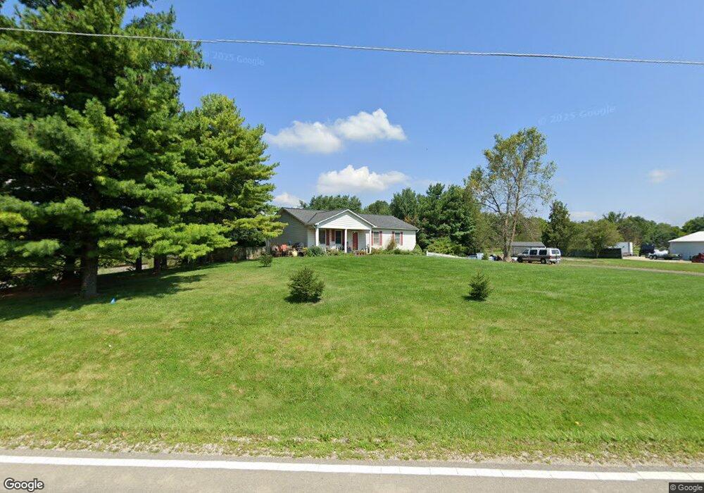
2360 Clark Shaw Rd Powell, OH 43065
Liberty Township NeighborhoodEstimated Value: $347,000 - $519,000
3
Beds
2
Baths
1,600
Sq Ft
$269/Sq Ft
Est. Value
About This Home
This home is located at 2360 Clark Shaw Rd, Powell, OH 43065 and is currently estimated at $429,685, approximately $268 per square foot. 2360 Clark Shaw Rd is a home located in Delaware County with nearby schools including Liberty Tree Elementary School, Hyatts Middle School, and Olentangy Berlin High School.
Ownership History
Date
Name
Owned For
Owner Type
Purchase Details
Closed on
Dec 28, 2017
Bought by
Norris Donna J
Current Estimated Value
Purchase Details
Closed on
Nov 15, 2004
Sold by
Euton Donald R and Euton Judy
Bought by
Norris John F and Norris Donna J
Home Financials for this Owner
Home Financials are based on the most recent Mortgage that was taken out on this home.
Original Mortgage
$95,900
Interest Rate
5.82%
Mortgage Type
Purchase Money Mortgage
Purchase Details
Closed on
Apr 12, 2000
Sold by
Johnson Michael
Bought by
Euton Donald R and Euton Judy
Home Financials for this Owner
Home Financials are based on the most recent Mortgage that was taken out on this home.
Original Mortgage
$116,100
Interest Rate
8.29%
Mortgage Type
New Conventional
Create a Home Valuation Report for This Property
The Home Valuation Report is an in-depth analysis detailing your home's value as well as a comparison with similar homes in the area
Home Values in the Area
Average Home Value in this Area
Purchase History
| Date | Buyer | Sale Price | Title Company |
|---|---|---|---|
| Norris Donna J | -- | -- | |
| Norris John F | $148,000 | -- | |
| Euton Donald R | $129,000 | -- |
Source: Public Records
Mortgage History
| Date | Status | Borrower | Loan Amount |
|---|---|---|---|
| Previous Owner | Norris John F | $95,900 | |
| Previous Owner | Euton Donald R | $116,100 | |
| Closed | Norris John F | $27,500 |
Source: Public Records
Tax History Compared to Growth
Tax History
| Year | Tax Paid | Tax Assessment Tax Assessment Total Assessment is a certain percentage of the fair market value that is determined by local assessors to be the total taxable value of land and additions on the property. | Land | Improvement |
|---|---|---|---|---|
| 2024 | $5,107 | $97,170 | $26,920 | $70,250 |
| 2023 | $5,127 | $97,170 | $26,920 | $70,250 |
| 2022 | $4,007 | $60,240 | $18,760 | $41,480 |
| 2021 | $4,031 | $60,240 | $18,760 | $41,480 |
| 2020 | $4,049 | $60,240 | $18,760 | $41,480 |
| 2019 | $3,333 | $51,700 | $15,650 | $36,050 |
| 2018 | $3,348 | $51,700 | $15,650 | $36,050 |
| 2017 | $3,312 | $46,130 | $12,530 | $33,600 |
| 2016 | $3,178 | $46,130 | $12,530 | $33,600 |
| 2015 | $2,873 | $46,130 | $12,530 | $33,600 |
| 2014 | $2,913 | $46,130 | $12,530 | $33,600 |
| 2013 | $2,897 | $44,840 | $12,530 | $32,310 |
Source: Public Records
Map
Nearby Homes
- 2481 Clark Shaw Rd
- 2513 Clark Shaw Rd
- 2073 Liberty Trail
- 5482 Dutch Ln
- 5488 Fawnsbury Ct
- 5492 Fawnsbury Ct
- 5480 Fawnsbury Ct
- 5484 Fawnsbury Ct
- 5502 Dutch Ln
- 5479 Fawnsbury Ct
- 5487 Fawnsbury Ct
- 2770 Drycreek Ct
- 2762 Drycreek Ct
- 2746 Drycreek Ct
- 5515 Fawnsbury Ct
- 2753 Drycreek Ct
- 2752 Drycreek Ct
- 5507 Fawnsbury Ct
- 5519 Fawnsbury Ct
- 2701 Drycreek Ct
- 2360 Clark-Shaw Rd
- 2320 Clark Shaw Rd
- 2270 Clark Shaw Rd
- 5158 Liberty Rd
- 5222 Liberty Rd
- 5302 Liberty Rd
- 2463 Clark Shaw Rd
- 2291 Clark Shaw Rd
- 5198 Liberty Rd
- 5162 Liberty Rd
- 2534 Clark Shaw Rd
- 5104 Liberty Rd
- 5311 Liberty Rd N
- 5106 Liberty Rd
- 2480 Clark Shaw Rd
- 2560 Clark Shaw Rd
- 5329 Liberty Rd N
- 5361 Liberty Rd N
- 2500 Clark Shaw Rd
- 2570 Clark Shaw Rd