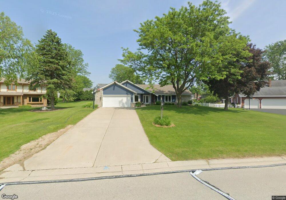
2360 Macaulay Dr Brookfield, WI 53045
Estimated Value: $599,679 - $702,000
3
Beds
3
Baths
2,442
Sq Ft
$265/Sq Ft
Est. Value
About This Home
This home is located at 2360 Macaulay Dr, Brookfield, WI 53045 and is currently estimated at $646,170, approximately $264 per square foot. 2360 Macaulay Dr is a home located in Waukesha County with nearby schools including Brookfield Elementary School, Wisconsin Hills Middle School, and Brookfield Central High School.
Ownership History
Date
Name
Owned For
Owner Type
Purchase Details
Closed on
Jan 17, 2015
Sold by
Runnells Craig R and Runnells Julie L
Bought by
The Craig R And Julie L Runnells Joint R
Current Estimated Value
Purchase Details
Closed on
Feb 5, 2009
Sold by
Faust Marilyn F
Bought by
Runnells Craig R and Runnells Julie L
Home Financials for this Owner
Home Financials are based on the most recent Mortgage that was taken out on this home.
Original Mortgage
$180,000
Interest Rate
5.14%
Mortgage Type
Purchase Money Mortgage
Purchase Details
Closed on
Jul 29, 1998
Sold by
Kapron Terrance and Kapron Jill E
Bought by
Faust Marilyn F
Home Financials for this Owner
Home Financials are based on the most recent Mortgage that was taken out on this home.
Original Mortgage
$204,000
Interest Rate
6.25%
Mortgage Type
Purchase Money Mortgage
Create a Home Valuation Report for This Property
The Home Valuation Report is an in-depth analysis detailing your home's value as well as a comparison with similar homes in the area
Home Values in the Area
Average Home Value in this Area
Purchase History
| Date | Buyer | Sale Price | Title Company |
|---|---|---|---|
| The Craig R And Julie L Runnells Joint R | -- | None Available | |
| Runnells Craig R | $325,000 | None Available | |
| Faust Marilyn F | $255,000 | -- |
Source: Public Records
Mortgage History
| Date | Status | Borrower | Loan Amount |
|---|---|---|---|
| Previous Owner | Runnells Craig R | $180,000 | |
| Previous Owner | Faust Marilyn F | $204,000 |
Source: Public Records
Tax History
| Year | Tax Paid | Tax Assessment Tax Assessment Total Assessment is a certain percentage of the fair market value that is determined by local assessors to be the total taxable value of land and additions on the property. | Land | Improvement |
|---|---|---|---|---|
| 2024 | $5,567 | $498,300 | $145,000 | $353,300 |
| 2023 | $5,570 | $498,300 | $145,000 | $353,300 |
| 2022 | $5,478 | $383,900 | $140,000 | $243,900 |
| 2021 | $5,801 | $383,900 | $140,000 | $243,900 |
| 2020 | $6,053 | $383,900 | $140,000 | $243,900 |
| 2019 | $5,814 | $383,900 | $140,000 | $243,900 |
| 2018 | $5,384 | $346,400 | $140,000 | $206,400 |
| 2017 | $6,198 | $346,400 | $140,000 | $206,400 |
| 2016 | $5,465 | $346,400 | $140,000 | $206,400 |
| 2015 | $5,435 | $346,400 | $140,000 | $206,400 |
| 2014 | $5,443 | $346,400 | $140,000 | $206,400 |
| 2013 | $5,638 | $346,400 | $140,000 | $206,400 |
Source: Public Records
Map
Nearby Homes
- 20305 Downing Ct
- 2820 Norman Dr
- 2550 Harmony Cir
- 2465 Lionel Ct
- Lt118 Berwick Ct
- Lt120 Berwick Ct
- Lt116 Berwick Ct
- Lt114 Berwick Ct
- 1825 Derrin Ln
- 1930 Cotton Tail Ln
- 1775 Derrin Ln
- 2000 Kathlynn Ct
- 19775 Trilby Ct
- 19260 Brookdale Dr
- 18860 N Hills Dr
- 18850 N Hills Dr
- W221N3075 Greenwood Ct
- 1040 Lansdowne Ct Unit V6
- 18865 Tanala Dr
- W224N2507 Ridgewood Ln
- 2370 Macaulay Dr
- 20680 Coventry Dr
- 20625 Milton Ct
- 20640 Coventry Dr
- 2380 Macaulay Dr
- 2365 Macaulay Dr
- 20595 Milton Ct
- 2355 Macaulay Dr
- 20620 Milton Ct
- 20600 Coventry Dr
- 20775 Tennyson Dr
- 20695 Tennyson Dr
- 20675 Coventry Dr
- 20785 Macaulay Dr
- 20725 Tennyson Dr
- 20770 Coventry Dr
- 20600 Milton Ct
- 20625 Coventry Dr
- 20555 Milton Ct
- 20655 Tennyson Dr
Your Personal Tour Guide
Ask me questions while you tour the home.