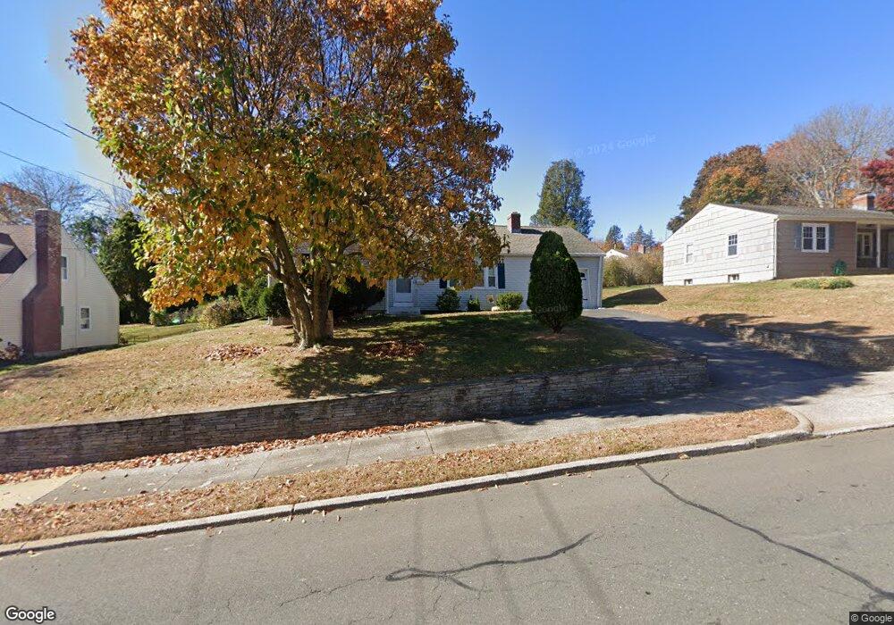
2360 Stanley St New Britain, CT 06053
Estimated Value: $252,000 - $306,000
2
Beds
1
Bath
1,168
Sq Ft
$242/Sq Ft
Est. Value
About This Home
This home is located at 2360 Stanley St, New Britain, CT 06053 and is currently estimated at $282,205, approximately $241 per square foot. 2360 Stanley St is a home located in Hartford County with nearby schools including Holmes School, Pulaski Middle School, and St. Francis of Assisi Middle School.
Ownership History
Date
Name
Owned For
Owner Type
Purchase Details
Closed on
Apr 29, 2011
Sold by
Est Jakowenco Frances and Dounouk Carin
Bought by
Camerato Carol
Current Estimated Value
Purchase Details
Closed on
Apr 29, 1996
Sold by
Lange Clifford and Lange Cynthia
Bought by
Haug William and Haug Beverly
Home Financials for this Owner
Home Financials are based on the most recent Mortgage that was taken out on this home.
Original Mortgage
$348,750
Interest Rate
6.75%
Mortgage Type
Unknown
Create a Home Valuation Report for This Property
The Home Valuation Report is an in-depth analysis detailing your home's value as well as a comparison with similar homes in the area
Home Values in the Area
Average Home Value in this Area
Purchase History
| Date | Buyer | Sale Price | Title Company |
|---|---|---|---|
| Camerato Carol | -- | -- | |
| Camerato Carol | -- | -- | |
| Haug William | $465,000 | -- |
Source: Public Records
Mortgage History
| Date | Status | Borrower | Loan Amount |
|---|---|---|---|
| Previous Owner | Haug William | $348,750 |
Source: Public Records
Tax History Compared to Growth
Tax History
| Year | Tax Paid | Tax Assessment Tax Assessment Total Assessment is a certain percentage of the fair market value that is determined by local assessors to be the total taxable value of land and additions on the property. | Land | Improvement |
|---|---|---|---|---|
| 2025 | $5,417 | $138,250 | $66,640 | $71,610 |
| 2024 | $5,473 | $138,250 | $66,640 | $71,610 |
| 2023 | $5,292 | $138,250 | $66,640 | $71,610 |
| 2022 | $4,491 | $90,720 | $30,730 | $59,990 |
| 2021 | $4,491 | $90,720 | $30,730 | $59,990 |
| 2020 | $4,581 | $90,720 | $30,730 | $59,990 |
| 2019 | $4,581 | $90,720 | $30,730 | $59,990 |
| 2018 | $4,581 | $90,720 | $30,730 | $59,990 |
| 2017 | $4,539 | $89,880 | $28,000 | $61,880 |
| 2016 | $4,539 | $89,880 | $28,000 | $61,880 |
| 2015 | $4,404 | $89,880 | $28,000 | $61,880 |
| 2014 | $4,404 | $89,880 | $28,000 | $61,880 |
Source: Public Records
Map
Nearby Homes
- 40 Varmor Dr
- 164 Brittany Farms Rd Unit A
- 55 Alexander Rd
- 90 Country Club Rd
- 198 Brittany Farms Rd Unit D
- 192 Blodgett Roy Dr
- 29 Bradford Walk Unit 29
- 135 Village Square Dr Unit 1
- 57 Merigold Dr
- 180 Batterson Park Rd
- 182 Batterson Park Rd
- 187 Miriam Rd
- 84 Barbour Rd
- 910 Farmington Ave
- 83 Kim Dr
- 281 South Rd
- 34 Hutchinson St
- 5 Yorkshire Ct Unit 5
- 236 Sterling Dr Unit 236
- 218 Sterling Dr Unit 218
- 2366 Stanley St
- 2354 Stanley St
- 41 Blodgett Roy Dr
- 2344 Stanley St
- 47 Blodgett Roy Dr
- 2378 Stanley St
- 35 Blodgett Roy Dr
- 2357 Stanley St
- 29 Blodgett Roy Dr
- 2340 Stanley St
- 55 Blodgett Roy Dr
- 2369 Stanley St
- 2347 Stanley St
- 2386 Stanley St
- 23 Blodgett Roy Dr
- 2334 Stanley St
- 101 Highridge Rd
- 2381 Stanley St
- 17 Blodgett Roy Dr
- 2330 Stanley St