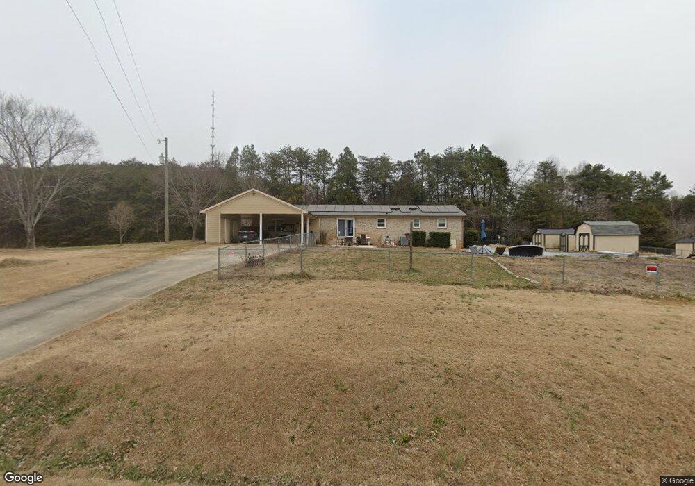
2362 Agony Acres Rd Unit Tract 4 Clover, SC 29710
Estimated Value: $324,000 - $431,000
3
Beds
2
Baths
2,093
Sq Ft
$178/Sq Ft
Est. Value
About This Home
This home is located at 2362 Agony Acres Rd Unit Tract 4, Clover, SC 29710 and is currently estimated at $372,793, approximately $178 per square foot. 2362 Agony Acres Rd Unit Tract 4 is a home located in York County with nearby schools including Bethany Elementary School, Clover Middle School, and Clover High School.
Ownership History
Date
Name
Owned For
Owner Type
Purchase Details
Closed on
May 30, 2024
Sold by
Alford Thomas J and Alford Kari T
Bought by
Rodgers Cecil D and Rodgers Vonda C
Current Estimated Value
Home Financials for this Owner
Home Financials are based on the most recent Mortgage that was taken out on this home.
Original Mortgage
$332,500
Outstanding Balance
$327,736
Interest Rate
7.1%
Mortgage Type
VA
Estimated Equity
$45,057
Purchase Details
Closed on
Dec 28, 2018
Sold by
Byers Corena S and Margozzi Corena S
Bought by
Alford Thomas J and Alford Kari T
Home Financials for this Owner
Home Financials are based on the most recent Mortgage that was taken out on this home.
Original Mortgage
$258,250
Interest Rate
4.9%
Mortgage Type
VA
Create a Home Valuation Report for This Property
The Home Valuation Report is an in-depth analysis detailing your home's value as well as a comparison with similar homes in the area
Home Values in the Area
Average Home Value in this Area
Purchase History
| Date | Buyer | Sale Price | Title Company |
|---|---|---|---|
| Rodgers Cecil D | $350,000 | None Listed On Document | |
| Alford Thomas J | $250,000 | None Available |
Source: Public Records
Mortgage History
| Date | Status | Borrower | Loan Amount |
|---|---|---|---|
| Open | Rodgers Cecil D | $332,500 | |
| Previous Owner | Alford Thomas J | $258,250 |
Source: Public Records
Tax History Compared to Growth
Tax History
| Year | Tax Paid | Tax Assessment Tax Assessment Total Assessment is a certain percentage of the fair market value that is determined by local assessors to be the total taxable value of land and additions on the property. | Land | Improvement |
|---|---|---|---|---|
| 2025 | -- | $0 | $0 | $0 |
| 2024 | $1,265 | $9,771 | $1,600 | $8,171 |
| 2023 | $1,295 | $9,733 | $1,600 | $8,133 |
| 2022 | $1,047 | $9,733 | $1,600 | $8,133 |
| 2021 | -- | $9,733 | $1,600 | $8,133 |
| 2020 | $1,030 | $9,733 | $0 | $0 |
| 2019 | $4,905 | $14,100 | $0 | $0 |
| 2018 | $485 | $4,140 | $0 | $0 |
| 2017 | $450 | $4,140 | $0 | $0 |
| 2016 | $441 | $4,140 | $0 | $0 |
| 2014 | $481 | $4,140 | $880 | $3,260 |
| 2013 | $481 | $4,300 | $880 | $3,420 |
Source: Public Records
Map
Nearby Homes
- 966 Laurelwood Dr
- 946 Laurelwood Dr
- 00 State Road S-46-883
- 1240 Beamguard Rd
- 0000 Davis Cir
- 1312 Sage Pine Cir Unit 19
- Lot 1 Rhyne Rd
- Princeton Plan at Shepherd's Trace - Shepherds Trace
- Pinehurst Plan at Shepherd's Trace - Shepherds Trace
- Muirfield Plan at Shepherd's Trace - Shepherds Trace
- Pinehurst with 3rd Floor Retreat Plan at Shepherd's Trace - Shepherds Trace
- Madison Plan at Shepherd's Trace - Shepherds Trace
- Davidson Plan at Shepherd's Trace - Shepherds Trace
- Bethpage Plan at Shepherd's Trace - Shepherds Trace
- Columbia Plan at Shepherd's Trace - Shepherds Trace
- St. Andrews Plan at Shepherd's Trace - Shepherds Trace
- Augusta Plan at Shepherd's Trace - Shepherds Trace
- St. Andrews with 3rd Floor Retreat Plan at Shepherd's Trace - Shepherds Trace
- Harvard Plan at Shepherd's Trace - Shepherds Trace
- 1069 Sage Pine Cir Unit 57
- 2362 Agony Acres Rd
- 2240 Highway 55 W
- 2230 Highway 55 W
- 2375 Agony Acres Rd
- 2375 Agony Acres Rd
- 998 Laurelwood Dr
- 990 Laurelwood Dr
- 970 Laurelwood Dr
- 2347 Highway 55 W
- 955 Laurelwood Dr
- 960 Laurelwood Dr
- 921 Laurelwood Dr
- 921 Laurelwood Dr
- 275 Frontier Rd
- 930 Laurelwood Dr
- 285 Frontier Rd
- 2355 Highway 55 W
- 0000 45+/- Acres Laurelwood Dr
- 104.7 Henry Knob Rd
- 104.7 Henry Knob Rd