Estimated Value: $428,000 - $674,000
Studio
--
Bath
1,620
Sq Ft
$324/Sq Ft
Est. Value
About This Home
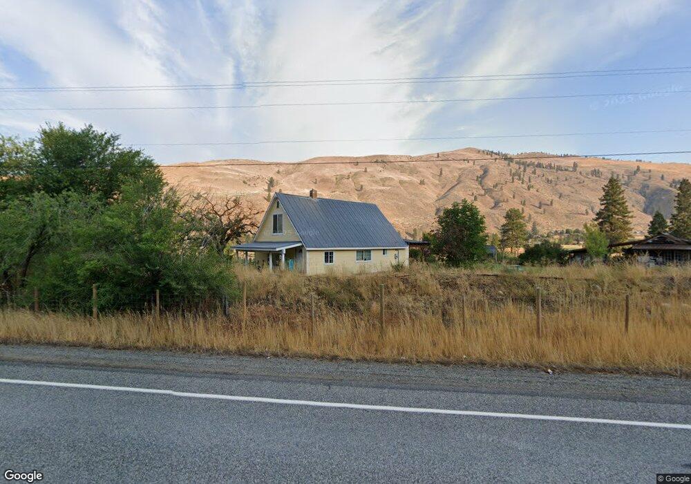
This home is located at 2363 State Route 153, Twisp, WA 98856 and is currently estimated at $525,333, approximately $324 per square foot. 2363 State Route 153 is a home with nearby schools including Methow Valley Elementary School, Liberty Bell Junior/Senior High School, and Methow Valley Independent Learning Center.
Ownership History
Date
Name
Owned For
Owner Type
Purchase Details
Closed on
Feb 10, 2012
Sold by
Sampson John S
Bought by
Robbins Daniel B
Current Estimated Value
Home Financials for this Owner
Home Financials are based on the most recent Mortgage that was taken out on this home.
Original Mortgage
$183,673
Outstanding Balance
$125,895
Interest Rate
3.9%
Mortgage Type
New Conventional
Estimated Equity
$399,438
Create a Home Valuation Report for This Property
The Home Valuation Report is an in-depth analysis detailing your home's value as well as a comparison with similar homes in the area
Purchase History
| Date | Buyer | Sale Price | Title Company |
|---|---|---|---|
| Robbins Daniel B | $180,000 | Inland Professional Title |
Source: Public Records
Mortgage History
| Date | Status | Borrower | Loan Amount |
|---|---|---|---|
| Open | Robbins Daniel B | $183,673 |
Source: Public Records
Tax History
| Year | Tax Paid | Tax Assessment Tax Assessment Total Assessment is a certain percentage of the fair market value that is determined by local assessors to be the total taxable value of land and additions on the property. | Land | Improvement |
|---|---|---|---|---|
| 2025 | $2,776 | $361,700 | $63,600 | $298,100 |
| 2024 | $2,776 | $350,600 | $63,600 | $287,000 |
| 2022 | $2,285 | $212,100 | $43,100 | $169,000 |
| 2021 | $2,442 | $212,100 | $43,100 | $169,000 |
| 2020 | $1,967 | $212,100 | $43,100 | $169,000 |
| 2019 | $1,873 | $173,100 | $43,100 | $130,000 |
| 2018 | $1,954 | $173,100 | $43,100 | $130,000 |
| 2017 | $1,775 | $173,100 | $43,100 | $130,000 |
| 2016 | $1,414 | $139,600 | $39,200 | $100,400 |
| 2015 | $1,308 | $139,600 | $39,200 | $100,400 |
| 2013 | -- | $139,600 | $39,200 | $100,400 |
Source: Public Records
Map
Nearby Homes
- 87 Vintin Rd
- 245 Twisp Carlton Rd
- 1941 Washington 153
- 54B Ross Rd Unit B
- 2081 Washington 153
- 14 Maverick Ln
- 48 Thurlow Rd
- 88 TBD Gold Creek Rd
- 2992 Washington 153
- 121 Finley Canyon Rd
- 1221 Riverside Ave
- 1110 Riverside Ave
- 0 Lot 2 Amended Surface Short Plat
- 805 Marble St
- 318 Lombard St
- 136 Johnson St
- 115 Johnson St N Unit 1,2,3
- 140 Twisp Ave W Unit 204
- 240 Mc Farland Creek Rd
- 1 Terrace View Short Plat
- 21 Bell Ln
- 15 Bell Ln
- 2362A State Route 153
- 2362B State Route 153
- 2377A Highway 153
- 17 Bell Ln
- 19 Bell Ln
- 2331 State Route 153
- 2383 Washington 153
- 2383 Highway 153
- 29 Old Orchard Ln
- 48 Vintin Rd
- 4 Beulah Rd
- 3 Old Orchard Ln
- 0 NHN Old Orchard Ln
- 3 Lois Ln
- 18 Old Orchard Ln
- 24 Beulah Rd
- 146 Twisp Carlton Rd
- 35 Old
Your Personal Tour Guide
Ask me questions while you tour the home.