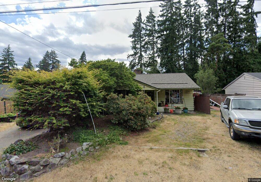
23632 101st Ave W Edmonds, WA 98020
Sherwood Forest NeighborhoodEstimated Value: $699,000 - $1,024,000
3
Beds
1
Bath
1,597
Sq Ft
$533/Sq Ft
Est. Value
About This Home
This home is located at 23632 101st Ave W, Edmonds, WA 98020 and is currently estimated at $850,817, approximately $532 per square foot. 23632 101st Ave W is a home located in Snohomish County with nearby schools including Sherwood Elementary School, College Place Middle School, and Edmonds-Woodway High School.
Ownership History
Date
Name
Owned For
Owner Type
Purchase Details
Closed on
Dec 16, 1996
Sold by
Murray Darrell K and Murray Denise M
Bought by
Batrack Dan and Batrack Darwisa J
Current Estimated Value
Purchase Details
Closed on
Jun 21, 1995
Sold by
Stroud William L and Stroud Marilyn L
Bought by
Sayers Gary G and Sayers Jean G
Home Financials for this Owner
Home Financials are based on the most recent Mortgage that was taken out on this home.
Original Mortgage
$70,000
Interest Rate
7.42%
Create a Home Valuation Report for This Property
The Home Valuation Report is an in-depth analysis detailing your home's value as well as a comparison with similar homes in the area
Home Values in the Area
Average Home Value in this Area
Purchase History
| Date | Buyer | Sale Price | Title Company |
|---|---|---|---|
| Batrack Dan | $340,000 | Transamerica Title Ins Compa | |
| Sayers Gary G | $152,950 | Stewart Title Company |
Source: Public Records
Mortgage History
| Date | Status | Borrower | Loan Amount |
|---|---|---|---|
| Previous Owner | Sayers Gary G | $70,000 |
Source: Public Records
Tax History Compared to Growth
Tax History
| Year | Tax Paid | Tax Assessment Tax Assessment Total Assessment is a certain percentage of the fair market value that is determined by local assessors to be the total taxable value of land and additions on the property. | Land | Improvement |
|---|---|---|---|---|
| 2025 | $4,993 | $712,300 | $571,000 | $141,300 |
| 2024 | $4,993 | $700,300 | $559,000 | $141,300 |
| 2023 | $5,076 | $737,800 | $584,000 | $153,800 |
| 2022 | $4,753 | $568,200 | $452,000 | $116,200 |
| 2020 | $4,412 | $471,600 | $355,000 | $116,600 |
| 2019 | $4,073 | $438,600 | $326,000 | $112,600 |
| 2018 | $4,067 | $378,500 | $278,000 | $100,500 |
| 2017 | $3,386 | $329,700 | $241,000 | $88,700 |
| 2016 | $3,092 | $298,200 | $213,000 | $85,200 |
| 2015 | -- | $299,300 | $204,000 | $95,300 |
| 2013 | -- | $224,600 | $138,000 | $86,600 |
Source: Public Records
Map
Nearby Homes
- 24012 102nd Place W
- 9801 234th St SW Unit 1
- 23511 96th Ave W
- 9526 234th St SW
- 24104 105th Place W
- 24109 106th Place W
- 23024 99th Ave W
- 9906 242nd Place SW
- 303 NW 203rd St
- 23227 92nd Ave W
- 11108 239th Place SW
- 9511 Edmonds Way
- 11211 Wachusett Rd
- 22628 106th Ave W
- 23601 Edmonds Way
- 20142 17th Ave NW
- 11130 S Deer Dr
- 23121 Edmonds Way Unit 2
- 20005 13th Place NW
- 22910 90th Ave W Unit C306
- 23706 101st Ave W
- 23626 101st Ave W
- 23701 101st Place W
- 23625 101st Place W
- 23618 101st Ave W
- 23712 101st Ave W
- 23707 101st Place W
- 23619 101st Place W
- 23633 101st Ave W
- 23627 101st Ave W
- 23707 101st Ave W
- 23718 101st Ave W
- 10109 238th St SW
- 23610 101st Ave W
- 23619 101st Ave W
- 23611 101st Place W
- 23715 101st Ave W
- 23702 101st Place W
- 23606 101st Ave W
- 23716 101st Place W