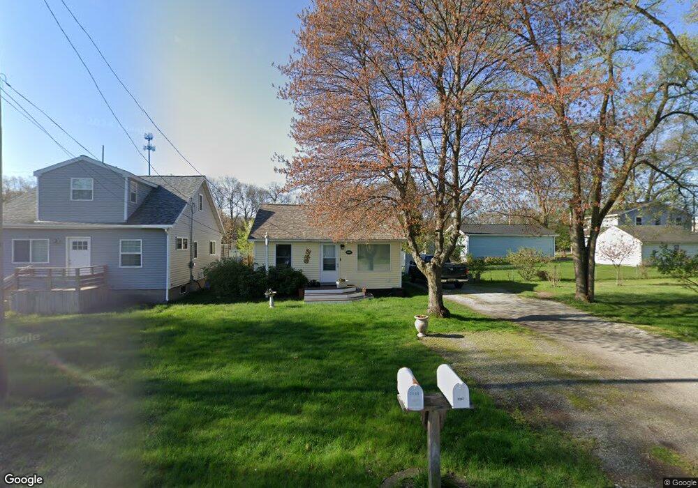
2367 Norman Ave Norton Shores, MI 49441
Estimated Value: $192,000 - $210,000
3
Beds
1
Bath
963
Sq Ft
$208/Sq Ft
Est. Value
About This Home
This home is located at 2367 Norman Ave, Norton Shores, MI 49441 and is currently estimated at $200,160, approximately $207 per square foot. 2367 Norman Ave is a home located in Muskegon County with nearby schools including Mona Shores High School, Muskegon Montessori Academy for Environmental Change, and St. Francis De Sales Elementary School.
Ownership History
Date
Name
Owned For
Owner Type
Purchase Details
Closed on
Jun 20, 2025
Sold by
Loyselle Deborah
Bought by
Deborah Jane Loyselle Revocable Trust and Loyselle
Current Estimated Value
Purchase Details
Closed on
Feb 12, 2003
Sold by
Loyselle Deborah J and Lani Timothy E
Bought by
Loyselle Deborah
Home Financials for this Owner
Home Financials are based on the most recent Mortgage that was taken out on this home.
Original Mortgage
$51,500
Interest Rate
6.06%
Mortgage Type
Purchase Money Mortgage
Create a Home Valuation Report for This Property
The Home Valuation Report is an in-depth analysis detailing your home's value as well as a comparison with similar homes in the area
Home Values in the Area
Average Home Value in this Area
Purchase History
| Date | Buyer | Sale Price | Title Company |
|---|---|---|---|
| Deborah Jane Loyselle Revocable Trust | -- | None Listed On Document | |
| Loyselle Deborah | -- | -- |
Source: Public Records
Mortgage History
| Date | Status | Borrower | Loan Amount |
|---|---|---|---|
| Previous Owner | Loyselle Deborah | $51,500 |
Source: Public Records
Tax History Compared to Growth
Tax History
| Year | Tax Paid | Tax Assessment Tax Assessment Total Assessment is a certain percentage of the fair market value that is determined by local assessors to be the total taxable value of land and additions on the property. | Land | Improvement |
|---|---|---|---|---|
| 2025 | $1,460 | $73,900 | $0 | $0 |
| 2024 | $1,145 | $68,800 | $0 | $0 |
| 2023 | $1,093 | $61,900 | $0 | $0 |
| 2022 | $1,333 | $54,100 | $0 | $0 |
| 2021 | $1,295 | $48,900 | $0 | $0 |
| 2020 | $1,046 | $39,800 | $0 | $0 |
| 2019 | $1,027 | $36,000 | $0 | $0 |
| 2018 | $1,002 | $29,600 | $0 | $0 |
| 2017 | $979 | $28,700 | $0 | $0 |
| 2016 | $758 | $26,200 | $0 | $0 |
| 2015 | -- | $25,000 | $0 | $0 |
| 2014 | $910 | $24,900 | $0 | $0 |
| 2013 | -- | $23,600 | $0 | $0 |
Source: Public Records
Map
Nearby Homes
- 2361 Norman Ave
- 2270 Norman Ave
- 2686 Forest Hills Rd
- 2715 Liberty Rd
- 2559 Letart Ave
- 2165 Letart Ave
- 2484 Lincoln St
- 2278 Reneer Ave
- 2340 Cutler Ave
- 2625 Liberty Rd
- 3507 Winnetaska Rd
- 2648 Bellevue Rd
- 2280 Arbor Ave
- 2163 Harding Ave
- 2263 Lawnel Ave
- 1936 W Sherman Blvd
- 1965 Philo Ave
- 2245 Morton Ave
- 2525 Morton Ave
- 2278 Morton Ave
- 2788 Lincoln St
- 2794 Lincoln St
- 2780 Lincoln St
- 2366 Norman Ave
- 2360 Norman Ave
- 2337 Norman Ave
- 2352 Norman Ave
- 2344 Norman Ave
- 2331 Norman Ave
- 2746 Lincoln St
- 2332 Norman Ave
- 2323 Norman Ave
- 2738 Lincoln St
- 2317 Norman Ave
- 2363 Hughes Ave
- 2320 Norman Ave
- 2345 Hughes Ave
- 2313 Norman Ave
- 2730 Lincoln St
- 2314 Norman Ave