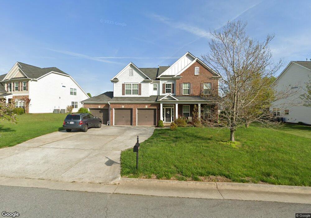
2367 Rockland Cir High Point, NC 27265
Sandy Ridge NeighborhoodEstimated Value: $530,000 - $545,000
5
Beds
4
Baths
3,630
Sq Ft
$147/Sq Ft
Est. Value
About This Home
This home is located at 2367 Rockland Cir, High Point, NC 27265 and is currently estimated at $534,281, approximately $147 per square foot. 2367 Rockland Cir is a home located in Guilford County with nearby schools including Southwest Elementary School, Southwest Guilford Middle School, and Southwest Guilford High School.
Ownership History
Date
Name
Owned For
Owner Type
Purchase Details
Closed on
Dec 30, 2008
Sold by
D R Horton Inc
Bought by
Hamouda Koballa E and Lartey Esther
Current Estimated Value
Home Financials for this Owner
Home Financials are based on the most recent Mortgage that was taken out on this home.
Original Mortgage
$208,000
Outstanding Balance
$136,851
Interest Rate
5.96%
Mortgage Type
Purchase Money Mortgage
Estimated Equity
$397,430
Create a Home Valuation Report for This Property
The Home Valuation Report is an in-depth analysis detailing your home's value as well as a comparison with similar homes in the area
Home Values in the Area
Average Home Value in this Area
Purchase History
| Date | Buyer | Sale Price | Title Company |
|---|---|---|---|
| Hamouda Koballa E | $260,000 | None Available |
Source: Public Records
Mortgage History
| Date | Status | Borrower | Loan Amount |
|---|---|---|---|
| Open | Hamouda Koballa E | $208,000 |
Source: Public Records
Tax History Compared to Growth
Tax History
| Year | Tax Paid | Tax Assessment Tax Assessment Total Assessment is a certain percentage of the fair market value that is determined by local assessors to be the total taxable value of land and additions on the property. | Land | Improvement |
|---|---|---|---|---|
| 2025 | $5,422 | $393,500 | $80,000 | $313,500 |
| 2024 | $5,422 | $393,500 | $80,000 | $313,500 |
| 2023 | $5,422 | $393,500 | $80,000 | $313,500 |
| 2022 | $5,304 | $393,500 | $80,000 | $313,500 |
| 2021 | $3,850 | $279,400 | $52,000 | $227,400 |
| 2020 | $3,850 | $279,400 | $52,000 | $227,400 |
| 2019 | $3,850 | $279,400 | $0 | $0 |
| 2018 | $3,831 | $279,400 | $0 | $0 |
| 2017 | $3,850 | $279,400 | $0 | $0 |
| 2016 | $3,676 | $262,100 | $0 | $0 |
| 2015 | $3,696 | $262,100 | $0 | $0 |
| 2014 | $3,759 | $262,100 | $0 | $0 |
Source: Public Records
Map
Nearby Homes
- 2304 Rockland Cir
- 2350 Birch View Dr
- 2305 Faircloth Way
- 4612 Owls View Ct
- 3171 Riley Ford Trail
- 3025 Sycamore Point Trail
- 3199 Riley Ford Trail
- 3199 Riley Ford Trail Unit Lot 33
- 4728 Sandy Camp Rd
- 4711 Willowstone Dr
- 4713 Willowstone Dr
- 4715 Willowstone Dr
- 4717 Willowstone Dr
- 4723 Willowstone Dr
- 4725 Willowstone Dr
- 3273 Alyssa Way
- 4802 Tradition Way
- 4722 Willowstone Dr
- 4743 Willowstone Dr
- Greenwich Plan at Trellises
- 2361 Rockland Cir
- 2373 Rockland Cir
- 4604 River Valley Rd
- 2353 Rockland Cir
- 2379 Rockland Cir
- 2368 Rockland Cir
- 2372 Rockland Cir
- 4600 River Valley Rd
- 2364 Rockland Cir
- 2376 Rockland Cir
- 4608 River Valley Rd
- 2360 Rockland Cir
- 2349 Rockland Cir
- 4601 River Valley Rd
- 2320 Alderbrook Dr
- 2324 Alderbrook Dr
- 2380 Rockland Cir
- 2356 Rockland Cir
- 2316 Alderbrook Dr
- 2345 Rockland Cir