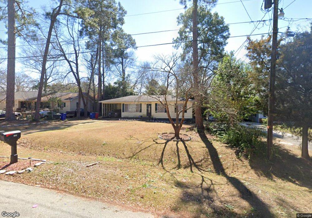
2369 Bristol Dr Macon, GA 31217
Estimated Value: $69,640 - $106,000
3
Beds
1
Bath
1,013
Sq Ft
$82/Sq Ft
Est. Value
About This Home
This home is located at 2369 Bristol Dr, Macon, GA 31217 and is currently estimated at $82,660, approximately $81 per square foot. 2369 Bristol Dr is a home located in Bibb County with nearby schools including Martin Luther King Jr. Elementary School, Appling Middle School, and Northeast High School.
Ownership History
Date
Name
Owned For
Owner Type
Purchase Details
Closed on
Jun 30, 2006
Sold by
Wooten J H Buster and Wooten Stokes E
Bought by
Murphy Ladawna
Current Estimated Value
Home Financials for this Owner
Home Financials are based on the most recent Mortgage that was taken out on this home.
Original Mortgage
$69,500
Outstanding Balance
$40,596
Interest Rate
6.55%
Mortgage Type
New Conventional
Estimated Equity
$42,064
Purchase Details
Closed on
Mar 7, 2006
Sold by
Federal National Mortgage Association
Bought by
Wooten J H Buster and Wooten Stokes E
Purchase Details
Closed on
Nov 5, 2005
Purchase Details
Closed on
May 13, 2003
Create a Home Valuation Report for This Property
The Home Valuation Report is an in-depth analysis detailing your home's value as well as a comparison with similar homes in the area
Purchase History
| Date | Buyer | Sale Price | Title Company |
|---|---|---|---|
| Murphy Ladawna | $69,500 | -- | |
| Wooten J H Buster | -- | None Avelable | |
| -- | $60,300 | -- | |
| -- | -- | -- |
Source: Public Records
Mortgage History
| Date | Status | Borrower | Loan Amount |
|---|---|---|---|
| Open | Murphy Ladawna | $69,500 |
Source: Public Records
Tax History
| Year | Tax Paid | Tax Assessment Tax Assessment Total Assessment is a certain percentage of the fair market value that is determined by local assessors to be the total taxable value of land and additions on the property. | Land | Improvement |
|---|---|---|---|---|
| 2025 | $389 | $22,813 | $3,240 | $19,573 |
| 2024 | $402 | $22,813 | $3,240 | $19,573 |
| 2023 | $468 | $22,813 | $3,240 | $19,573 |
| 2022 | $246 | $14,095 | $2,059 | $12,036 |
| 2021 | $127 | $10,336 | $1,373 | $8,963 |
| 2020 | $71 | $8,827 | $1,144 | $7,683 |
| 2019 | $72 | $8,827 | $1,144 | $7,683 |
| 2018 | $290 | $8,827 | $1,144 | $7,683 |
| 2017 | $68 | $8,827 | $1,144 | $7,683 |
| 2016 | $86 | $9,480 | $1,144 | $8,336 |
| 2015 | $140 | $9,862 | $1,525 | $8,336 |
| 2014 | $256 | $10,624 | $2,288 | $8,336 |
Source: Public Records
Map
Nearby Homes
- 2229 New Clinton Rd
- 2161 Melton Ave
- 896 Roseview Dr
- 2146 Melton Ave
- 2066 Melton Ave
- 1977 Thomas Dr
- 2675 Andy Dr
- 1840 Kinder Kare Dr
- 875 Artic Cir
- 837 Artic Cir
- 875 Artic Place
- 964 Irving Dr
- 4436 Jeffersonville Rd
- 860 Morningside Dr
- 2720 Jordan Ave
- 2333 Shurling Dr
- 1980 Bayswater Rd
- 2954 Tyler Place
- 909 Johnson St
- 3009 Millerfield Rd
- 2375 Bristol Dr
- 2363 Bristol Dr
- 2357 Bristol Dr Unit A13
- 2357 Bristol Dr
- 2381 Bristol Dr
- 405 Bray Ct
- 206 Bradstone Cir
- 2366 Bristol Dr
- 2372 Bristol Dr
- 2358 Bristol Dr
- 202 Bradstone Cir
- 2351 Bristol Dr
- 2387 Bristol Dr
- 2378 Bristol Dr
- 210 Bradstone Cir
- 2386 Bristol Dr
- 2345 Bristol Dr
- 2331 Danbury Dr
- 2348 Bristol Dr
- 2339 Danbury Dr
Your Personal Tour Guide
Ask me questions while you tour the home.