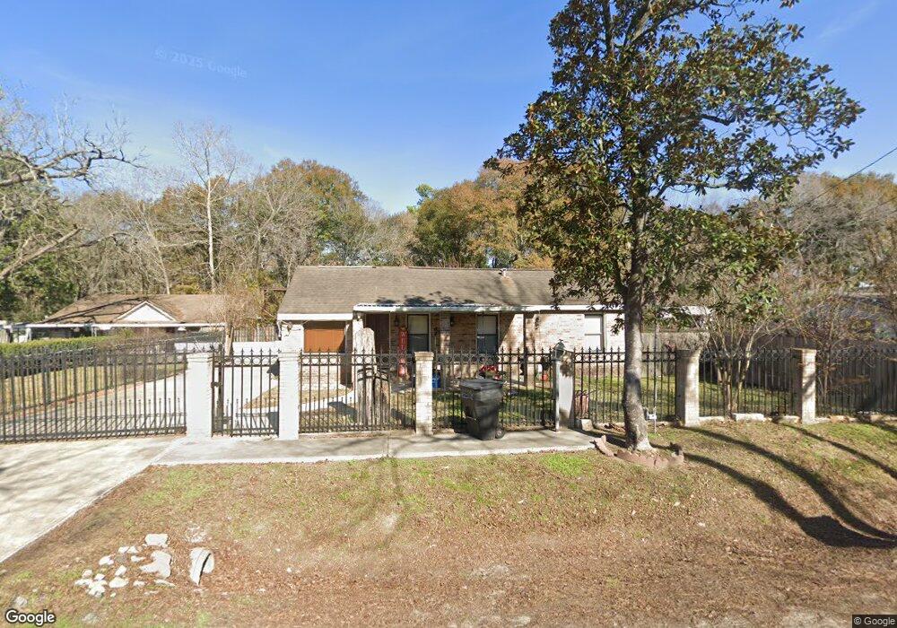
2369 Margaret St Houston, TX 77093
Eastex-Jensen NeighborhoodEstimated Value: $220,212 - $274,000
3
Beds
2
Baths
1,695
Sq Ft
$147/Sq Ft
Est. Value
About This Home
This home is located at 2369 Margaret St, Houston, TX 77093 and is currently estimated at $248,553, approximately $146 per square foot. 2369 Margaret St is a home located in Harris County with nearby schools including Coop Elementary School, Patrick Henry Middle School, and Sam Houston Math, Science & Technology Center.
Ownership History
Date
Name
Owned For
Owner Type
Purchase Details
Closed on
Nov 15, 2002
Sold by
Civallero Oscar A and Civallero Reina
Bought by
Campos Victor M and Hernandez Maria G
Current Estimated Value
Home Financials for this Owner
Home Financials are based on the most recent Mortgage that was taken out on this home.
Original Mortgage
$75,600
Outstanding Balance
$31,362
Interest Rate
5.89%
Estimated Equity
$217,191
Create a Home Valuation Report for This Property
The Home Valuation Report is an in-depth analysis detailing your home's value as well as a comparison with similar homes in the area
Home Values in the Area
Average Home Value in this Area
Purchase History
| Date | Buyer | Sale Price | Title Company |
|---|---|---|---|
| Campos Victor M | -- | Fidelity National Title |
Source: Public Records
Mortgage History
| Date | Status | Borrower | Loan Amount |
|---|---|---|---|
| Open | Campos Victor M | $75,600 |
Source: Public Records
Tax History Compared to Growth
Tax History
| Year | Tax Paid | Tax Assessment Tax Assessment Total Assessment is a certain percentage of the fair market value that is determined by local assessors to be the total taxable value of land and additions on the property. | Land | Improvement |
|---|---|---|---|---|
| 2025 | $1,574 | $175,222 | $74,313 | $100,909 |
| 2024 | $1,574 | $221,332 | $69,600 | $151,732 |
| 2023 | $1,574 | $184,282 | $54,375 | $129,907 |
| 2022 | $2,651 | $148,970 | $45,313 | $103,657 |
| 2021 | $2,551 | $125,559 | $32,625 | $92,934 |
| 2020 | $2,409 | $118,928 | $32,625 | $86,303 |
| 2019 | $2,289 | $118,928 | $32,625 | $86,303 |
| 2018 | $1,371 | $82,231 | $25,013 | $57,218 |
| 2017 | $2,079 | $82,231 | $25,013 | $57,218 |
| 2016 | $2,079 | $82,231 | $25,013 | $57,218 |
| 2015 | $1,373 | $86,657 | $19,938 | $66,719 |
| 2014 | $1,373 | $86,657 | $19,938 | $66,719 |
Source: Public Records
Map
Nearby Homes
- 2332 Margaret St
- 2415 Goodloe St
- 2315 Langley Rd
- 2318 Cresline St
- 1728 Little York Rd
- 10512 Exeter St
- 10514 Exeter St
- 2636 Lone Oak Rd
- 1829 Skinner Rd
- 2633 Hollis St
- 1908 Little York Rd
- 1904 Little York Rd
- 2629 Kowis St
- 3202 Parker Rd
- 2122 Kowis St
- 2152 William Tell St
- 4918 Langley Rd
- 2237 Cromwell St
- 2817 Cromwell St
- 1731 Schilder Dr
- 2363 Margaret St
- 2371 Margaret St
- 2357 Margaret St
- 2383 Margaret St
- 2368 Margaret St
- 2372 Margaret St
- 2360 Margaret St
- 2351 Margaret St
- 2387 Margaret St
- 2356 Margaret St
- 2382 Margaret St
- 2345 Margaret St
- 2391 Margaret St
- 2427 Moreau St
- 2503 Moreau St
- 2423 Moreau St
- 2392 Margaret St
- 2346 Margaret St
- 2509 Moreau St Unit B
- 2509 Moreau St Unit A