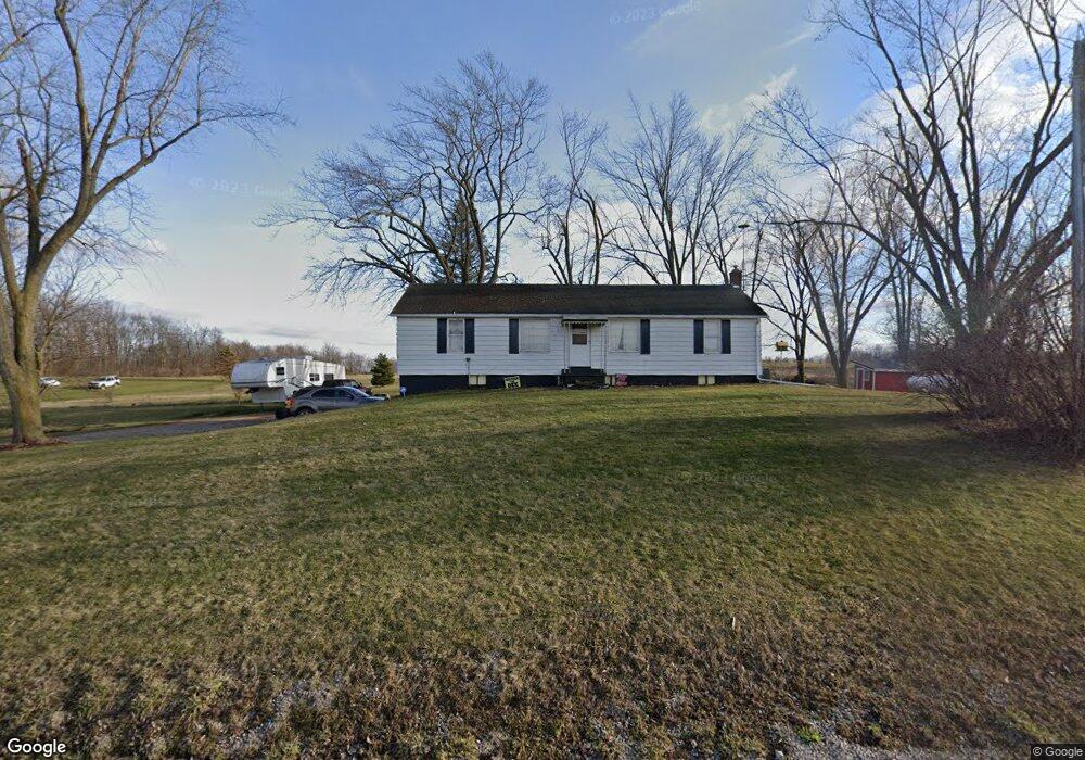
2369 Service Rd Clinton, MI 49236
Estimated Value: $211,000 - $240,000
4
Beds
1
Bath
1,173
Sq Ft
$190/Sq Ft
Est. Value
About This Home
This home is located at 2369 Service Rd, Clinton, MI 49236 and is currently estimated at $222,571, approximately $189 per square foot. 2369 Service Rd is a home located in Lenawee County with nearby schools including Clinton Elementary School, Clinton Middle School, and Clinton High School.
Ownership History
Date
Name
Owned For
Owner Type
Purchase Details
Closed on
May 13, 2010
Sold by
Sackett Herbert M
Bought by
Tilton Dennis J and Tilton Debra L
Current Estimated Value
Purchase Details
Closed on
Nov 2, 2009
Sold by
Faust Donna J and Estate Of Herbert Warren Sacke
Bought by
Tilton Delnnis J and Tilton Debra L
Home Financials for this Owner
Home Financials are based on the most recent Mortgage that was taken out on this home.
Original Mortgage
$44,000
Interest Rate
5.05%
Mortgage Type
New Conventional
Create a Home Valuation Report for This Property
The Home Valuation Report is an in-depth analysis detailing your home's value as well as a comparison with similar homes in the area
Home Values in the Area
Average Home Value in this Area
Purchase History
| Date | Buyer | Sale Price | Title Company |
|---|---|---|---|
| Tilton Dennis J | -- | None Available | |
| Tilton Delnnis J | $85,206 | American Title |
Source: Public Records
Mortgage History
| Date | Status | Borrower | Loan Amount |
|---|---|---|---|
| Previous Owner | Tilton Delnnis J | $44,000 |
Source: Public Records
Tax History Compared to Growth
Tax History
| Year | Tax Paid | Tax Assessment Tax Assessment Total Assessment is a certain percentage of the fair market value that is determined by local assessors to be the total taxable value of land and additions on the property. | Land | Improvement |
|---|---|---|---|---|
| 2025 | $2,028 | $96,500 | $0 | $0 |
| 2024 | $790 | $89,000 | $0 | $0 |
| 2022 | $1,688 | $68,700 | $0 | $0 |
| 2021 | $1,665 | $65,200 | $0 | $0 |
| 2020 | $1,645 | $60,000 | $0 | $0 |
| 2019 | $193,596 | $72,500 | $0 | $0 |
| 2018 | $1,835 | $57,213 | $0 | $0 |
| 2017 | $1,700 | $57,991 | $0 | $0 |
| 2016 | $1,694 | $57,798 | $0 | $0 |
| 2014 | -- | $62,150 | $0 | $0 |
Source: Public Records
Map
Nearby Homes
- 12460 Wisner Hwy
- 2962 U S 12
- 11800 N Adrian Hwy
- 1351 Taylor Rd
- 11481 N Adrian Hwy
- 19740 Lemm Rd
- 10454 Tipton Hwy
- 9000 Matthews Hwy
- 5000 Us 12 Hwy
- 4460 Munger Rd
- 20664 Allen Rd
- 5252 Tripp Rd
- 10746 Beebe Hwy
- 9200 Walnut Dr
- 14525 Sharon Hollow Rd
- 18490 Burtless Rd
- 3987 W M 50 M 50
- 317 Clark St Unit B
- 5600 Michigan Ave
- 19200 Stonefield
- 2301 Service Rd
- 2465 Service Rd
- 2615 Service Rd
- 2973 Service Rd
- 0 Service Rd
- 2537 Service Rd
- 2550 Service Rd
- 2000 Service Rd Unit BLK
- 2000 Service Rd Unit BLK
- 0 Wisner Hwy Unit 31343677
- 0 Wisner Hwy Unit 5522948
- 0 Wisner Hwy Unit 5581947
- 0 Wisner Hwy Unit 31308147
- 0 Wisner Hwy Unit 31318425
- 11918 Carson Hwy
- 12000 Wisner Hwy
- 12061 Carson Hwy
- 12164 Wisner Hwy
- 12212 Carson Hwy
- 11873 Carson Hwy