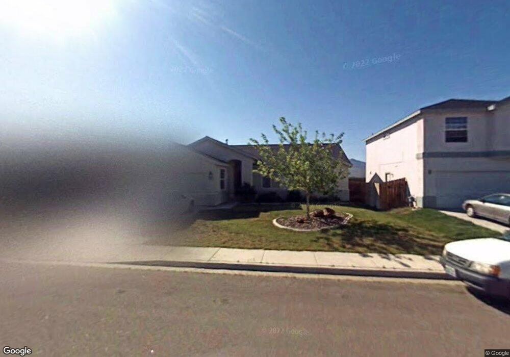
237 Corral Dr Dayton, NV 89403
Estimated Value: $394,384 - $409,000
3
Beds
2
Baths
1,414
Sq Ft
$284/Sq Ft
Est. Value
About This Home
This home is located at 237 Corral Dr, Dayton, NV 89403 and is currently estimated at $401,346, approximately $283 per square foot. 237 Corral Dr is a home located in Lyon County with nearby schools including Sutro Elementary School, Dayton Intermediate School, and Dayton High School.
Ownership History
Date
Name
Owned For
Owner Type
Purchase Details
Closed on
May 12, 2021
Sold by
Stark Joan K
Bought by
Stark Joan K and The Joan T Stark Revocable Liv
Current Estimated Value
Purchase Details
Closed on
Aug 6, 2011
Sold by
Baker Brian and Baker Nicole
Bought by
Stark Joan T
Home Financials for this Owner
Home Financials are based on the most recent Mortgage that was taken out on this home.
Original Mortgage
$113,989
Outstanding Balance
$78,519
Interest Rate
4.46%
Estimated Equity
$322,827
Purchase Details
Closed on
Apr 20, 2005
Sold by
Baker Brian
Bought by
Baker Brian and Baker Nicole
Home Financials for this Owner
Home Financials are based on the most recent Mortgage that was taken out on this home.
Original Mortgage
$202,400
Interest Rate
5.84%
Purchase Details
Closed on
Apr 13, 2005
Sold by
Baker Nicole and Wilkinson Nicole
Bought by
Baker Brian
Home Financials for this Owner
Home Financials are based on the most recent Mortgage that was taken out on this home.
Original Mortgage
$202,400
Interest Rate
5.84%
Create a Home Valuation Report for This Property
The Home Valuation Report is an in-depth analysis detailing your home's value as well as a comparison with similar homes in the area
Home Values in the Area
Average Home Value in this Area
Purchase History
| Date | Buyer | Sale Price | Title Company |
|---|---|---|---|
| Stark Joan K | -- | None Available | |
| Stark Joan T | $110,000 | First American Title Ins Co | |
| Baker Brian | -- | Accommodation | |
| Baker Brian | -- | First American Title Co Nv |
Source: Public Records
Mortgage History
| Date | Status | Borrower | Loan Amount |
|---|---|---|---|
| Open | Stark Joan T | $113,989 | |
| Previous Owner | Baker Brian | $202,400 |
Source: Public Records
Tax History
| Year | Tax Paid | Tax Assessment Tax Assessment Total Assessment is a certain percentage of the fair market value that is determined by local assessors to be the total taxable value of land and additions on the property. | Land | Improvement |
|---|---|---|---|---|
| 2025 | $1,775 | $118,144 | $56,000 | $62,144 |
| 2024 | $1,723 | $118,874 | $56,000 | $62,873 |
| 2023 | $1,723 | $114,493 | $56,000 | $58,493 |
| 2022 | $1,369 | $97,394 | $43,785 | $53,609 |
| 2021 | $1,329 | $96,180 | $43,785 | $52,395 |
| 2020 | $1,290 | $94,333 | $43,790 | $50,543 |
| 2019 | $1,252 | $75,702 | $29,190 | $46,512 |
| 2018 | $1,216 | $66,340 | $21,000 | $45,340 |
| 2017 | $1,180 | $59,389 | $14,000 | $45,389 |
| 2016 | $1,150 | $49,622 | $7,880 | $41,742 |
| 2015 | $1,148 | $38,780 | $7,880 | $30,900 |
| 2014 | $1,114 | $34,905 | $7,880 | $27,025 |
Source: Public Records
Map
Nearby Homes
- 430 Crosswinds Dr
- 334 Monte Cristo Dr
- 629 Westwinds Dr
- 209 Corral Dr
- 737 Butte Creek Rd
- 720 Butte Creek Rd
- 539 Rawe Peak Dr
- 7013 Highway 50
- 737 Roberts Creek Dr
- 1115 Gold Crater Place
- 708 Grubbs Well Trail
- 345 Halite Dr
- 343 Halite Dr
- 201 Crown Point Dr
- 246 Green Ln
- 244 Green Ln
- 1107 Gold Crater Place Unit Homesite 4
- 1109 Gold Crater Place Unit Homesite 5
- 1103 Gold Crater Place Unit Homesite 2
- 1105 Gold Crater Place Unit Homesite 3
- 235 Corral Dr
- 239 Corral Dr
- 269 Corral Dr Unit Lot 41
- 271 Corral Dr Unit Lot 42
- 241 Corral Dr
- 266 Corral Dr Unit Lot 37
- 238 Corral Dr
- 236 Corral Dr
- 234 Corral Dr
- 243 Corral Dr
- 240 Corral Dr
- 232 Corral Dr
- 242 Corral Dr
- 245 Corral Dr
- 509 Windchase Dr
- 244 Corral Dr
- 507 Windchase Dr
- 230 Corral Dr
- 511 Windchase Dr
- 505 Windchase Dr
Your Personal Tour Guide
Ask me questions while you tour the home.