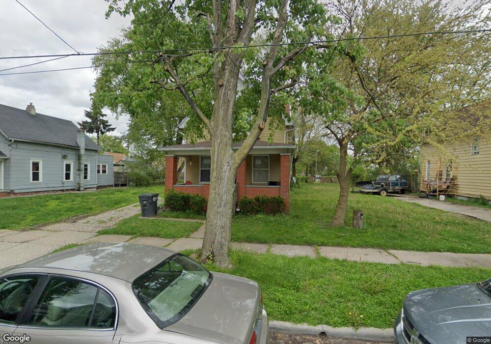
237 Hanover St Toledo, OH 43609
Southside NeighborhoodEstimated Value: $81,000 - $111,000
3
Beds
1
Bath
1,519
Sq Ft
$61/Sq Ft
Est. Value
About This Home
This home is located at 237 Hanover St, Toledo, OH 43609 and is currently estimated at $92,846, approximately $61 per square foot. 237 Hanover St is a home located in Lucas County with nearby schools including Burroughs Elementary School, Bowsher High School, and Explorers Academy of Science and Technology.
Ownership History
Date
Name
Owned For
Owner Type
Purchase Details
Closed on
Feb 23, 2021
Sold by
Adams Stephen T and Adams Terry L
Bought by
Dix Charity
Current Estimated Value
Purchase Details
Closed on
Mar 22, 2014
Sold by
Adams Steve
Bought by
Adams Stephen T and Adams Terry L
Purchase Details
Closed on
Nov 30, 2007
Sold by
Adams Steve
Bought by
Garza Alicia R
Home Financials for this Owner
Home Financials are based on the most recent Mortgage that was taken out on this home.
Original Mortgage
$56,000
Interest Rate
6.47%
Mortgage Type
Seller Take Back
Purchase Details
Closed on
Jan 30, 2007
Sold by
Bank Of New York
Bought by
Adams Steve
Purchase Details
Closed on
Nov 3, 2006
Sold by
Drouillard Natalie
Bought by
Bank Of New York and Encore Credit Receivables Trust 2005-1
Purchase Details
Closed on
Feb 22, 2005
Sold by
Westhaven Group Llc
Bought by
Drouillard Natalie
Home Financials for this Owner
Home Financials are based on the most recent Mortgage that was taken out on this home.
Original Mortgage
$80,000
Interest Rate
5.71%
Mortgage Type
Purchase Money Mortgage
Purchase Details
Closed on
Mar 5, 2004
Sold by
Ulmer Scot F
Bought by
Drouillard Natalie Arm
Home Financials for this Owner
Home Financials are based on the most recent Mortgage that was taken out on this home.
Original Mortgage
$72,900
Interest Rate
9.5%
Mortgage Type
Seller Take Back
Purchase Details
Closed on
Nov 17, 2003
Sold by
The Huntington Mortgage Co
Bought by
Westhaven Group Llc
Purchase Details
Closed on
Sep 13, 2003
Sold by
Drake Denise R
Bought by
The Huntington Mortgage Co
Purchase Details
Closed on
Oct 25, 1999
Sold by
Swigart Dawn L and Lawrence Michael A
Bought by
Drake Denise R
Home Financials for this Owner
Home Financials are based on the most recent Mortgage that was taken out on this home.
Original Mortgage
$36,000
Interest Rate
7.87%
Purchase Details
Closed on
Aug 10, 1990
Sold by
Malan Andrew D and Malan Brenda S
Create a Home Valuation Report for This Property
The Home Valuation Report is an in-depth analysis detailing your home's value as well as a comparison with similar homes in the area
Home Values in the Area
Average Home Value in this Area
Purchase History
| Date | Buyer | Sale Price | Title Company |
|---|---|---|---|
| Dix Charity | -- | None Available | |
| Adams Property Management Llc | -- | None Listed On Document | |
| Adams Stephen T | -- | None Available | |
| Garza Alicia R | $66,000 | None Available | |
| Adams Steve | $20,000 | None Available | |
| Bank Of New York | $48,000 | None Available | |
| Drouillard Natalie | $76,900 | -- | |
| Drouillard Natalie Arm | $76,900 | -- | |
| Westhaven Group Llc | $23,500 | -- | |
| The Huntington Mortgage Co | $26,667 | -- | |
| Drake Denise R | $37,900 | Northwest Title Agency Of Oh | |
| Swigart Dawn L | -- | Northwest Title Agency Of Oh | |
| -- | $30,500 | -- |
Source: Public Records
Mortgage History
| Date | Status | Borrower | Loan Amount |
|---|---|---|---|
| Previous Owner | Garza Alicia R | $56,000 | |
| Previous Owner | Drouillard Natalie | $80,000 | |
| Previous Owner | Drouillard Natalie Arm | $72,900 | |
| Previous Owner | Drake Denise R | $36,000 |
Source: Public Records
Tax History
| Year | Tax Paid | Tax Assessment Tax Assessment Total Assessment is a certain percentage of the fair market value that is determined by local assessors to be the total taxable value of land and additions on the property. | Land | Improvement |
|---|---|---|---|---|
| 2025 | -- | $23,765 | $4,165 | $19,600 |
| 2024 | $768 | $23,765 | $4,165 | $19,600 |
| 2023 | $1,175 | $16,870 | $3,850 | $13,020 |
| 2022 | $1,173 | $16,870 | $3,850 | $13,020 |
| 2021 | $1,178 | $16,870 | $3,850 | $13,020 |
| 2020 | $1,214 | $15,225 | $3,570 | $11,655 |
| 2019 | $1,177 | $15,225 | $3,570 | $11,655 |
| 2018 | $1,177 | $15,225 | $3,570 | $11,655 |
| 2017 | $1,225 | $14,875 | $3,220 | $11,655 |
| 2016 | $1,200 | $42,500 | $9,200 | $33,300 |
| 2015 | $1,165 | $42,500 | $9,200 | $33,300 |
| 2014 | $962 | $14,880 | $3,220 | $11,660 |
| 2013 | $962 | $14,880 | $3,220 | $11,660 |
Source: Public Records
Map
Nearby Homes
- 1936 Airport Hwy
- 142 S Detroit Ave
- 2010 Airport Hwy
- 131 S Detroit Ave
- 337 S Detroit Ave
- 1836 Finch St
- 115 Lake Shore Ave
- 140 Whiting Ave
- 415 Mayberry St
- 333 Danberry St
- 119 Whiting Ave
- 2121 Airport Hwy
- 2052 South Ave
- 2019 South Ave
- 511 S Detroit Ave
- 139 Kenmore Ave
- 1601 Airline Ave
- 323 Champion St
- 2335 Airport Hwy
- 317 Eldred Ave
- 239 Hanover St
- 235 Hanover St
- 231 Hanover St
- 243 Hanover St
- 223 Hanover St
- 247 Hanover St
- 221 Hanover St
- 238 S Fearing Blvd
- 236 S Fearing Blvd
- 217 Hanover St
- 230 S Fearing Blvd
- 215 Hanover St
- 228 S Fearing Blvd
- 236 Hanover St
- 238 Hanover St
- 232 Hanover St
- 242 Hanover St
- 228 Hanover St
- 224 S Fearing Blvd
- 224 Hanover St
Your Personal Tour Guide
Ask me questions while you tour the home.