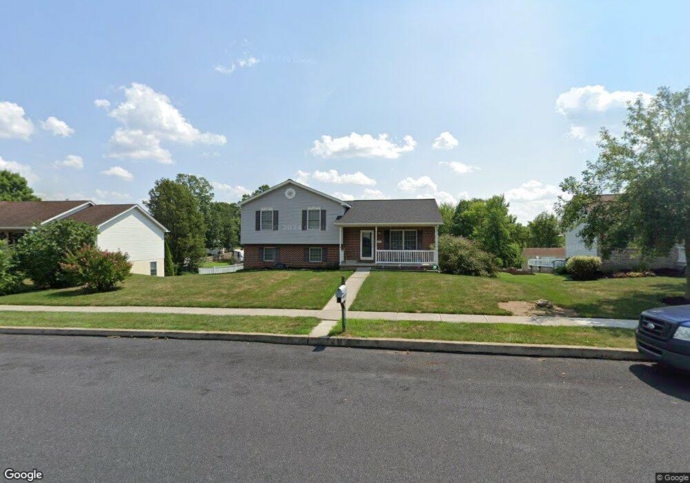
237 S Columbus Ave Unit 92 Littlestown, PA 17340
Estimated Value: $281,000 - $310,000
3
Beds
2
Baths
1,152
Sq Ft
$256/Sq Ft
Est. Value
About This Home
This home is located at 237 S Columbus Ave Unit 92, Littlestown, PA 17340 and is currently estimated at $295,449, approximately $256 per square foot. 237 S Columbus Ave Unit 92 is a home located in Adams County with nearby schools including Rolling Acres El School, Maple Avenue Middle School, and Littlestown Senior High School.
Ownership History
Date
Name
Owned For
Owner Type
Purchase Details
Closed on
Dec 22, 2011
Sold by
Flanary Angela F
Bought by
Flanary Jeffery E
Current Estimated Value
Home Financials for this Owner
Home Financials are based on the most recent Mortgage that was taken out on this home.
Original Mortgage
$124,200
Interest Rate
4%
Mortgage Type
New Conventional
Create a Home Valuation Report for This Property
The Home Valuation Report is an in-depth analysis detailing your home's value as well as a comparison with similar homes in the area
Home Values in the Area
Average Home Value in this Area
Purchase History
| Date | Buyer | Sale Price | Title Company |
|---|---|---|---|
| Flanary Jeffery E | -- | None Available |
Source: Public Records
Mortgage History
| Date | Status | Borrower | Loan Amount |
|---|---|---|---|
| Closed | Flanary Jeffery E | $124,200 |
Source: Public Records
Tax History Compared to Growth
Tax History
| Year | Tax Paid | Tax Assessment Tax Assessment Total Assessment is a certain percentage of the fair market value that is determined by local assessors to be the total taxable value of land and additions on the property. | Land | Improvement |
|---|---|---|---|---|
| 2025 | $4,191 | $182,300 | $45,800 | $136,500 |
| 2024 | $4,038 | $182,300 | $45,800 | $136,500 |
| 2023 | $3,882 | $182,300 | $45,800 | $136,500 |
| 2022 | $3,858 | $182,300 | $45,800 | $136,500 |
| 2021 | $3,744 | $182,300 | $45,800 | $136,500 |
| 2020 | $3,699 | $182,300 | $45,800 | $136,500 |
| 2019 | $3,589 | $182,300 | $45,800 | $136,500 |
| 2018 | $3,523 | $182,300 | $45,800 | $136,500 |
| 2017 | $3,433 | $182,300 | $45,800 | $136,500 |
| 2016 | -- | $182,300 | $45,800 | $136,500 |
| 2015 | -- | $182,300 | $45,800 | $136,500 |
| 2014 | -- | $182,300 | $45,800 | $136,500 |
Source: Public Records
Map
Nearby Homes
- 15 Yorktowne Ct Unit 97
- 28 Gettysburg Ct Unit 60
- 129 W King St
- 22 Rita Marie Ave
- 117 Charles St
- 115 Charles St
- 1024 Frederick Pike Unit 6
- 52 Stayman Way Unit 81
- 61 E King St
- 140 Apple Grove Ln Unit 425
- 135 Apple Grove Ln Unit 438
- 161 Stoners Cir
- 211 E King St
- 440 N Queen St
- 162 Newark St
- 58 Windsor Ct
- 48 Windsor Ct
- 449 Glenwyn Dr
- 20c Locust Dr
- 0 Locust Dr Unit PAAD2015910
- 229 S Columbus Ave Unit 91
- 247 S Columbus Ave Unit 93
- 253 S Columbus Ave Unit 94
- 233 S Columbus Ave Unit 90
- 11 Yorktowne Ct Unit 96
- 217 S Columbus Ave Unit 89
- 236 S Columbus Ave Unit 152
- 265 S Columbus Ave Unit 95
- 244 S Columbus Ave Unit 151
- 226 S Columbus Ave Unit 153
- 252 S Columbus Ave Unit 150
- 315D Mengus Mill Rd
- 21 Yorktowne Ct Unit 98
- 260 S Columbus Ave Unit 149
- 212 S Columbus Ave Unit 155
- 268 S Columbus Ave Unit 148
- 454 Lexington Way Unit 163
- 450 Lexington Way Unit 164
- 201 S Columbus Ave Unit 87
- 444 Lexington Way Unit 165