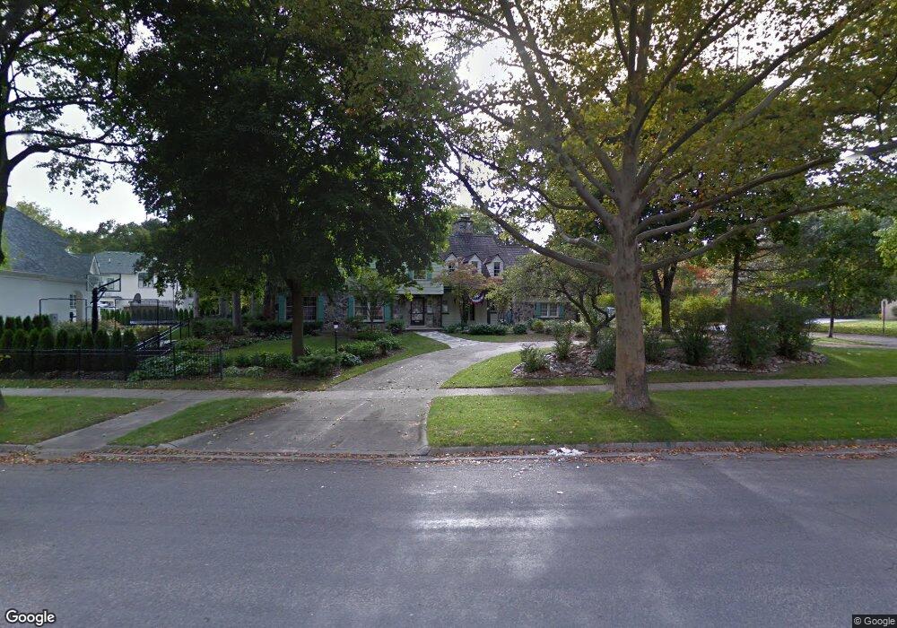
2371 Radnor St Unit Bldg-Unit Birmingham, MI 48009
Estimated Value: $1,405,120 - $1,544,000
4
Beds
5
Baths
3,902
Sq Ft
$380/Sq Ft
Est. Value
About This Home
This home is located at 2371 Radnor St Unit Bldg-Unit, Birmingham, MI 48009 and is currently estimated at $1,484,030, approximately $380 per square foot. 2371 Radnor St Unit Bldg-Unit is a home located in Oakland County with nearby schools including Pierce Elementary School, Derby Middle School, and Ernest W. Seaholm High School.
Ownership History
Date
Name
Owned For
Owner Type
Purchase Details
Closed on
May 2, 2019
Sold by
Jack D Laslie Revocable Trust
Bought by
Vestevich Mark and Vestevich Shawn K
Current Estimated Value
Home Financials for this Owner
Home Financials are based on the most recent Mortgage that was taken out on this home.
Original Mortgage
$484,350
Outstanding Balance
$424,103
Interest Rate
4%
Mortgage Type
New Conventional
Estimated Equity
$1,059,927
Purchase Details
Closed on
Aug 13, 2009
Sold by
Laslie Jack D and Laslie Judith A
Bought by
Laslie Jack D and Jack D Laslie Revocable Trust
Create a Home Valuation Report for This Property
The Home Valuation Report is an in-depth analysis detailing your home's value as well as a comparison with similar homes in the area
Home Values in the Area
Average Home Value in this Area
Purchase History
| Date | Buyer | Sale Price | Title Company |
|---|---|---|---|
| Vestevich Mark | $890,000 | Equity Title Agency Llc | |
| Laslie Jack D | -- | None Available |
Source: Public Records
Mortgage History
| Date | Status | Borrower | Loan Amount |
|---|---|---|---|
| Open | Vestevich Mark | $484,350 |
Source: Public Records
Tax History Compared to Growth
Tax History
| Year | Tax Paid | Tax Assessment Tax Assessment Total Assessment is a certain percentage of the fair market value that is determined by local assessors to be the total taxable value of land and additions on the property. | Land | Improvement |
|---|---|---|---|---|
| 2024 | $17,915 | $558,680 | $0 | $0 |
| 2023 | $17,167 | $500,930 | $0 | $0 |
| 2022 | $19,148 | $496,320 | $0 | $0 |
| 2021 | $19,962 | $514,310 | $0 | $0 |
| 2020 | $17,762 | $489,000 | $0 | $0 |
| 2019 | $13,605 | $426,140 | $0 | $0 |
| 2018 | $13,501 | $407,660 | $0 | $0 |
| 2017 | $13,478 | $383,020 | $0 | $0 |
| 2016 | $13,502 | $362,880 | $0 | $0 |
| 2015 | -- | $352,740 | $0 | $0 |
| 2014 | -- | $329,050 | $0 | $0 |
| 2011 | -- | $302,830 | $0 | $0 |
Source: Public Records
Map
Nearby Homes
- 397 S Cranbrook Rd
- 394 S Glenhurst Dr
- 120 Westchester Way
- 345 Kimberly St
- 695 Westchester Way
- 1834 Fairview St
- 2802 Heathfield Rd
- 2579 Amberly Rd
- 520 Pleasant St
- 786 S Cranbrook Rd
- 2721 Heathfield Rd
- 1882 Melbourne St
- 100 Overhill Rd
- 222 Arlington St
- 2330 Fairway Dr
- 586 Fairfax St
- 1019 N Cranbrook Rd
- 956 Westwood Dr
- 999 Pleasant Ave
- 231 Wadsworth Ln
- 2371 Radnor St
- 340 Wellesley St
- 275 Bryn Mawr St
- 2400 Devon Ln
- 2401 Radnor St
- 2338 Radnor St
- 348 Wellesley St
- 311 Bryn Mawr St
- 2434 Devon Ln
- 2300 Avon Ln
- 2347 W Maple Rd
- 333 Bryn Mawr St
- 2368 Radnor St
- 2325 W Maple Rd
- 325 Wellesley St
- 374 Wellesley St
- 2453 Radnor St
- 2276 Avon Ln
- 2299 W Maple Rd
- 2259 Avon Ln