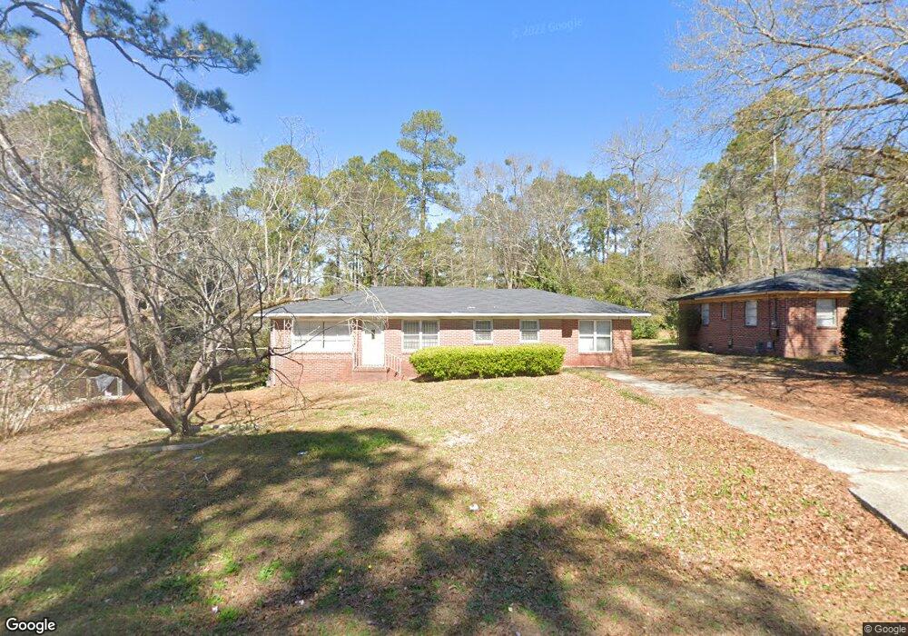
2372 Bristol Dr Macon, GA 31217
Estimated Value: $90,000 - $114,000
3
Beds
2
Baths
1,463
Sq Ft
$69/Sq Ft
Est. Value
About This Home
This home is located at 2372 Bristol Dr, Macon, GA 31217 and is currently estimated at $100,916, approximately $68 per square foot. 2372 Bristol Dr is a home located in Bibb County with nearby schools including Martin Luther King Jr. Elementary School, Appling Middle School, and Northeast High School.
Ownership History
Date
Name
Owned For
Owner Type
Purchase Details
Closed on
Jul 18, 2018
Sold by
Sanders Brittney
Bought by
Sanders Brittney and Sanders Regis D
Current Estimated Value
Purchase Details
Closed on
Jun 10, 1999
Bought by
Sims Maria
Create a Home Valuation Report for This Property
The Home Valuation Report is an in-depth analysis detailing your home's value as well as a comparison with similar homes in the area
Purchase History
| Date | Buyer | Sale Price | Title Company |
|---|---|---|---|
| Sanders Brittney | -- | None Available | |
| Sanders Brittney | -- | None Available | |
| Sanders Brittney | -- | None Available | |
| Sims Maria | $55,000 | -- |
Source: Public Records
Tax History
| Year | Tax Paid | Tax Assessment Tax Assessment Total Assessment is a certain percentage of the fair market value that is determined by local assessors to be the total taxable value of land and additions on the property. | Land | Improvement |
|---|---|---|---|---|
| 2025 | $853 | $34,724 | $3,000 | $31,724 |
| 2024 | $882 | $34,724 | $3,000 | $31,724 |
| 2023 | $882 | $34,724 | $3,000 | $31,724 |
| 2022 | $692 | $19,974 | $2,014 | $17,960 |
| 2021 | $535 | $14,067 | $1,343 | $12,724 |
| 2020 | $467 | $12,038 | $1,119 | $10,919 |
| 2019 | $476 | $12,172 | $1,119 | $11,053 |
| 2018 | $490 | $12,172 | $1,119 | $11,053 |
| 2017 | $251 | $13,690 | $1,119 | $12,571 |
| 2016 | $248 | $14,177 | $1,119 | $13,058 |
| 2015 | $370 | $14,550 | $1,492 | $13,058 |
| 2014 | $537 | $15,608 | $2,238 | $13,370 |
Source: Public Records
Map
Nearby Homes
- 2229 New Clinton Rd
- 2285 New Clinton Rd
- 896 Roseview Dr
- 2161 Melton Ave
- 2361 Ollie Dr
- 2675 Andy Dr
- 2066 Melton Ave
- 2740 Millerfield Rd
- 1977 Thomas Dr
- 973 Irving Dr
- 964 Irving Dr
- 2720 Jordan Ave
- 2792 Jordan Ave
- 2877 Wilkes Ct
- 837 Artic Cir
- 4436 Jeffersonville Rd
- 2954 Tyler Place
- 3009 Millerfield Rd
- 3020 Millerfield Rd
- 3020 Millersfield Rd
- 2378 Bristol Dr
- 2366 Bristol Dr
- 2386 Bristol Dr
- 2345 Danbury Dr
- 2339 Danbury Dr
- 2353 Danbury Dr
- 2358 Bristol Dr
- 2359 Danbury Dr
- 2400 Bristol Dr
- 2375 Bristol Dr
- 2369 Bristol Dr
- 2331 Danbury Dr
- 2381 Bristol Dr
- 2363 Bristol Dr
- 2367 Danbury Dr
- 2410 Bristol Dr
- 2387 Bristol Dr
- 2357 Bristol Dr Unit A13
- 2357 Bristol Dr
- 2348 Bristol Dr
Your Personal Tour Guide
Ask me questions while you tour the home.