


2372 S Union Ave Alliance, OH 44601
Estimated payment $1,120/month
Total Views
13,538
4
Beds
1
Bath
--
Sq Ft
--
Price per Sq Ft
Highlights
- Popular Property
- No HOA
- Forced Air Heating System
- Colonial Architecture
About This Home
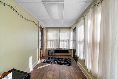
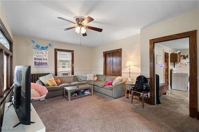
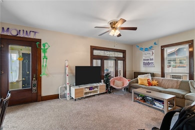
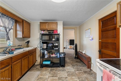
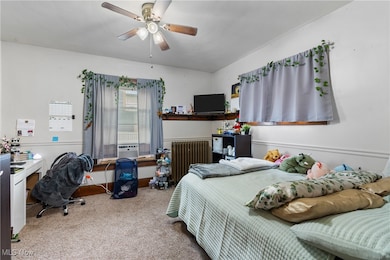
Solid income, strong location, and dependable tenants make this 4-bedroom, 1-bath home a standout in the local college rental market. Conveniently located just a short distance from campus, this property offers students easy access to classes, dining, and entertainment — keeping demand high and vacancies low. The home features a spacious layout ideal for student living, with well-sized bedrooms and common areas that appeal to groups of tenants. It shares a large off-street parking lot with the two adjoining portfolio properties, simplifying management and offering ample parking for all residents. Currently leased to college tenants with a history of full occupancy and consistent rent collection, this property is a proven performer and a dependable addition to any investor’s portfolio. It’s one of three properties being offered as a complete investment package — two single-family rentals and a mixed-use commercial/residential building with a salon and student rental — all on the same block. Great cash flow and long-term investment potential!
Listing Agent
Keller Williams Legacy Group Realty Brokerage Email: Justin@JCSells.com, 330-705-3640 License #2015004696 Listed on: 10/26/2025
Home Details
Home Type
- Single Family
Est. Annual Taxes
- $1,804
Year Built
- Built in 1910
Home Design
- Colonial Architecture
- Traditional Architecture
- Fiberglass Roof
- Asphalt Roof
- Vinyl Siding
Bedrooms and Bathrooms
- 4 Bedrooms | 1 Main Level Bedroom
- 1 Full Bathroom
Parking
- Gravel Driveway
- On-Site Parking
- Parking Lot
Utilities
- No Cooling
- Forced Air Heating System
- Heating System Uses Gas
Additional Features
- 2-Story Property
- 0.26 Acre Lot
Community Details
- No Home Owners Association
- Alliance Subdivision
Listing and Financial Details
- Assessor Parcel Number 00108312
Map
Create a Home Valuation Report for This Property
The Home Valuation Report is an in-depth analysis detailing your home's value as well as a comparison with similar homes in the area
Home Values in the Area
Average Home Value in this Area
Tax History
| Year | Tax Paid | Tax Assessment Tax Assessment Total Assessment is a certain percentage of the fair market value that is determined by local assessors to be the total taxable value of land and additions on the property. | Land | Improvement |
|---|---|---|---|---|
| 2025 | $2,083 | $48,760 | $12,150 | $36,610 |
| 2024 | -- | $48,760 | $12,150 | $36,610 |
| 2023 | $1,250 | $30,380 | $9,520 | $20,860 |
| 2022 | $1,259 | $30,380 | $9,520 | $20,860 |
| 2021 | $1,262 | $30,380 | $9,520 | $20,860 |
| 2020 | $1,163 | $26,150 | $8,260 | $17,890 |
| 2019 | $1,148 | $26,150 | $8,260 | $17,890 |
| 2018 | $1,153 | $26,150 | $8,260 | $17,890 |
| 2017 | $1,062 | $23,670 | $6,830 | $16,840 |
| 2016 | $1,057 | $23,350 | $6,830 | $16,520 |
| 2015 | $1,066 | $23,350 | $6,830 | $16,520 |
| 2014 | $1,114 | $23,240 | $6,790 | $16,450 |
| 2013 | $556 | $23,240 | $6,790 | $16,450 |
Source: Public Records
Property History
| Date | Event | Price | List to Sale | Price per Sq Ft |
|---|---|---|---|---|
| 10/26/2025 10/26/25 | For Sale | $185,000 | -- | -- |
Source: MLS Now
Purchase History
| Date | Type | Sale Price | Title Company |
|---|---|---|---|
| Land Contract | $415,000 | None Available | |
| Deed | -- | -- | |
| Deed | $65,000 | -- |
Source: Public Records
Mortgage History
| Date | Status | Loan Amount | Loan Type |
|---|---|---|---|
| Open | $375,000 | Land Contract Argmt. Of Sale | |
| Closed | -- | No Value Available | |
| Previous Owner | $48,750 | New Conventional |
Source: Public Records
About the Listing Agent
Purchasing or selling a home is likely to be the single largest financial transaction of your life. When selecting a Realtor to represent you, you need to choose a powerful advocate to have on your side. As a licensed attorney, certified arbitrator, and trained mediator, I have the strong negotiating power, keen attention to detail, and the proven contract drafting abilities that you need.
Justin's Other Listings
Source: MLS Now
MLS Number: 5167531
APN: 00108312
Disclaimer: Certain information contained herein is derived from information provided by parties other than Homes.com. All information provided is deemed reliable, but is not guaranteed to be accurate and should be independently verified.
![]() IDX information is provided exclusively for personal, non-commercial use, and may not be used for any purpose other than to identify prospective properties consumers may be interested in purchasing. Information is deemed reliable but not guaranteed.
IDX information is provided exclusively for personal, non-commercial use, and may not be used for any purpose other than to identify prospective properties consumers may be interested in purchasing. Information is deemed reliable but not guaranteed.
Nearby Homes
- 2406 S Union Ave
- 2405 Cherry Ave
- 2135 Cherry Ave
- 2041 Watson Ave
- 2408 S Linden Ave
- 2364 Shunk Ave
- 317 E State St
- 2705 Shunk Ave
- 112 E College St
- 1745 S Linden Ave
- 555 E Milton St
- 1846 S Freedom Ave
- 2245 Ridgewood Ave
- 390 E College St
- 477 Linwood Dr
- 549 Linwood Dr
- 853 Fairway Dr
- 224 Shadyside Ct
- 825 E College St
- 3116 Ridgehill Ave
- 734 Mill Cir
- 1850 S Seneca Ave
- 1202 Turnbury St
- 721 Forest Ave
- 22807 Alden Ave Unit A
- 39 S Arch Ave Unit 2
- 1342 W Cambridge St
- 70 E Main St
- 974 Madison Ave
- 1370 W Vine St
- 11661 Rockhill Ave NE
- 219-235 Brookfield St
- 525 S Marion Ave
- 1286 N Chapel St Unit 5
- 400-508 Woodmoor St
- 110 W Frana Clara St
- 130 Frana Clara St
- 292 Kennedy St Unit 2
- 292 Kennedy St Unit 2
- 713 Mosby Ln