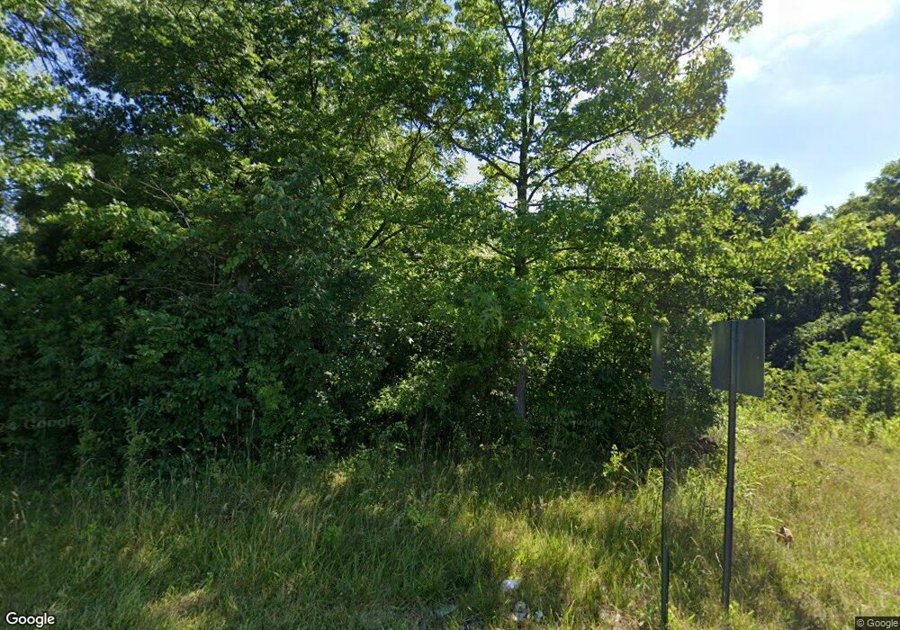
2374 Banning Rd Cincinnati, OH 45239
Estimated Value: $131,000 - $250,000
--
Bed
--
Bath
--
Sq Ft
7.39
Acres
About This Home
This home is located at 2374 Banning Rd, Cincinnati, OH 45239 and is currently estimated at $184,000. 2374 Banning Rd is a home located in Hamilton County with nearby schools including White Oak Middle School, Colerain High School, and Cincinnati Achievement Academy.
Ownership History
Date
Name
Owned For
Owner Type
Purchase Details
Closed on
Aug 12, 2020
Sold by
Buckeye Community Hope Foundation
Bought by
Lsr Llc
Current Estimated Value
Purchase Details
Closed on
Mar 30, 2011
Sold by
Fifth Third Bank
Bought by
Buckeye Community Hope Foundation
Purchase Details
Closed on
Jun 30, 2005
Sold by
Banks Donna Sue and Banks Roger
Bought by
Rare Earth Land Co Llc
Home Financials for this Owner
Home Financials are based on the most recent Mortgage that was taken out on this home.
Original Mortgage
$780,000
Interest Rate
5.75%
Mortgage Type
Unknown
Create a Home Valuation Report for This Property
The Home Valuation Report is an in-depth analysis detailing your home's value as well as a comparison with similar homes in the area
Home Values in the Area
Average Home Value in this Area
Purchase History
| Date | Buyer | Sale Price | Title Company |
|---|---|---|---|
| Lsr Llc | $39,900 | None Available | |
| Buckeye Community Hope Foundation | $30,000 | Attorney | |
| Rare Earth Land Co Llc | $85,000 | None Available |
Source: Public Records
Mortgage History
| Date | Status | Borrower | Loan Amount |
|---|---|---|---|
| Previous Owner | Rare Earth Land Co Llc | $780,000 |
Source: Public Records
Tax History Compared to Growth
Tax History
| Year | Tax Paid | Tax Assessment Tax Assessment Total Assessment is a certain percentage of the fair market value that is determined by local assessors to be the total taxable value of land and additions on the property. | Land | Improvement |
|---|---|---|---|---|
| 2024 | $359 | $6,262 | $6,262 | -- |
| 2023 | $334 | $6,262 | $6,262 | $0 |
| 2022 | $53 | $718 | $718 | $0 |
| 2021 | $53 | $718 | $718 | $0 |
| 2020 | $380 | $5,278 | $5,278 | $0 |
| 2019 | $343 | $4,473 | $4,473 | $0 |
| 2018 | $343 | $4,473 | $4,473 | $0 |
| 2017 | $328 | $4,473 | $4,473 | $0 |
| 2016 | $46 | $609 | $609 | $0 |
| 2015 | $45 | $609 | $609 | $0 |
| 2014 | $45 | $609 | $609 | $0 |
| 2013 | $50 | $700 | $700 | $0 |
Source: Public Records
Map
Nearby Homes
- 2342 Banning Rd
- 2424 Banning Rd
- 2412 Amelia Ct
- 2538 Byrneside Dr
- 2268 Deblin Dr
- 2481 Crosley Meadow
- 2503 Flanigan Ct
- 2598 Byrneside Dr
- 2532 Flanigan Ct
- 2536 Flanigan Ct
- 2125 Mckinley Ave
- 6851 Rutherford Ct
- 5851 Monfort Hills Ave
- 2477 Kipling Ave
- 2021 Catalpa Ave
- 2146 W North Bend Rd
- 2142 W North Bend Rd
- 6292 Simpson Ave
- 2606 Kipling Ave
- 2347 Golf Dr
- 2390 Banning Rd
- 2364 Banning Rd
- 2398 Banning Rd
- 2404 Banning Rd Unit 4
- 2404 Banning Rd Unit 10
- 2410 Banning Rd
- 6806 Kenbyrne Ct
- 6814 Kenbyrne Ct
- 2414 Banning Rd Unit 3
- 2414 Banning Rd Unit 4
- 2414 Banning Rd Unit 9
- 6826 Kenbyrne Ct
- 6802 Kenbyrne Ct
- 6838 Kenbyrne Ct
- 2420 Banning Rd
- 2409 Amelia Ct
- 6842 Kenbyrne Ct
- 2405 Amelia Ct
- 2336 Banning Rd
- 6807 Kenbyrne Ct