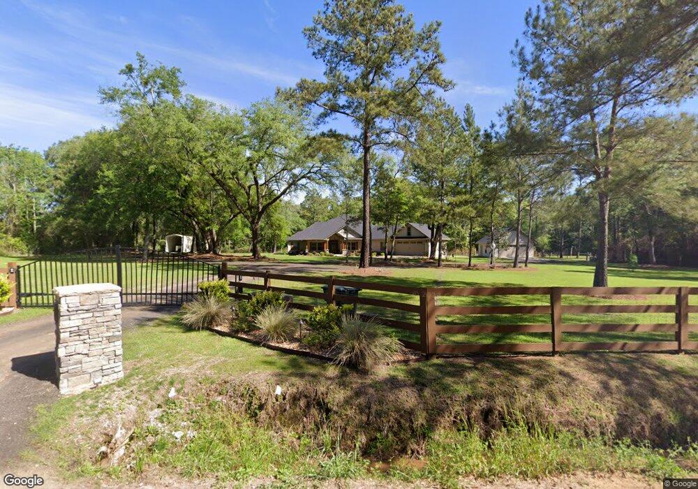
2375 Duncan Rd Quitman, GA 31643
Estimated Value: $343,000 - $560,460
4
Beds
3
Baths
2,807
Sq Ft
$155/Sq Ft
Est. Value
About This Home
This home is located at 2375 Duncan Rd, Quitman, GA 31643 and is currently estimated at $436,487, approximately $155 per square foot. 2375 Duncan Rd is a home with nearby schools including Quitman Elementary School and First Baptist Church Preschool & Kindergarten.
Ownership History
Date
Name
Owned For
Owner Type
Purchase Details
Closed on
Nov 27, 2018
Sold by
Kinnett Rick W
Bought by
Cameron Cody Michael and Cody Tracy
Current Estimated Value
Home Financials for this Owner
Home Financials are based on the most recent Mortgage that was taken out on this home.
Original Mortgage
$28,000
Interest Rate
4.8%
Mortgage Type
New Conventional
Purchase Details
Closed on
Apr 19, 2007
Sold by
Brooks County Land & Tim
Bought by
Kinnett Rick W
Create a Home Valuation Report for This Property
The Home Valuation Report is an in-depth analysis detailing your home's value as well as a comparison with similar homes in the area
Purchase History
| Date | Buyer | Sale Price | Title Company |
|---|---|---|---|
| Cameron Cody Michael | $35,000 | -- | |
| Kinnett Rick W | $43,510 | -- |
Source: Public Records
Mortgage History
| Date | Status | Borrower | Loan Amount |
|---|---|---|---|
| Closed | Cameron Cody Michael | $28,000 |
Source: Public Records
Tax History
| Year | Tax Paid | Tax Assessment Tax Assessment Total Assessment is a certain percentage of the fair market value that is determined by local assessors to be the total taxable value of land and additions on the property. | Land | Improvement |
|---|---|---|---|---|
| 2025 | $5,581 | $207,480 | $19,440 | $188,040 |
| 2024 | $5,581 | $207,480 | $19,440 | $188,040 |
| 2023 | $4,241 | $172,880 | $18,040 | $154,840 |
| 2022 | $4,778 | $160,560 | $17,160 | $143,400 |
| 2021 | $4,026 | $133,400 | $17,880 | $115,520 |
| 2020 | $3,705 | $133,400 | $17,880 | $115,520 |
| 2019 | $609 | $17,160 | $17,160 | $0 |
| 2018 | $475 | $16,280 | $16,280 | $0 |
| 2017 | $495 | $16,280 | $16,280 | $0 |
| 2016 | $492 | $16,280 | $16,280 | $0 |
| 2015 | -- | $16,280 | $16,280 | $0 |
| 2014 | -- | $16,280 | $16,280 | $0 |
| 2013 | -- | $16,280 | $16,280 | $0 |
Source: Public Records
Map
Nearby Homes
- 237 Turkey Ridge Ln
- 1019 Fodie Rd
- 1521 Mount Carmel Chuch Rx
- 2430 Spain Rd
- 714 Morris Ave
- 103 Victorian Way
- 506 Oglesby St
- 807 N Court St
- 1306 E Screven St
- 700 N Washington St
- 606 N Court St
- 0 E Gordon St
- 203 N Clay St
- Lot 14 Dawn Ln
- 1001 W Bartow St
- 1501 W Screven St
- 309 Eastlake Dr
- 103 Magnolia Dr
- 103 Camellia Dr
- 2466 Dunn Rd
- 3346 Adel Hwy
- 3282 Adel Hwy
- 3424 Adel Hwy
- 2484 Duncan Rd
- 3478 Adel Hwy
- 3369 Adel Hwy
- 45 Turkey Ridge Ln
- 2670 Duncan Rd
- 0 Duncan Rd
- 00 Duncan Rd
- 99 Turkey Ridge Ln
- 183 Turkey Ridge Ln
- 2896 Adel Hwy
- 299 Turkey Ridge Ln
- 48 Turkey Ridge Ln
- 279 Turkey Ridge Ln
- 204 Turkey Ridge Ln
- 1911 Duncan Rd
- 286 Turkey Ridge Ln
- 336 Turkey Ridge Ln
Your Personal Tour Guide
Ask me questions while you tour the home.