Estimated Value: $94,000 - $128,000
3
Beds
1
Bath
1,202
Sq Ft
$92/Sq Ft
Est. Value
About This Home
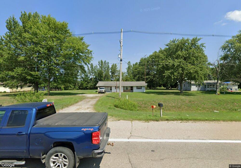
This home is located at 2375 W Us Highway 12, Niles, MI 49120 and is currently estimated at $110,734, approximately $92 per square foot. 2375 W Us Highway 12 is a home located in Berrien County with nearby schools including Ballard Elementary School, Oak Manor Sixth Grade Center, and Ring Lardner Middle School.
Ownership History
Date
Name
Owned For
Owner Type
Purchase Details
Closed on
Sep 12, 2025
Sold by
Turnbo Allen D
Bought by
Freel Colin
Current Estimated Value
Home Financials for this Owner
Home Financials are based on the most recent Mortgage that was taken out on this home.
Original Mortgage
$10,000
Outstanding Balance
$10,000
Interest Rate
6.63%
Estimated Equity
$100,734
Purchase Details
Closed on
May 25, 2018
Sold by
Fannie Mae
Bought by
Tumbo Allen D
Purchase Details
Closed on
Jun 3, 1993
Purchase Details
Closed on
Oct 16, 1987
Create a Home Valuation Report for This Property
The Home Valuation Report is an in-depth analysis detailing your home's value as well as a comparison with similar homes in the area
Home Values in the Area
Average Home Value in this Area
Purchase History
| Date | Buyer | Sale Price | Title Company |
|---|---|---|---|
| Freel Colin | $90,490 | Chicago Title Of Michigan | |
| Tumbo Allen D | $28,000 | None Available | |
| -- | $100 | -- | |
| -- | -- | -- |
Source: Public Records
Mortgage History
| Date | Status | Borrower | Loan Amount |
|---|---|---|---|
| Open | Freel Colin | $10,000 | |
| Open | Freel Colin | $84,072 |
Source: Public Records
Tax History Compared to Growth
Tax History
| Year | Tax Paid | Tax Assessment Tax Assessment Total Assessment is a certain percentage of the fair market value that is determined by local assessors to be the total taxable value of land and additions on the property. | Land | Improvement |
|---|---|---|---|---|
| 2025 | $1,268 | $70,400 | $0 | $0 |
| 2024 | $678 | $64,500 | $0 | $0 |
| 2023 | $646 | $56,800 | $0 | $0 |
| 2022 | $615 | $49,000 | $0 | $0 |
| 2021 | $1,120 | $47,200 | $11,100 | $36,100 |
| 2020 | $1,112 | $48,300 | $0 | $0 |
| 2019 | $1,084 | $38,900 | $8,900 | $30,000 |
| 2018 | $1,641 | $38,900 | $0 | $0 |
| 2017 | $1,608 | $38,800 | $0 | $0 |
| 2016 | $1,578 | $41,900 | $0 | $0 |
| 2015 | $1,567 | $40,400 | $0 | $0 |
| 2014 | $397 | $38,300 | $0 | $0 |
Source: Public Records
Map
Nearby Homes
- 1675 Mallard Dr
- 143 Sweet William Ln
- 2160 Portage Rd
- 144 Poppy Ct
- 139 Poppy Ct
- 133 Hummingbird Ln
- 115 Hummingbird Ln
- 110 Bridle Path Ln
- 123 Saratoga Ln
- 134 Turfway Park
- 134 Lexington Pointe Dr
- Integrity 1610 Plan at Longmeadow
- Elements 2700 Plan at Longmeadow
- 219 Arlington Ln
- 218 Arlington Ln
- 103 Lexington Pointe Dr
- 143 Lexington Pointe Dr
- 1604 Orchard Ln
- 4844 Ontario
- 301 Woodland
- 2365 W Us Highway 12
- 2365 U S 12
- 2385 W Us Highway 12
- 2355 U S 12
- 2355 W Us Highway 12
- 1645 Mallard Dr
- 2335 W Us Highway 12 W
- 1665 Mallard Dr
- 2405 W Chicago Rd
- 1650 Portage Rd N
- V/L W Us 12
- 1710 Portage Rd
- 2250 W Chicago Rd
- 2627 W Chicago Rd
- 1760 Portage Rd
- 1555 Portage Rd N
- 1755 Portage Rd
- 2190 W Chicago Rd
- 2150 W Chicago Rd
- 2121 W Chicago Rd Unit C