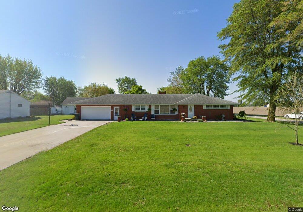
23774 State Route 697 Delphos, OH 45833
Estimated Value: $221,161 - $247,000
3
Beds
2
Baths
1,672
Sq Ft
$138/Sq Ft
Est. Value
About This Home
This home is located at 23774 State Route 697, Delphos, OH 45833 and is currently estimated at $230,290, approximately $137 per square foot. 23774 State Route 697 is a home located in Van Wert County with nearby schools including Delphos St. John's High School and Delphos St. John's Elementary School.
Ownership History
Date
Name
Owned For
Owner Type
Purchase Details
Closed on
Aug 23, 2007
Sold by
Suever Norman B
Bought by
Werts Timothy L and Werts Cory D
Current Estimated Value
Home Financials for this Owner
Home Financials are based on the most recent Mortgage that was taken out on this home.
Original Mortgage
$110,400
Interest Rate
6.77%
Mortgage Type
Purchase Money Mortgage
Create a Home Valuation Report for This Property
The Home Valuation Report is an in-depth analysis detailing your home's value as well as a comparison with similar homes in the area
Home Values in the Area
Average Home Value in this Area
Purchase History
| Date | Buyer | Sale Price | Title Company |
|---|---|---|---|
| Werts Timothy L | $138,000 | Attorney |
Source: Public Records
Mortgage History
| Date | Status | Borrower | Loan Amount |
|---|---|---|---|
| Closed | Werts Timothy L | $110,400 |
Source: Public Records
Tax History Compared to Growth
Tax History
| Year | Tax Paid | Tax Assessment Tax Assessment Total Assessment is a certain percentage of the fair market value that is determined by local assessors to be the total taxable value of land and additions on the property. | Land | Improvement |
|---|---|---|---|---|
| 2024 | $1,766 | $60,880 | $5,240 | $55,640 |
| 2023 | $1,766 | $60,880 | $5,240 | $55,640 |
| 2022 | $1,515 | $47,250 | $4,480 | $42,770 |
| 2021 | $1,520 | $47,250 | $4,480 | $42,770 |
| 2020 | $1,556 | $47,250 | $4,480 | $42,770 |
| 2019 | $1,195 | $41,220 | $4,030 | $37,190 |
| 2018 | $1,196 | $41,220 | $4,030 | $37,190 |
| 2017 | $1,131 | $41,220 | $4,030 | $37,190 |
| 2016 | $1,030 | $37,120 | $4,030 | $33,090 |
| 2015 | $1,030 | $37,120 | $4,030 | $33,090 |
| 2014 | $1,081 | $37,120 | $4,030 | $33,090 |
| 2013 | $1,164 | $37,120 | $4,030 | $33,090 |
Source: Public Records
Map
Nearby Homes
- 11630 Clearview Dr
- 606 S Cass St
- 634 S Clay St
- 409 N Bredeick St
- 616 W 5th St
- 424 S Canal St
- 604 W 6th St
- 503 W 6th St
- 221 S Main St
- 516 S Main St
- 827 S Washington St
- 508 S Washington St
- 210 E 3rd St
- 405 N Franklin St
- 610 N Washington St
- 1001 S Adams St
- 704 N Franklin St
- 628 N Pierce St
- 810 N Franklin St
- 633 E 2nd St
- 23796 State Route 697
- 11553 Wellman Rd
- 11536 Mox Rd
- 23826 State Route 697
- 11585 Wellman Rd
- 23850 State Route 697
- 23811 Jennings Delphos Rd
- 23861 Jennings Delphos Rd
- 23843 Jennings Delphos Rd
- 23785 Jennings Delphos Rd
- 23876 State Route 697
- 23771 Jennings Delphos Rd
- 23889 Jennings Delphos Rd
- 23850 Jennings Delphos Rd
- 23796 Jennings Delphos Rd
- 23890 State Route 697
- 23840 Jennings Delphos Rd