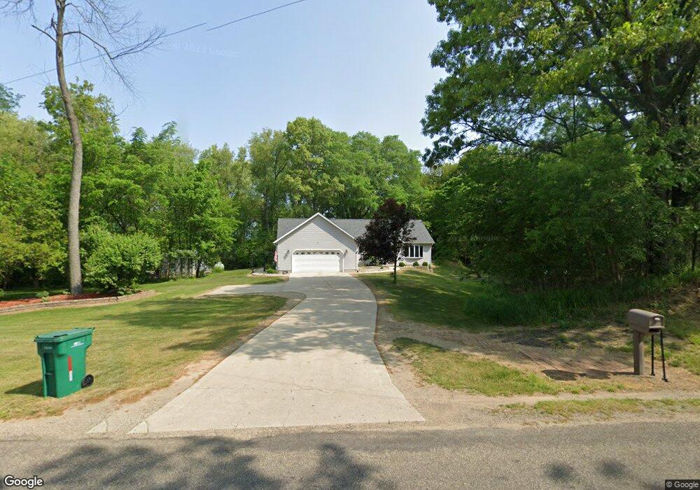
23780 Airline Rd Sturgis, MI 49091
Estimated Value: $364,308 - $452,000
--
Bed
--
Bath
1,680
Sq Ft
$238/Sq Ft
Est. Value
About This Home
This home is located at 23780 Airline Rd, Sturgis, MI 49091 and is currently estimated at $399,327, approximately $237 per square foot. 23780 Airline Rd is a home located in St. Joseph County with nearby schools including Sturgis High School and New Dawn School.
Ownership History
Date
Name
Owned For
Owner Type
Purchase Details
Closed on
Dec 15, 2016
Sold by
Yerrick Robetr D and Yerrick Joanne J
Bought by
Yerrick Robert D and Yerrick Joanne J
Current Estimated Value
Purchase Details
Closed on
Nov 22, 2011
Sold by
Gushwa Gail and Hart Gail
Bought by
Yerrick Robert and Yerrick Joanne
Home Financials for this Owner
Home Financials are based on the most recent Mortgage that was taken out on this home.
Original Mortgage
$120,000
Outstanding Balance
$82,065
Interest Rate
4.08%
Mortgage Type
New Conventional
Estimated Equity
$317,262
Purchase Details
Closed on
Apr 11, 2001
Purchase Details
Closed on
Jun 11, 1992
Create a Home Valuation Report for This Property
The Home Valuation Report is an in-depth analysis detailing your home's value as well as a comparison with similar homes in the area
Home Values in the Area
Average Home Value in this Area
Purchase History
| Date | Buyer | Sale Price | Title Company |
|---|---|---|---|
| Yerrick Robert D | -- | Attorney | |
| Yerrick Robert | $155,000 | Patrick Abstract | |
| -- | -- | -- | |
| -- | -- | -- |
Source: Public Records
Mortgage History
| Date | Status | Borrower | Loan Amount |
|---|---|---|---|
| Open | Yerrick Robert | $120,000 |
Source: Public Records
Tax History Compared to Growth
Tax History
| Year | Tax Paid | Tax Assessment Tax Assessment Total Assessment is a certain percentage of the fair market value that is determined by local assessors to be the total taxable value of land and additions on the property. | Land | Improvement |
|---|---|---|---|---|
| 2025 | $3,949 | $203,400 | $17,400 | $186,000 |
| 2024 | $1,349 | $188,200 | $15,000 | $173,200 |
| 2023 | $1,143 | $156,400 | $10,600 | $145,800 |
| 2022 | $0 | $135,500 | $8,700 | $126,800 |
| 2021 | $2,038 | $116,500 | $8,200 | $108,300 |
| 2020 | $1,042 | $117,600 | $7,400 | $110,200 |
| 2019 | $1,023 | $104,300 | $7,400 | $96,900 |
| 2018 | $2,645 | $101,800 | $7,400 | $94,400 |
| 2017 | $2,659 | $101,000 | $101,000 | $0 |
| 2016 | -- | $102,600 | $102,600 | $0 |
| 2015 | -- | $98,700 | $0 | $0 |
| 2014 | -- | $93,200 | $93,200 | $0 |
| 2012 | -- | $66,500 | $66,500 | $0 |
Source: Public Records
Map
Nearby Homes
- 23772 Wilson Rd
- 22025 Airline Rd
- 68534 Hill St
- 68751 Oak St
- 2 Creekside Dr
- 11 Creekside Dr
- 5 Creekside Dr
- 1 Creekside Dr
- 12 Creekside Dr
- 4 Creekside Dr
- 0 Vl Seneca Ct
- VL1 Ottokee Dr
- VL2 Ottokee Dr
- 67696 Thunderbird Dr
- 65890 Burg Rd
- 0 Deer Rd
- 67850 Crooked Creek Rd
- 69375 Vicky Dr
- 26137 Diana Dr
- 69760 White School Rd
- 23578 Airline Rd
- 23622 Airline Rd
- 23372 Airline Rd
- 23281 Airline Rd
- 23840 Airline Rd
- 24026 Airline Rd
- 67840 Shimmel Rd
- 68473 Shimmel Rd
- 68415 Shimmel Rd
- 23972 Airline Rd
- 23614 Wilson Rd
- 23756 Wilson Rd
- 0 Airline Rd Unit M13053154
- 0 Airline Rd
- 68420 Shimmel Rd
- 24270 Airline Rd
- 24300 Airline Rd
- 68660 Shimmel Rd
- 68466 Shimmel Rd
- 68492 Shimmel Rd